Kimsaqucha (Pisac)

Last updated
Kimsaqucha
Quimsacocha, Kinsaqocha
Peru physical map.svg
Red pog.svg
Kimsaqucha
South America laea relief location map.jpg
Red pog.svg
Kimsaqucha
Location Peru
Cusco Region, Calca Province
Coordinates 13°20′55″S71°49′42″W / 13.34861°S 71.82833°W / -13.34861; -71.82833 Coordinates: 13°20′55″S71°49′42″W / 13.34861°S 71.82833°W / -13.34861; -71.82833
References [1]

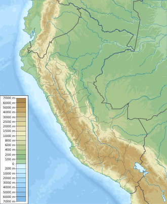
Kimsaqucha or Quimsacocha (Quechua kimsa three, qucha lake, [2] "three lakes", hispanicized spellings Kinsa Qocha, Quimsacocha) is a group of lakes in Peru located in the Cusco Region, Calca Province, Pisac District. The lakes lie in the north of the district, northeast of Pisac, in the community of Paru Paru. [3] [4]
See also

Related Research Articles

Calca Province Province in Cusco, Peru

Calca Province is one of thirteen provinces in the Cusco Region in the southern highlands of Peru. Its seat is Calca.

Pisac District District in Cusco, Peru

Pisac District is one of eight districts of the province Calca in Peru.

Taray District District in Cusco, Peru

Taray District is one of eight districts of the Calca Province in the Cusco Region in Peru. Its seat is Taray. The town lies near Pisac, southwest of it, at a stream called Pawayuq (Pahuayoc), an affluent of Willkanuta River.

Kimsaqucha (Lamay)

Kimsaqucha is a group of lakes in Peru located in the Cusco Region, Calca Province, Lamay District. The lakes lie northeast of Lamay and Calca and southwest of the larger lake Pampaqucha {Laguna Pampacocha) of the Calca District.

Inti Watana may refer to:

Pillku Urqu

Pillku Urqu, also known as Pikul, Piqul or Wayna Piqul, is a 4,448-metre-high (14,593 ft) mountain in the Andes of Peru, near the city of Cusco. It is situated in the Cusco Region, Calca Province, Taray District, and in the Cusco Province, San Jerónimo District, north of San Jerónimo.

Chawaytiri is an archaeological site with rock paintings in Peru. It is situated in the Cusco Region, Calca Province, Pisac District, near the village Chawaytiri. The principal section with paintings predominantly showing llamas is named Llamachayuq Qaqa or Chawaytiri. It lies on the slope of the mountain Muruwiksa (Moro-Wicsa, Morowiqsa, Morro Huicsa). The other sections are named Wamanwachana, Kawituyuq (Cahuituyoc), P'allqapata (Pallcapata), Musuqllaqta (Mosoqllaqta), Misaqaqa and Qaqa.

Llamayuq is an archaeological site with tombs and rock paintings in Peru. It is situated in the Cusco Region, Calca Province, Calca District. The site lies at a height of about 4,000 metres (13,123 ft) on the slope of Llamayuq Q'asa, also known as Qucha Quyllur, in a valley called Wakan Wayq'u (Waqhanhuayq’o).

Pukaqucha may refer to:

Inti Watana, Calca

Inti Watana or Intiwatana (Quechua) is an archaeological site in Peru. It lies in the Cusco Region, Calca Province, Pisac District.

Parorjo

Parorjo is a mountain in the Urubamba mountain range in the Andes of Peru. It is situated in the Cusco Region, Calca Province, Lares District. Its summit is 4,891 m (16,047 ft) high. Parorjo is situated at the Lares trek north of Chicón and Sirihuani and west of Pucaorjo. One of the nearest populated places is Quishuarani. There is a small lake at its feet named Parococha.

Kimsaqucha or Kimsa Qucha may refer to:

Machu Kuntur Sinqa

Machu Kuntur Sinqa or Machu Kuntur Sankha is a mountain in the Cusco Region in Peru, about 4,200 metres (13,780 ft) high. It is situated in the Calca Province, on the border of the districts Pisac and San Salvador. Machu Kuntur Sinqa lies on the right bank of the Willkanuta River, near the archaeological park of Pisac.

Sóndor (Cusco)

Sóndor is a mountain in the Cusco Region in Peru, about 4,400 metres (14,436 ft) high. It is situated in the Calca Province, on the border of the districts of Calca and Lamay. Sóndor lies southeast of a group of lakes. The largest of them is Pampacocha. South of the mountain there is an intermittent stream named Vilcabamba. It flows to the southwest as a right tributary of the Vilcanota River. The confluence is in Lamay.

Ichhunayuq

Ichhunayuq is a mountain in the Andes of Peru, about 4,200 metres (13,780 ft) high. It is located in the Cusco Region, Calca Province, on the border of the districts of Coya and Pisac. Ichhunayuq lies at the archaeological site of Písac, northwest of the town.

Yanaorjo (Calca)

Yanaorjo is a mountain in the Urubamba mountain range in the Andes of Peru, about 4,800 metres (15,748 ft) high. It lies in the Cusco Region, Calca Province, Calca District. Yanaorjo is situated southeast of Sahuasiray, south of Ccerayoc, north of Ajosune or Aqosune and Apurinru and northwest of Pumacallanca and Llamayojcasa.

Ñustapata

Ñust'apata "princess bank") is a mountain in the Cusco Region in Peru, about 4,000 metres (13,123 ft) high. It is situated in the Calca Province, on the border of the districts of Pisac and Taray. Ñust'apata lies on the left bank of the Willkanuta River, near the archaeological park of Pisac.

Coscojahuarina (Calca)

Coscojahuarina is a mountain in the eastern extensions of the Urubamba mountain range in the Andes of Peru, about 4,600 m (15,100 ft) high. It is located in the Cusco Region, Calca Province, Calca District. It lies southeast of Huamanchoque and Pitusiray.

Coscojahuarina (Totora)

Coscojahuarina is a 4,623-metre-high (15,167 ft) mountain in the eastern extensions of the Urubamba mountain range in the Andes of Peru. It is located in the Cusco Region, Calca Province, Calca District. It lies south of Llamayojcasa and west of the village of Totora.

Lake Challhuacocha (Cusco)

Challhuacocha is a lake in the Cusco Region in Peru. It is situated in the Calca Province, Pisac District.

References

  1. Way: Kinsaqocha (46153104) OpenStreetMap
  2. Teofilo Laime Acopa, Diccionario Bilingüe, Iskay simipi yuyay k'ancha, Quechua – Castellano, Castellano – Quechua (Quechua-Spanish dictionary)
  3. "Laguna de Kinsa Qocha". mincetur. Retrieved March 23, 2014.
  4. escale.minedu.gob.pe - UGEL map of the Calca Province (Cusco Region), ZOOM 1