
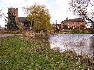
Kings Caple [1] is a village in the largest loop of the River Wye between Hereford and Ross-on-Wye in the English county of Herefordshire. The population of the civil parish at the 2011 census was 331. [2]
Kings Caple [1] is a village in the largest loop of the River Wye between Hereford and Ross-on-Wye in the English county of Herefordshire. The population of the civil parish at the 2011 census was 331. [2]
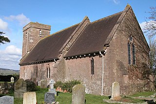
King's Caple has a parish church of St John the Baptist, a primary school, and the small old school which now is used as a parish room.
Opposite the church there is an earthwork known as Caple Tump, reputed to be the remains of a castle motte. The tump is round and now has trees growing on top. Legend has it that this was the site of village fairs in recent centuries.

King's Caple's main economic activity is agriculture, both traditional farming and fruit farming especially at Pennoxstone. At Aramstone there is also a large enterprise where race horses are trained. There are various farms which are involved in the tourism industry both camping and caravanning as well as B & B and rented accommodation.
Poulstone Court, on the edge of the village, is a residential centre offering retreats and courses with a spiritual and personal growth focus.
King's Caple is linked to Hoarwithy by a road bridge, and to Sellack by an 1895 Louis Harper pedestrian suspension bridge. Until 1963 King's Caple was linked by the Hereford, Ross & Gloucester Railway to Hereford and Ross, and Fawley railway station was used daily by the local population.

Hay-on-Wye, or simply Hay, is a market town and community in Powys, Wales, in the historic county of Brecknockshire. With over twenty bookshops, it is often described as a "town of books"; it is both the National Book Town of Wales and the site of the annual Hay Festival. The community had a population of 1,675 at the 2021 census.
Wye is a village and former civil parish, now in the parish of Wye with Hinxhill, in the Ashford district, in Kent, England, 5 miles (8.0 km) from Ashford and 12 miles (19 km) from Canterbury. It is the main settlement in the parish of Wye with Hinxhill. Hop varieties including Wye Challenger were bred at Wye College and named for the village.

Ross-on-Wye is a market town and civil parish in Herefordshire, England, near the border with Wales. It had a population estimated at 10,978 in 2021. It lies in south-east of the county, on the River Wye and on the northern edge of the Forest of Dean.

Weston under Penyard is a small village in Herefordshire, England. The population of the civil parish at the 2011 Census was 1,007.

Goodrich is a village and civil parish in south Herefordshire, England close to Gloucestershire and the Forest of Dean, situated near the River Wye at grid reference SO574193. It is known for its Norman and mediaeval castle built with Old Red Sandstone.

Llanwarne is a village and civil parish in Herefordshire, England. The population of the civil Parish as taken at the 2011 census was 380. It is about 5 miles (8 km) from the Welsh border, is approximately 6 miles (10 km) north-west of Ross-on-Wye, and near Harewood End and Pencoyd.

Walford is a village and civil parish in south Herefordshire, England, two miles south of the market town of Ross-on-Wye. It includes the settlements of Bishopswood, Coughton, Deep Dean, Hom Green and Walford.
Preston on Wye is a village and civil parish in Herefordshire, England. It is situated near the River Wye, about 9 miles west of Hereford. Nearby places are Monnington on Wye, Lulham and Moccas.

Ballingham is a small village of about 140 people, increasing to 181 at the 2011 Census in Herefordshire, England, situated in a loop of the River Wye, between Hereford and Ross-on-Wye.

Whitney-on-Wye is a village and civil parish in Herefordshire, England, and approximately 1 mile (1.6 km) east from the border with Wales. The village is on the A438 road, on the River Wye, and 16 mi (25 km) west from Hereford. Parish population in 2011 was 117.

Stretton Sugwas is a village and civil parish in Herefordshire, England, about 4 miles (6.4 km) northwest of Hereford. The parish also includes the hamlet of Swainshill. The population of this Civil Parish at the 2011 census was 505. In 1087 the village was held by Roger de Lacy and consisted of two and a half hides paying geld, in demesne there was 2 ploughs, 1 villan, 9 bordars, 4 oxmen, and 2 radknights, as well as a mill rendering 32d. The village had increased in value from 40 to 50s from the time of the conquest to that of Domesday. The village lies within the ancient Hundred of Grimsworth
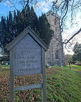
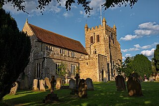
Upton Bishop is a small village in Herefordshire, England. The population of the village at the 2011 census was 602.

Kinnersley is a village and civil parish in Herefordshire, England. The village is about 5 miles (8 km) east of the Wales-England border and 10 miles (16 km) north-west of Hereford.

Much Birch is a village and civil parish in Herefordshire, England, between Hereford and Ross-on-Wye. The parish includes the settlements of Kings Thorn, Much Birch and parts of Wormelow.

Llangarron is a small village and civil parish in southwest Herefordshire within 7 miles (11 km) of both Ross-on-Wye and Monmouth. The population of the civil parish at the 2011 census was 1,053. The civil parish includes the settlements of Llangrove, Llancloudy, Biddlestone and Three Ashes. The church is dedicated to St. Deinst. The village no longer has a post office nor pub, though it does have a community hall.

Bridstow is a village and civil parish in Herefordshire, England, 2 km west of Ross-on-Wye and 17 km south-east of Hereford. The parish is bounded to the east and south by the River Wye. The A40 road linking the M50 motorway to South Wales runs through the parish, crossing the Wye at Bridstow Bridge. The parish had a population of 906 in the 2011 UK census, and an estimated population of 941 in 2018.

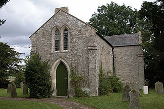
How Caple is a village and civil parish in the English county of Herefordshire. The population of this civil parish at the 2011 census was 118.
Yatton is a village and parish in south-east Herefordshire, England. Yatton is situated on Perrystone Hill, between Ross-on-Wye and Much Marcle. The population of the civil parish at the 2011 census was 208.

Marstow is a hamlet and civil parish in south eastern Herefordshire, England. Most of the parish is within the Wye Valley Area of Outstanding Natural Beauty.
Pencoyd is a hamlet and civil parish in Herefordshire, England. The parish, which also includes the hamlet of Netherton and part of the hamlet of Harewood End, both to the east of Pencoyd hamlet, is approximately 8 miles (13 km) south from the city and county town of Hereford and 5 miles (8 km) west-northwest from the market town of Ross-on-Wye.
51°57′25″N2°38′21″W / 51.9569°N 2.6393°W
| | This Herefordshire location article is a stub. You can help Wikipedia by expanding it. |