
King's Cross railway station, also known as London King's Cross, is a passenger railway terminus in the London Borough of Camden, on the edge of Central London. It is in the London station group, one of the busiest stations in the United Kingdom and the southern terminus of the East Coast Main Line to Yorkshire and the Humber, North East England and Scotland. Adjacent to King's Cross station is St Pancras International, the London terminus for Eurostar services to continental Europe. Beneath both main line stations is King's Cross St Pancras tube station on the London Underground; combined, they form one of the country's largest and busiest transport hubs.
St Pancras is a district in central London. It was originally a medieval ancient parish and subsequently became a metropolitan borough. The metropolitan borough then merged with neighbouring boroughs and the area it covered now forms around half of the modern London Borough of Camden. The area of the parish and borough includes the sub-districts of Camden Town, Kentish Town, Gospel Oak, Somers Town, King's Cross, Chalk Farm, Dartmouth Park, the core area of Fitzrovia and a part of Highgate.

King's Cross is a district in the London Boroughs of Camden and Islington, on either side of Euston Road in north London, England, 1.5 miles (2.4 km) north of Charing Cross, bordered by Barnsbury to the north, Clerkenwell to the southeast, Angel to the east, Holborn and Bloomsbury to the south, Euston to the west and Camden Town to the northwest. It is served by two major rail termini, St Pancras and King's Cross. King's Cross station is the terminus of one of the major rail routes between London and the North.

Euston Road is a road in Central London that runs from Marylebone Road to King's Cross. The route is part of the London Inner Ring Road and forms part of the London congestion charge zone boundary. It is named after Euston Hall, the family seat of the Dukes of Grafton, who had become major property owners in the area during the mid-19th century.

King's Cross Thameslink station is a closed railway station in central London, England. It is located on Pentonville Road, around 250 metres (0.2 mi) east of King's Cross mainline station. At the time of closure, in 2007, it was served by Thameslink trains and managed by First Capital Connect. Services have been transferred to a new station underneath St Pancras.

Tavistock Square is a public square in Bloomsbury, in the London Borough of Camden near Euston Station.

John Ernest Grabe, Anglican divine, was born at Königsberg, where his father, Martin Sylvester Grabe, was professor of theology and history.

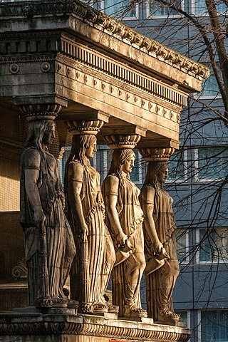
St Pancras Church is a Greek Revival church in St Pancras, London, built in 1819–22 to the designs of William and Henry William Inwood. The church is one of the most important 19th-century churches in England and is a Grade I listed building.

All Saints Cathedral, Camden Street, London, originally All Saints Church, Camden Town, St Pancras, Middlesex, is a church in the Camden Town area of London, England. It was built for the Church of England, but it is now a Greek Orthodox church known as the Greek Orthodox Cathedral Church of All Saints. It stands where Camden Street and Pratt Street meet.

The Survey of London is a research project to produce a comprehensive architectural survey of central London and its suburbs, or the area formerly administered by the London County Council. It was founded in 1894 by Charles Robert Ashbee, an Arts-and-Crafts designer, architect and social reformer and was motivated by a desire to record and preserve London's ancient monuments. The first volume was published in 1900, but the completion of the series remains far in the future.
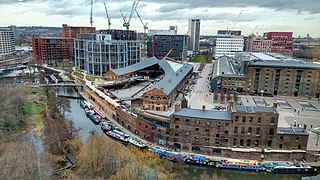
King's Cross Central (KXC) is a mixed-use development in the north-east of central London. The site is owned and controlled by the King's Cross Central Limited Partnership. It consists of approximately 67 acres (27 ha) of former railway lands to the north of King's Cross and St Pancras mainline railway stations. The site is largely determined by three boundaries: the existing East Coast Main Line railway leading out of King's Cross; York Way, a road marking the division between Camden and Islington boroughs; and the new railway line, High Speed 1 (HS1), formerly known as the Channel Tunnel Rail Link, which curves around the site to the north and west.
George Nevill, de facto 11th Baron Bergavenny was a de facto English peer.
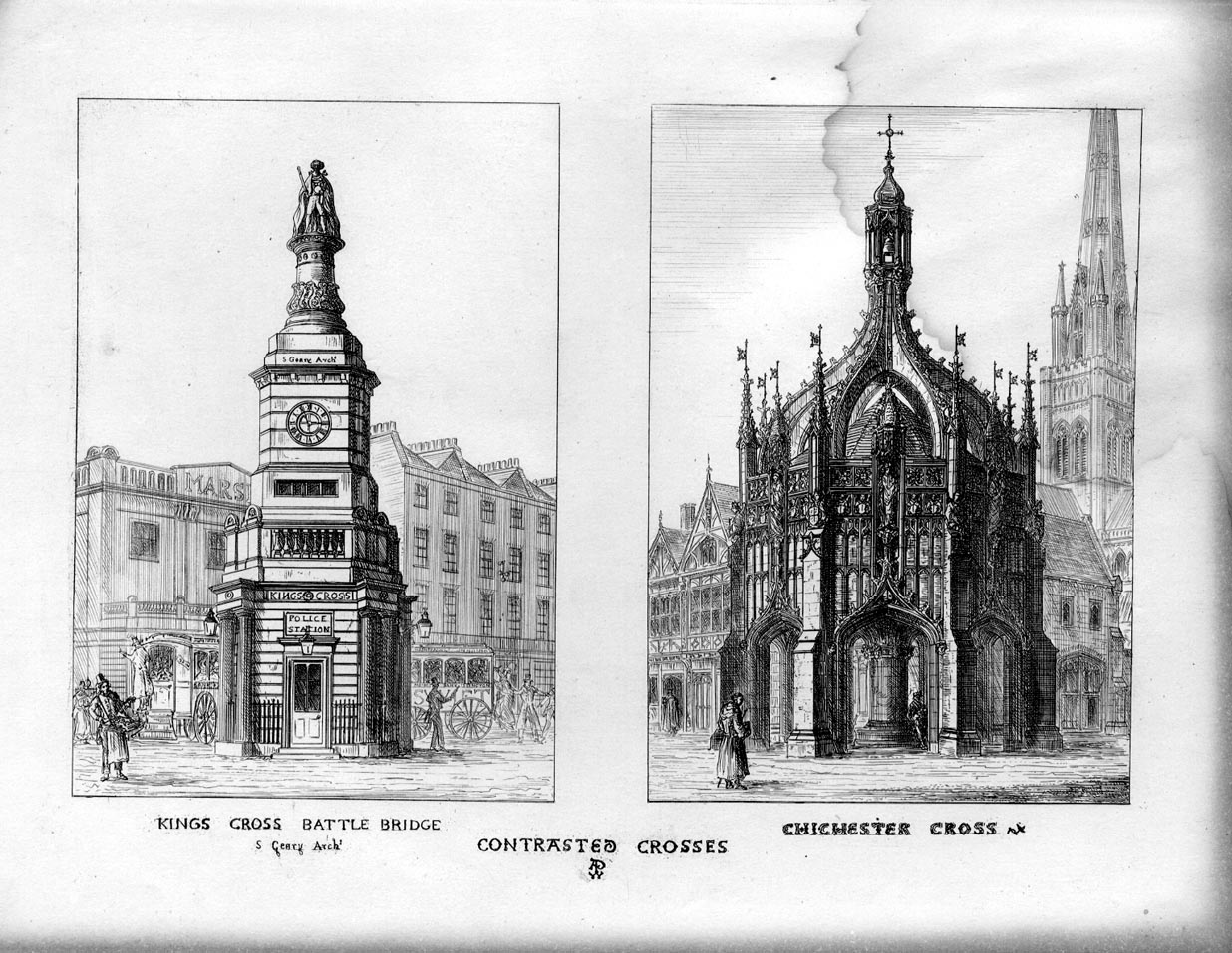
Stephen Geary was a British architect, inventor, entrepreneur, and, from 1850, Temperance activist.
Walter Hindes Godfrey, CBE, FSA, FRIBA (1881–1961), was an English architect, antiquary, and architectural and topographical historian. He was also a landscape architect and designer, and an accomplished draftsman and illustrator. He was (1941–60) the first director and the inspiration behind the foundation of the National Buildings Record, the basis of today's Historic England Archive, and edited or contributed to numerous volumes of the Survey of London. He devised a system of Service Heraldry for recording service in the European War.

Cromer Street is a road in St Pancras, London in central London, England. It starts in the west at Judd Street, then goes east, ending at Gray's Inn Road. It gave access from Gray's Inn Road to Greenland Place and a bowling green.

The London Borough of Camden is a borough in Inner London, England. Camden Town Hall, on Euston Road, lies 1.4 mi (2.3 km) north of Charing Cross. The borough was established on 1 April 1965 from the former metropolitan boroughs of Holborn, St Pancras and Hampstead.

Pancras Square Library is in the London Borough of Camden located just off the Euston Road in the King's Cross area of the borough. It is situated on the ground floor of Camden Council's Town Hall complex. With a separate children's library it provides a wide selection of books, CDs and DVDs available to borrow, and free internet access, making it central to provide a library service and gateway to other Council services to the local community.

The Burdett-Coutts Memorial Sundial is a structure built in the churchyard of Old St Pancras, London, in 1877–79, at the behest of Baroness Burdett-Coutts. The former churchyard included the burial ground for St Giles-in-the-Fields, where many Catholics and French émigrés were buried. The graveyard closed to burials in 1850, but some graves were disturbed by a cutting of the Midland Railway in 1865 as part of the works to construct its terminus at St Pancras railway station. The churchyard was acquired by the parish authorities in 1875 and reopened as a public park in June 1877. The high Victorian Gothic memorial was built from 1877 and unveiled in 1879. The obelisk acts as a memorial to people buried near the church whose graves were disturbed; the names of over 70 of them are listed on the memorial, including the Chevalier d'Éon, Sir John Soane, John Flaxman, Sir John Gurney, and James Leoni.
St Martin's Church is a Church of England church in Gospel Oak in London, England. Located on Vicars Road, the church building is Grade I listed. The church was built between 1864 and 1866 to a curious-looking design by Edward Buckton Lamb and was discussed by John Summerson in his Victorian Architecture in England. The church was built at the personal cost of John Derby Allcroft to commemorate his late wife. The architectural historian Nikolaus Pevsner described it as "the craziest of London’s Victorian churches".
St Peter's Church was an Anglican church in Regent Square in the London Borough of Camden. It was built in 1826, and was demolished after being badly damaged in World War II.

