
A rock shelter is a shallow cave-like opening at the base of a bluff or cliff. In contrast to solutional caves (karst), which are often many miles long or wide, rock shelters are almost always modest in size and extent.

Scouting in Alabama has a long history, from the 1910s to the present day, serving thousands of youth in programs that suit the environment in which they live.
Scouting in Connecticut has experienced many organizational changes since 1910. With only eight counties, Connecticut has had 40 Boy Scout Councils since the Scouting movement began in 1910. In 1922, 17 Boy Scout Councils existed in Connecticut, but currently only four exist. The Girl Scouts of the USA has had at least 53 Girl Scout Councils in Connecticut since their program began in 1912. Today there is one, Girl Scouts of Connecticut, which assumed operation on October 1, 2007.

Russell Cave National Monument is a U.S. national monument in northeastern Alabama, United States, close to the city of Bridgeport. The monument was established on May 11, 1961, when 310 acres (1.3 km2) of land were donated by the National Geographic Society to the American people. It is now administered and maintained by the National Park Service. The national monument was listed on the National Register of Historic Places on October 15, 1966.

The Sipsey Wilderness lies within Bankhead National Forest around the Sipsey Fork of the Black Warrior River in northwestern Alabama, United States. Designated in 1975 and expanded in 1988, 24,922-acre (10,086 ha) Sipsey is the largest and most frequently visited Wilderness area in Alabama and contains dozens of waterfalls. It was also the first designated wilderness area east of the Mississippi River.

The William B. Bankhead National Forest is one of Alabama's four National Forests, covering 181,230 acres (733 km2). It is home to Alabama's only National Wild and Scenic River, the Sipsey Fork. It is located in northwestern Alabama, around the town of Double Springs. It is named in honor of William B. Bankhead, a longtime U.S. Representative from Alabama.

The Yuchi people are a Native American tribe based in Oklahoma. Their original homeland was in the southeast of the present United States.
The Coushatta are a Muskogean-speaking Native American people now living primarily in the U.S. states of Louisiana, Oklahoma, and Texas.

The stomp dance is performed by various Eastern Woodland tribes and Native American communities in the United States, including the Muscogee, Yuchi, Cherokee, Chickasaw, Choctaw, Delaware, Miami, Caddo, Tuscarora, Ottawa, Quapaw, Peoria, Shawnee, Seminole, Natchez, and Seneca-Cayuga tribes. Stomp dance communities are active in Georgia, North Carolina, Oklahoma, Alabama, Mississippi, and Florida.

Horse Pens 40 is a privately owned outdoor nature park located in St. Clair County near Steele, Alabama. The park is situated atop Chandler Mountain, in the foothills of The Appalachian Mountains. The park is known among the rock climbing community as a premier bouldering site in the American Southeast. The site is also home to a "Bluegrass Park" where it hosts festivals showcasing the genre several times per year. The biggest of these festivals occurs on the Fourth of July. The park features both RV and primitive camping.
Black Fox, also called Enola, was a Cherokee leader during the Cherokee–American wars. He was a signatory of the Holston Treaty, and later became a Principal Chief of the Cherokee Nation.

Junaluska, was a leader of Cherokee who resided in towns in western North Carolina in the early 19th century. He fought alongside Andrew Jackson at the Battle of Horseshoe Bend during the War of 1812/Creek War. In the course of the battle he saved Jackson's life, an act he reportedly regretted later in life.
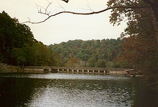
Standing Stone State Park is a state park in Overton County, Tennessee, in the southeastern United States. The park consists of 855 acres (3.46 km2) along the shoreline of the man-made 69-acre (0.28 km2) Standing Stone Lake. The 11,000-acre (45 km2) Standing Stone State Forest surrounds the park.
The Battle of Taliwa was fought in Ball Ground, Georgia, in 1755. The battle was part of a larger campaign of the Cherokee against the Muscogee Creek people, where a contingent of 500 Cherokee warriors led by war chief Oconostota defeated the Muscogee Creek people and pushed them south from their northern Georgia homelands, allowing the Cherokee to begin settling in the region.
Buffalo Rock State Park & Effigy Tumuli is an Illinois state park on 298 acres (121 ha) in LaSalle County, Illinois, United States. The park sits across the Illinois River from Starved Rock State Park, just south of the Illinois and Michigan Canal trail. According to legend, it was once used as a "blind canyon" for Indians to capture buffalo. Effigy Tumuli, an art exhibit on the park property, consists of five earth art animal sculptures native to the Illinois River. It was constructed as a tribute to Native American tradition. The park is located 5 miles (8.0 km) east of Utica, Illinois, and approximately 85 miles (137 km) southwest of Chicago, Illinois. Its sandstone bluffs were carved by the Illinois River near the end of the Pleistocene epoch, and now serves as a State Park for local residents and tourists.

Yuchi Town Site, or Yuchi Town, is a late prehistoric and historic era archaeological site showing occupation of both the Apalachicola and of Yuchi tribes. The site is located in a remote area of Fort Moore, Russell County, Alabama. The Yuchi Town Site is an example of historic Native American cultures adopting various strategies to maintain their cultural integrity in the face of European colonization and the expansion of the United States. It was declared a National Historic Landmark in 1996.

Cherokee history is the written and oral lore, traditions, and historical record maintained by the living Cherokee people and their ancestors. In the 21st century, leaders of the Cherokee people define themselves as those persons enrolled in one of the three federally recognized Cherokee tribes: The Eastern Band of Cherokee Indians, The Cherokee Nation, and The United Keetoowah Band of Cherokee Indians.

Shell gorgets are a Native American art form of polished, carved shell pendants worn around the neck. The gorgets are frequently engraved, and are sometimes highlighted with pigments, or fenestrated.
The Cherokee removal, part of the Indian removal, refers to the removal of an estimated 15,500 Cherokees and 1,500 African-American slaves from the U.S. states of Georgia, North Carolina, Tennessee and Alabama to the West according to the terms of the 1835 Treaty of New Echota. It is estimated that 3,500 Cherokees and African-American slaves died en route.
