Kirala Kelle wetlands

Last updated
Matara District, Sri Lanka Matara district.svg
Matara District, Sri Lanka

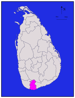
The Kirila Kelle wetlands are found a short distance inland from the southern Sri Lankan city of Matara. The wetlands are a part of the Nilwala River basin. [1] They comprise some 750 acres of wetlands. Canals were built by Portuguese Colonialists to mitigate flooding of the Nilwala river into Matara township and aid in the cropping of a further surrounding 6000 acres of rice and other farming. A failed attempt at flood mitigation in the early 1990s has meant that the once arable 6000 acres has now become un-farmable. [2] [3] This reduction in historically arable land has resulted in widespread poverty and associated social and environmental problems for some 35,000 people.

Sri Lanka Island country in South Asia

Sri Lanka, officially the Democratic Socialist Republic of Sri Lanka, is an island country in South Asia, located in the Indian Ocean to the southwest of the Bay of Bengal and to the southeast of the Arabian Sea. The island is geographically separated from the Indian subcontinent by the Gulf of Mannar and the Palk Strait. The legislative capital, Sri Jayawardenepura Kotte, is a suburb of the commercial capital and largest city, Colombo.

Matara, Sri Lanka City in Southern, Sri Lanka

Matara is a major city in Sri Lanka, on the southern coast of Southern Province, 160 km from Colombo. It is a major commercial hub, and it is the administrative capital of Matara District. It was gravely affected by the Asian tsunami in December 2004.

Portuguese India former colony of Portugal

The State of India, also referred as the Portuguese State of India or simply Portuguese India, was a state of the Portuguese Overseas Empire, founded six years after the discovery of a sea route between Portugal and the Indian Subcontinent to serve as the governing body of a string of Portuguese fortresses and colonies overseas.

KirilaKelleWetlands 3.jpg

The Kirila Kelle Wetlands are the focus for a sustainable Environmental Conservation Community Development program. This is being developed through Ecotourism and community development, by way of a provincial integrated development strategy, that is managed and implemented by the community for the community.

Habitat conservation

Habitat conservation is a management practice that seeks to conserve, protect and restore habitats and prevent species extinction, fragmentation or reduction in range. It is a priority of many groups that cannot be easily characterized in terms of any one ideology.

Ecotourism form of tourism

Ecotourism is a form of tourism involving visiting fragile, pristine, and relatively undisturbed natural areas, intended as a low-impact and often small scale alternative to standard commercial mass tourism. It means responsible travel to natural areas, conserving the environment, and improving the well-being of the local people. Its purpose may be to educate the traveler, to provide funds for ecological conservation, to directly benefit the economic development and political empowerment of local communities, or to foster respect for different cultures and for human rights. Since the 1980s, ecotourism has been considered a critical endeavor by environmentalists, so that future generations may experience destinations relatively untouched by human intervention. Several university programs use this description as the working definition of ecotourism.

The United Nations defines community development as "a process where community members come together to take collective action and generate solutions to common problems." It is a broad term given to the practices of civic leaders, activists, involved citizens and professionals to improve various aspects of communities, typically aiming to build stronger and more resilient local communities.

Related Research Articles

Wetland A land area that is permanently or seasonally saturated with water

A wetland is a distinct ecosystem that is inundated by water, either permanently or seasonally, where oxygen-free processes prevail. The primary factor that distinguishes wetlands from other land forms or water bodies is the characteristic vegetation of aquatic plants, adapted to the unique hydric soil. Wetlands play a number of functions, including water purification, water storage, processing of carbon and other nutrients, stabilization of shorelines, and support of plants and animals. Wetlands are also considered the most biologically diverse of all ecosystems, serving as home to a wide range of plant and animal life. Whether any individual wetland performs these functions, and the degree to which it performs them, depends on characteristics of that wetland and the lands and waters near it. Methods for rapidly assessing these functions, wetland ecological health, and general wetland condition have been developed in many regions and have contributed to wetland conservation partly by raising public awareness of the functions and the ecosystem services some wetlands provide.

Hambantota Town in Southern Province, Sri Lanka

Hambantota is the main town in Hambantota District, Southern Province, Sri Lanka. This underdeveloped area was hit hard by the 2004 Indian Ocean tsunami and is undergoing a number of major development projects including the construction of a new sea port and international airport finished in 2013. These projects and others such as Hambantota Cricket Stadium are said to form part of the government's plan to transform Hambantota into the second major urban hub of Sri Lanka, away from Colombo.

The California Coastal Conservancy is a state agency in California established in 1976 to enhance coastal resources and access.

University of Ruhuna

The University of Ruhuna is a public university in Matara, Sri Lanka.

Lough Oughter

Lough Oughter is a lake, or complex of lakes, in County Cavan covering more than 8,900 hectares. The complex of lakes lies on the River Erne, and forms the southern part of the Lough Erne complex. The lakes are bounded roughly by Belturbet in the north, Cavan town to the east, Crossdoney to the south and Killeshandra to the west.

Mitigation banking is the preservation, enhancement, restoration or creation (PERC) of a wetland, stream, or habitat conservation area which offsets, or compensates for, expected adverse impacts to similar nearby ecosystems. The goal is to replace the exact function and value of specific habitats that would be adversely affected by a proposed activity or project. The public interest is served when enforcement agencies require more habitat as mitigation, often referred to as a mitigation ratio, than is adversely impacted by management or development of nearby acreage.

St. Servatius College

St. Servatius' College is a boys' school located in Matara, Sri Lanka. Initially founded by a group of Jesuit fathers in 1897, the high school was nationalised in the 1960s, and is now run as a state school.

Deforestation in Sri Lanka

Deforestation is one of the most serious environmental issues in Sri Lanka. In the 1920s, the island had a 49 percent forest cover but by 2005 this had fallen by approximately 26 percent. Between 1990 and 2000, Sri Lanka lost an average of 26,800 ha of forests per year. This amounts to an average annual deforestation rate of 1.14%. Between 2000 and 2005 the rate accelerated to 1.43% per annum. However, with a long history of policy and laws towards environmental protection, deforestation rates of primary cover have actually decreased 35% since the end of the 1990s thanks to a strong history of conservation measures. The problem of deforestation in Sri Lanka is not as significant in the southern mountainous regions as it is in northern and lowland southern Sri Lanka, largely due to the nature of environmental protection.

The Conservation Fund is an American environmental non-profit with a dual charter to pursue environmental preservation and economic development. Since its founding in 1985, the organization has protected more than 7 million acres of land and water in all 50 states, including parks, historic battlefields, and wild areas. The Fund works with community and government leaders, businesses, landowners, conservation nonprofits and other partners to create innovative solutions that integrate economic and environmental objectives. The Fund also works with communities to strategically plan development and green space and offer training in conservation and the sustainable use of natural resources.

Toolibin Lake lake in Australia

Toolibin Lake is a seasonal fresh to brackish water perched lake or wooded swamp, in south-western Australia. The lake is contained with a 493-hectare (1,218-acre) nature reserve and it is located about 200 kilometres (124 mi) south-east of Perth, in the Shire of Narrogin, and 40 kilometres (25 mi) east of the town of Narrogin, in the Wheatbelt region of Western Australia. The lake is listed by the Australian Government as a threatened ecological community under the Environment Protection and Biodiversity Conservation Act 1999.

Kataragama Place in Uva Province

Kataragama is a pilgrimage town sacred to Buddhist, Hindu and indigenous Vedda people of Sri Lanka. People from South India also go there to worship. The town has the Kataragama temple, a shrine dedicated to Skanda Kumara also known as Kataragama deviyo. Kataragama is located in the Monaragala District of Uva province, Sri Lanka. It is 228 km ESE of Colombo, the capital of Sri Lanka. Although Kataragama was a small village in medieval times, today it is a fast-developing township surrounded by jungle in the southeastern region of Sri Lanka.

Malimbada Divisional Secretariat is a Divisional Secretariat of Matara District, of Southern Province, Sri Lanka.

Effects of global warming on Sri Lanka

Sri Lanka, an equatorial island of 65,610 square kilometres (25,330 sq mi), is a biodiversity hotspot. It has 480 bird species and 121 amphibious species. Climate change is a threat to the island's hyperdiversity, including its marine ecosystem and coastal coral reef environments. Climate variability and sea-level rise has the potential to affect the overall abundance of endemic species. It is likely that anthropogenic influences driven climate-change trends. Despite continued efforts for environmental-policy implementation at the local and global levels, greenhouse gases increased by 2.2 percent annually from 2000 to 2010 and the global sea level rose 2.8 to 3.6 millimetres annually from 1993 to 2010.

Star fort, Matara

The Star Fort is a fort in Matara, Sri Lanka, located on the eastern bank of the Nilwala River, approximately 350 metres (1,150 ft) from the gate to the Matara fort. It was constructed by the Dutch in 1765, and was originally called Redoute Van Eck.

Matara fort Sri Lanka

The Matara Fort was built in 1560 by the Portuguese and was substantially re-built by the Dutch in 1640, following the capture of Galle. The fort, which consists of a large stone rampart, occupies the promontory, which separates the Niwala Ganga (River) lagoon and the ocean.

Environmental issues in Sri Lanka

Environmental issues in Sri Lanka include large-scale logging of forests and degradation of mangroves, coral reefs and soil. Air pollution and water pollution are challenges for Sri Lanka since both cause negative health impacts. Insufficient waste management, especially in rural areas, leads to environmental pollution. Sri Lanka is also vulnerable to climate change impacts such as extreme weather events and sea level rise.

The 2017 Sri Lanka floods resulted from a heavy southwest monsoon, beginning around 18 to 19 May 2017. Flooding was worsened by the arrival of the precursor system to Cyclone Mora, causing flooding and landslides throughout Sri Lanka during the final week of May 2017. The floods affected 15 districts, killed at least 208 people and left a further 78 people missing. As of 3 June, 698,289 people were affected, while 11,056 houses were partially damaged and another 2,093 houses completely destroyed. According to Al Jazeera, about 600,000 people have been displaced due to the floods.

2018 Sri Lanka floods and landslides caused from an annual heavy southwest monsoon beginning around 19 May. As of 26 May 2018; the monsoon floods affected in about 19 districts, killed at least 21 people, about 150, 000 people were affected and further left approximately 23 people missing. The death casualties were reported from 22 May onwards in the provinces including South, Northwest, North and East. About 4 people were reported to have dead due to lightning, 5 people were killed due to floods and lightning, 8 people died due to drowning and further left 4 people dead resulting from fallen trees. The DMC report claimed about 400, 000 people have been displaced to safer locations. About 105 houses were reported to have fully damaged and over 4832 houses have been partially damaged.

Nilwala River

Nilwala is a river in Southern Province in Sri Lanka. It originates from Sinharaja Forest Reserve and drains to sea at Matara.

References

  1. Nilwala River on Facebook
  2. "Lessons from two long-term hydrological studies in Kenya and Sri Lanka" (PDF). Science Direct. September 2004. Retrieved 8 October 2010.
  3. "Flood reduction Strategies". Asian Disaster Reduction Centre Chapter 3.3. March 2001. Retrieved 8 October 2008.