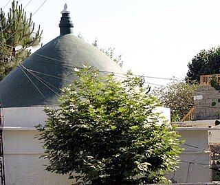
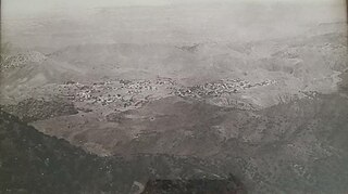
Jango is a village in Lower Dir District of Khyber-Pakhtunkhwa. It is located at 34°43'45N 72°2'60E and lies on the main Chakdara-Asbanr road, it has a population of about 3000. This village has been gradually merging with another village named Tazagram which is located near it. Jango village is the part of Union Council Tazagram. The literacy ratio in this village has climbed high in recent years, as it has been located in Dir District, known as a backward area in Pakistan. The population under 30 and above 10 has a literacy rate of over 80% which is a significant improvement from the 5% recorded in the 1970s. The village has produced highly qualified professionals in fields of Education, Sciences, Law and Engineering. People of Jango also gives high place to religion and their beloved country Pakistan. Brave sons of this village have given sacrifices in Afghanistan and Kashmir for the noble cause of Islam and Pakistan.

Swat District, also known as the Swat Valley, is a district in the Malakand Division of Khyber Pakhtunkhwa, Pakistan. Known for its stunning natural beauty, the district is a popular tourist destination. With a population of 2,309,570 per the 2017 national census, Swat is the 15th-largest district of Khyber Pakhtunkhwa.
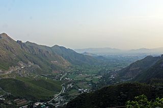
Chakdara (چکدرہ) is a city in the Lower Dir District of Khyber Pakhtunkhwa, Pakistan. It's the second largest city in Dir Lower after Timergara. It serves as a gateway of Malakand Division. It's located in the center of Malakand Division at the entrance of the Lower Dir District, also near the entrance of the Swat District. The Swat Expressway also touches this area Chakdara interchange. Chakdara is about 130 km far from Peshawar, 40km from Mingora and 38 km from Timergara.

Dir is a region in northwestern Pakistan in the Khyber Pakhtunkhwa, in the foothills of the Himalayas. Before the independence of Pakistan, Dir was a princely state, and it remained so until 1969 when it was abolished by a presidential declaration, and the Dir District was created the following year. The area covers 5,280 square kilometres. In 1996 Dir district was officially divided into Lower Dir District and Upper Dir District.

The Panjkora River is a river in the Khyber Pakhtunkhwa province in north-west Pakistan. The river runs through the mountainous northern part of the province, and forms the Kumrat Valley. It passes from Dir, Timergara, and joins with Swat River at Chakdara. It is generally characterized by having steep slopes on either side of the riverbank covered in thick forests. The river has a large catchment area, making the river susceptible to significant flooding – most notably during the 2010 floods that occurred throughout much of Pakistan.
Lower Dir District is a district in the Khyber Pakhtunkhwa province of Pakistan. Timergara city is the district's headquarter. This district was formed in 1996, when Dir District was divided into Upper Dir and Lower Dir districts. Recently, On 22 January 2023, both Lower Dir and Upper Dir districts further bifurcated to create a new Central Dir District. Lower Dir contains a lot of valleys and mountains. "tajoka sar" was a mountain peak in Dir. and Highest mountain peak in Lower Dir Kpk Pakistan. Hight of Tajoka sar was a (3308m/10853ft) From Sea Level. It is Located in BinShahi Valley Dir lower kpk pakistan.

Dir was a princely state in a subsidiary alliance with the British Raj, located within the North-West Frontier Province. Following the Partition of British India, Dir remained independent and unaligned until February 1948, when the Dominion of Pakistan accepted its accession.
The Lower Swat Valley in Swat and Lower Dir Districts in Pakistan is an area of important archeological sites.
Shawa is a village in the Lower Dir District of the Khyber-Pakhtunkhwa province of Pakistan.
Malakand District is a district in the Malakand Division of the Khyber Pakhtunkhwa province of Pakistan.
Aligrama is one of the historical towns of Swat District in Khyber Pakhtunkhwa province of Pakistan. The population is about ten thousand of Aligrama. Most of the people are well educated and serve in high posts of the government.
Serai Niamat Khan or Sarai Naimat Khan is one of the 44 union councils of the Haripur District in the Khyber Pakhtunkhwa province of Pakistan. It is divided into smaller areas including Mohallah Khu, Jora Pind, Moriyan, Najeeb Abad, and Mohalla Ziarat.

Badwan is a Union Council situated on the bank of the River Swat at an altitude of 2,192 feet. It is a part of the Adenzai Tehsil of the Lower Dir District, Khyber-Pakhtunkhwa. It contains many small villages including Badwan Upper, Badwan Lower, Badwan Khambo, Shamlai, Baghkandi, Ramyal, Othar, Safrona, Gadar, Barorri, Leko, Ghwando, Torogato, Swato Banda, Ghazo etc. Its population is approximately 25,000.
Saleh Khana is a large village in the Nowshera District of Khyber Pakhtunkhwa, Pakistan located just below the Cherat mountains.
Khadagzai is a village in the administrative unit Chakdara, of district Lower Dir in the Khyber Pakhtunkhwa province of Pakistan. Situated on the bank of River Swat. Historically the village is home of the Yousafzai Pukhtoon tribes notably Maadokhiel(مدوخیل) Aka khiel(اکاخیل)The village is divided into three major units .Khadagzai is subtribe of Yousafzai .The outskirts are connected with small villages like Mayar, Nagram, Bar Tangai, Kamala, Kaghan, Musa-Tangai, Bangokas, Dandona, Koz Tangai and Sogiyar. Its population is approximately 32000 to 40000.
Khanpur is a small city and the Tehsil/Taluka of District Shikarpur, Larkana Division in the province of Sindh, Pakistan. This town has a population of 52,946 per the 2017 Census of Pakistan.

Bagh Dushkhel is a union council in Lower Dir District, Khyber Pakhtunkhwa, Pakistan.
Kokarai is an administrative unit, known as Union council or Wards in Tehsil Babuzai, of Swat District in the Khyber Pakhtunkhwa province of Pakistan.
Madey Baba is a village and union council in the Takht Bhai Tehsil of Mardan District of the Pakistani province Khyber Pakhtunkhwa. It is situated on both sides of the Madey Baba-Mandani Road which originates from the Main Malakand Road towards West at Parao Chowk and ends up in Mandani, District Charsadda. The village is named after the famous sufi saint Madey baba, buried here in the middle of the grand graveyard. People initially came here mostly from the historic Jalala village in search of livelihood and to manage their agricultural land. The landscape of the village consists of fertile land, a river on one side and a canal on the other, sandy loams and plains. There are several small villages that constitutes the vast area of Madey Baba. These villages include, Parao, Sakhawat Shah Kalley, Colony, Manjawaro Kalley, Zamindaro Koroona, Madey Baba Chowk, Zor Talab Kalley, Serai, Sultan Member Kalley, Yakh Kohi, Tor Dher and several other small communities. Agriculture is the source of livelihood for majority of people who cultivate tobacco, sugarcane, wheat, maize and vegetables. Besides, a handsome number of people also work for the government in various departments. The area is famous for agricultural production, however agricultural land is ruthlessly being converted into housing societies which will surely cast a negative impact on its landscape as well as ecological characteristics in the future. Educational institutions are numbered and do not suffice the need of huge population of the area. Children mostly commute to Takht Bhai for better educational institutes. Famous personalities of the area are late Sakhawat Shah, late Babu Munawar Khan, late Maulana Qazi Miraj Ul Haq, late Sultan Shah, Haji Ikram Khan, Mir Alam, etc
Osakai is a village in Lower Dir District of the Khyber Pakhtunkhwa province of Pakistan. Osakai is divided into Osakai Bala and Osakai Payeen. It comes under Union Council Kotigram and under Tehsil Adenzai. Osakai as a whole consists of Karimabad, Dagai, Ghwandai, Qazi Abad and Lowarha. Osakai has a hospital unit, a government high school for girls and also a government high school for boys. Osakai has some historical places (e.g., Kafar Kot, now adays known as Muslim kot, Sroo Manroo, Shah Goo and also many picnic spots. Due to availability of almost all basic facilities many peoples from Lower Dir and Upper Dir and some ather district have started migration to this village. Large numbers of migrated families now reside in Kas and Kafar Kot, now known as Muslim kot. Osakai also has a quarry where stone slabs for graves are extracted. They can also be used for sewage systems.