Weilheim-Schongau is a Landkreis (district) in the south of Bavaria, Germany. Neighboring districts are Landsberg, Starnberg, Bad Tölz-Wolfratshausen, Garmisch-Partenkirchen and Ostallgäu.

Groot-Ammers is a town in the Dutch province of South Holland. It is a part of the municipality of Molenwaard, and is located about 13 km southeast of Gouda on the southside of the Lek River.

Ammersee is a Zungenbecken lake in Upper Bavaria, Germany, southwest of Munich between the towns of Herrsching and Dießen am Ammersee. With a surface area of approximately 47 square kilometres (18 sq mi), it is the sixth largest lake in Germany. The lake is at an elevation of 533 metres (1,749 ft), and has a maximum depth of 81 metres (266 ft). Like other Bavarian lakes, Ammersee developed as a result of the ice age glaciers melting. Ammersee is fed by the River Ammer, which flows as the Amper out of the lake. Like neighbouring Lake Starnberg, which is similar in size and shape, it is a popular location for watersports.

The Amper, called the Ammer upstream of the Ammersee, through which it runs, is the largest tributary of the Isar in southern Bavaria, Germany. It flows generally north-eastward, reaching the Isar in Moosburg, about 190 kilometres (120 mi) from its source in the Ammergau Alps, with a flow of 45 m³/s. Including its tributary, Linder, it is 209.5 km (130.2 mi) long. Major tributaries are the Glonn, which springs near Augsburg; the Würm, which is the outflow of Lake Starnberg; and the Maisach.
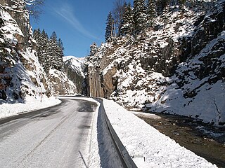
The Ammer Saddle is a high mountain pass in the Alps on the border between Tyrol, Austria and Bavaria, Germany.

Hohenpeißenberg is a municipality in the Weilheim-Schongau district, in Bavaria, Germany. Hohenpeißenberg is situated in the Bavarian Oberland, in the alpine uplan.
The 1999 Pentecost flood was a 100-year flood around the Pentecost season in 1999 that mostly affected Bavaria, Vorarlberg and Tirol. It was caused by heavy rainfall coinciding with the regular Alpine meltwater.

The Ammergau Railway or Ammergaubahn is a single-tracked, electrified railway line in Bavaria in southern Germany. It runs from Murnau to Oberammergau, its latter stages following the valley of the river Ammer from which it derives its name. This stub line to Oberammergau branches off at Murnau from the Munich–Garmisch-Partenkirchen main line.

Linder is a river of Bavaria, Germany. It flows into the Ammer near Oberammergau.

The Ach is a tributary of the Ammer river in Bavaria, Germany. Its total length, including its source rivers Glotzenbach and Bärenbach, is 43 km. It is the main river flowing through the Staffelsee. It flows into the Ammer east of Peißenberg.

Eyach is a river of Bavaria, Germany. It is a right tributary of the Ammer east of Peißenberg.

The Halbammer is a river in Bavaria, Germany. It flows into the Ammer west of Saulgrub.
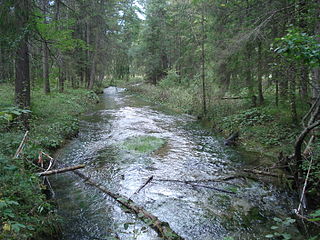
Kohlbach is a river of Bavaria, Germany. It is a left tributary of the Ammer south of Oberammergau.
The Ammergau is a lower area between Ettal and Bad Kohlgrub on the Amper river in Bavaria. It is near the border with Austrian Tyrol and maintains some cultural and geographical similarity. The nearby mountains are called the Ammergau Alps. It has the main municipal divisions of Unterammergau and Oberammergau, with Oberammergau as the main town, and is a part of the Garmisch-Partenkirchen District. The name possibly derives from the nearby Amber Road or the word Ameri, meaning Swamp.
Julius Naue was a German painter, illustrator and archaeologist.
This page is based on this
Wikipedia article Text is available under the
CC BY-SA 4.0 license; additional terms may apply.
Images, videos and audio are available under their respective licenses.
