Łosiny is a village in the administrative district of Gmina Cekcyn, within Tuchola County, Kuyavian-Pomeranian Voivodeship, in north-central Poland.

Marcinkowo Dolne is a village in the administrative district of Gmina Gąsawa, within Żnin County, Kuyavian-Pomeranian Voivodeship, in north-central Poland. It lies approximately 4 kilometres (2 mi) west of Gąsawa, 9 km (6 mi) south of Żnin, and 44 km (27 mi) south-west of Bydgoszcz.
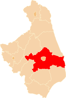
Kalitnik is a village in the administrative district of Gmina Michałowo, within Białystok County, Podlaskie Voivodeship, in north-eastern Poland, close to the border with Belarus.
Lewsze is a village in the administrative district of Gmina Michałowo, within Białystok County, Podlaskie Voivodeship, in northeastern Poland, near the border with Belarus.
Zusienko is a village in the administrative district of Gmina Przerośl, within Suwałki County, Podlaskie Voivodeship, in north-eastern Poland.

Biały Ług is a village in the administrative district of Gmina Zduńska Wola, within Zduńska Wola County, Łódź Voivodeship, in central Poland. It lies approximately 2 kilometres (1 mi) north-east of Zduńska Wola and 39 km (24 mi) south-west of the regional capital Łódź.

Hubinek is a village in the administrative district of Gmina Ulhówek, within Tomaszów Lubelski County, Lublin Voivodeship, in eastern Poland, close to the border with Ukraine. It lies approximately 6 kilometres (4 mi) west of Ulhówek, 21 km (13 mi) east of Tomaszów Lubelski, and 120 km (75 mi) south-east of the regional capital Lublin. The village is located in the historical region Galicia.

Oserdów is a village in the administrative district of Gmina Ulhówek, within Tomaszów Lubelski County, Lublin Voivodeship, in eastern Poland, close to the border with Ukraine. It lies approximately 15 kilometres (9 mi) east of Ulhówek, 41 km (25 mi) east of Tomaszów Lubelski, and 136 km (85 mi) south-east of the regional capital Lublin. The village is located in the historical region Galicia.

Głazów is a village in the administrative district of Gmina Obrazów, within Sandomierz County, Świętokrzyskie Voivodeship, in south-central Poland. It lies approximately 2 kilometres (1 mi) north-west of Obrazów, 10 km (6 mi) west of Sandomierz, and 74 km (46 mi) east of the regional capital Kielce.

Jęgrzna is a village in the administrative district of Gmina Łączna, within Skarżysko County, Świętokrzyskie Voivodeship, in south-central Poland. It lies approximately 1 kilometre (1 mi) south-west of Łączna, 18 km (11 mi) south-west of Skarżysko-Kamienna, and 17 km (11 mi) north-east of the regional capital Kielce.

Gąsów is a village in the administrative district of Gmina Górzno, within Garwolin County, Masovian Voivodeship, in east-central Poland. It lies approximately 5 kilometres (3 mi) south of Górzno, 12 km (7 mi) south-east of Garwolin, and 67 km (42 mi) south-east of Warsaw.

Czachorowo is a village in the administrative district of Gmina Gostyń, within Gostyń County, Greater Poland Voivodeship, in west-central Poland. It lies approximately 5 kilometres (3 mi) south-west of Gostyń and 62 km (39 mi) south of the regional capital Poznań.
Obrydy is a village in the administrative district of Gmina Malanów, within Turek County, Greater Poland Voivodeship, in west-central Poland.
Ciosaniec-Bolkowo is a village in the administrative district of Gmina Okonek, within Złotów County, Greater Poland Voivodeship, in west-central Poland.
Krzywa Wieś-Leśniczówka is a village in the administrative district of Gmina Złotów, within Złotów County, Greater Poland Voivodeship, in west-central Poland.
Karczyn is a village in the administrative district of Gmina Sulechów, within Zielona Góra County, Lubusz Voivodeship, in western Poland.

Żabno is a village in the administrative district of Gmina Brusy, within Chojnice County, Pomeranian Voivodeship, in northern Poland. It lies approximately 3 kilometres (2 mi) south-west of Brusy, 21 km (13 mi) north-east of Chojnice, and 83 km (52 mi) south-west of the regional capital Gdańsk.

Lotyń is a village in the administrative district of Gmina Chojnice, within Chojnice County, Pomeranian Voivodeship, in northern Poland. It lies approximately 13 kilometres (8 mi) east of Chojnice and 95 km (59 mi) south-west of the regional capital Gdańsk.

Kotłowo is a settlement in the administrative district of Gmina Kępice, within Słupsk County, Pomeranian Voivodeship, in northern Poland. It lies approximately 8 kilometres (5 mi) north-east of Kępice, 21 km (13 mi) south of Słupsk, and 108 km (67 mi) west of the regional capital Gdańsk.
Leśny Dwór is a village in the administrative district of Gmina Szczytno, within Szczytno County, Warmian-Masurian Voivodeship, in northern Poland.


