Konjic (Osečina)

Last updated

Konjic
Коњиц
Village
Serbia adm location map.svg
Red pog.svg
Konjic
Coordinates: 44°17′N19°33′E / 44.283°N 19.550°E / 44.283; 19.550
CountryFlag of Serbia.svg  Serbia
District Kolubara
Municipality Osečina
Time zone CET (UTC+1)
  Summer (DST) CEST (UTC+2)

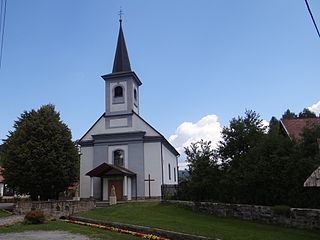
Konjic is a village located in Osečina Municipality, Kolubara District, Serbia. [1]

Osečina Town and municipality in Šumadija and Western Serbia, Serbia

Osečina is a town and municipality located in the Kolubara District of western Serbia. As of 2011, the population of the town is 2,730, while population of the municipality is 12,571 inhabitants.

Kolubara District District of Serbia in Šumadija and Western Serbia

The Kolubara District is one of eight administrative districts of Šumadija and Western Serbia. It occupies the central part of western Serbia. According to the 2011 census results, it has a population of 174,513 inhabitants. The administrative center of the Kolubara District is Valjevo, on the banks of the Kolubara River.

Serbia Republic in Southeastern Europe

Serbia, officially the Republic of Serbia, is a country situated at the crossroads of Central and Southeast Europe in the southern Pannonian Plain and the central Balkans. The sovereign state borders Hungary to the north, Romania to the northeast, Bulgaria to the southeast, North Macedonia to the south, Croatia and Bosnia and Herzegovina to the west, and Montenegro to the southwest. The country claims a border with Albania through the disputed territory of Kosovo. Serbia's population is about seven million. Its capital, Belgrade, ranks among the oldest and largest citiеs in southeastern Europe.

Related Research Articles

Hofors Municipality Municipality in Gävleborg County, Sweden

Hofors Municipality is a municipality in Gävleborg County, east central Sweden. Its seat is in Hofors with 7,400 inhabitants, situated at 60°33′N16°17′E.

Riesa-Großenhain District in Saxony, Germany

Riesa-Großenhain was a district in the Free State of Saxony, Germany. It was bounded by the districts of Elbe-Elster and Oberspreewald-Lausitz in Brandenburg, Kamenz, Meißen, Döbeln and Torgau-Oschatz.

Oravský Biely Potok municipality of Slovakia

Oravský Biely Potok is a village and municipality in Tvrdošín District in the Žilina Region of northern Slovakia.

Soltszentimre Place in Bács-Kiskun, Hungary

Soltszentimre is a village in Bács-Kiskun County, in the Southern Great Plain region of southern Hungary.

Mamdi is located in Arbil Governorate, Iraq.

San Millán de los Caballeros is a municipality located in the province of León, Castile and León, Spain. According to the 2004 census (INE), the municipality has a population of 179 inhabitants.

Almochuel municipality in Aragon, Spain

Almochuel is a municipality located in the Campo de Belchite comarca, province of Zaragoza, Aragon, Spain. According to the 2008 census (INE), the municipality has a population of 33 inhabitants.

Vâlcele, Olt Commune in Olt County, Romania

Vâlcele is a commune in Olt County, Romania. It is composed of three villages: Bărcănești, Vâlcele and Vâlcelele de Sus.

Stanisławów, Mińsk County Village in Masovian, Poland

Stanisławów is a village in Mińsk County, Masovian Voivodeship, in east-central Poland. It is the seat of the gmina called Gmina Stanisławów. It lies approximately 12 kilometres (7 mi) north of Mińsk Mazowiecki and 39 km (24 mi) east of Warsaw.

Sroczyn Village in Greater Poland, Poland

Sroczyn is a village in the administrative district of Gmina Kiszkowo, within Gniezno County, Greater Poland Voivodeship, in west-central Poland. It lies approximately 5 kilometres (3 mi) south of Kiszkowo, 22 km (14 mi) west of Gniezno, and 30 km (19 mi) north-east of the regional capital Poznań.

Pokrzywnica Wielka Village in Warmian-Masurian, Poland

Pokrzywnica Wielka is a village in the administrative district of Gmina Janowiec Kościelny, within Nidzica County, Warmian-Masurian Voivodeship, in northern Poland. It lies approximately 2 kilometres (1 mi) south-east of Janowiec Kościelny, 12 km (7 mi) south-east of Nidzica, and 56 km (35 mi) south of the regional capital Olsztyn.

Rosrovut is a town and jamoat in north-west Tajikistan. It is located in Ghonchi District in Sughd province. The jamoat has a total population of 11,550.

Bani `asim is a village in west-central Yemen. It is located in the San‘a’ Governorate.

Mascote is a municipality in the state of Bahia in the North-East region of Brazil.

Santana de Cataguases is a municipality in the state of Minas Gerais in the Southeast region of Brazil.

Upa is a village in Kaarma Parish, Saare County in western Estonia.

Kumarevo is a village in the municipality of Vranje, Serbia. According to the 2002 census, the village has a population of 283 people.

Stražbenice Village in Republika Srpska, Bosnia and Herzegovina

Stražbenice is a village in the municipality of Višegrad, Bosnia and Herzegovina.

German submarine <i>U-1014</i> German U-boat type VII C/41 of the Kriegsmarine in World War II

German submarine U-1014 was a Type VIIC/41 U-boat of Nazi Germany's Kriegsmarine during World War II.

References

Coordinates: 44°17′N19°33′E / 44.283°N 19.550°E / 44.283; 19.550

Geographic coordinate system Coordinate system

A geographic coordinate system is a coordinate system that enables every location on Earth to be specified by a set of numbers, letters or symbols. The coordinates are often chosen such that one of the numbers represents a vertical position and two or three of the numbers represent a horizontal position; alternatively, a geographic position may be expressed in a combined three-dimensional Cartesian vector. A common choice of coordinates is latitude, longitude and elevation. To specify a location on a plane requires a map projection.