Czarnogoździce is a village in the administrative district of Gmina Krośnice, within Milicz County, Lower Silesian Voivodeship, in south-western Poland. It lies approximately 6 kilometres (4 mi) south of Milicz, and 45 kilometres (28 mi) north-east of the regional capital Wrocław.
Troska is a village in the administrative district of Gmina Twardogóra, within Oleśnica County, Lower Silesian Voivodeship, in south-western Poland. Prior to 1945 it was in Germany.
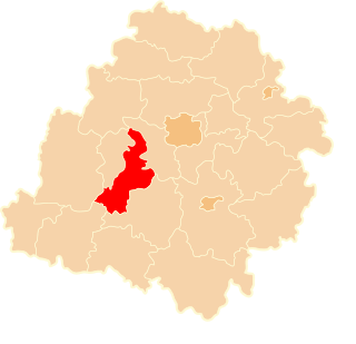
Sędziszowa is a village in the administrative district of Gmina Świerzawa, within Złotoryja County, Lower Silesian Voivodeship, in south-western Poland. Prior to 1945 it was in Germany.
Morsk is a village in the administrative district of Gmina Świecie, within Świecie County, Kuyavian-Pomeranian Voivodeship, in north-central Poland.
Ubrodowice is a village in the administrative district of Gmina Hrubieszów, within Hrubieszów County, Lublin Voivodeship, in eastern Poland, close to the border with Ukraine. It lies approximately 11 kilometres (7 mi) north of Hrubieszów and 99 km (62 mi) south-east of the regional capital Lublin.
Aleksandrówka is a village in the administrative district of Gmina Batorz, within Janów Lubelski County, Lublin Voivodeship, in eastern Poland. It lies approximately 4 kilometres (2 mi) north-west of Batorz, 18 km (11 mi) north of Janów Lubelski, and 43 km (27 mi) south of the regional capital Lublin.
Bielanowszczyzna is a village in the administrative district of Gmina Bielsk Podlaski, within Bielsk County, Podlaskie Voivodeship, in north-eastern Poland. It lies approximately 12 kilometres (7 mi) north of Bielsk Podlaski and 28 km (17 mi) south of the regional capital Białystok.
Adamów is a village in the administrative district of Gmina Poddębice, within Poddębice County, Łódź Voivodeship, in central Poland. It lies approximately 5 kilometres (3 mi) south-east of Poddębice and 34 km (21 mi) west of the regional capital Łódź.
Zamoście is a village in the administrative district of Gmina Zapolice, within Zduńska Wola County, Łódź Voivodeship, in central Poland. It lies approximately 4 kilometres (2 mi) south of Zapolice, 12 km (7 mi) south-west of Zduńska Wola, and 51 km (32 mi) south-west of the regional capital Łódź.

Mniów is a village in Kielce County, Świętokrzyskie Voivodeship, in south-central Poland. It is the seat of the gmina called Gmina Mniów. It lies approximately 17 km (11 mi) north-west of the regional capital Kielce.
Grzegorzowice is a village in the administrative district of Gmina Waśniów, within Ostrowiec County, Świętokrzyskie Voivodeship, in south-central Poland. It lies approximately 7 kilometres (4 mi) south-west of Waśniów, 20 km (12 mi) west of Ostrowiec Świętokrzyski, and 37 km (23 mi) east of the regional capital Kielce.
Żyźniewo is a village in the administrative district of Gmina Troszyn, within Ostrołęka County, Masovian Voivodeship, in east-central Poland. It lies approximately 10 kilometres (6 mi) east of Troszyn, 21 km (13 mi) east of Ostrołęka, and 111 km (69 mi) north-east of Warsaw.
Aleksandrowo is a village in the administrative district of Gmina Chorzele, within Przasnysz County, Masovian Voivodeship, in east-central Poland.
Podgóry is a settlement in the administrative district of Gmina Potworów, within Przysucha County, Masovian Voivodeship, in east-central Poland.
Płużniczka is a village in the administrative district of Gmina Toszek, within Gliwice County, Silesian Voivodeship, in southern Poland. It lies approximately 4 kilometres (2 mi) north-west of Toszek, 25 km (16 mi) north-west of Gliwice, and 45 km (28 mi) north-west of the regional capital Katowice.
Marianki is a village in the administrative district of Gmina Kolsko, within Nowa Sól County, Lubusz Voivodeship, in western Poland. It lies approximately 7 kilometres (4 mi) west of Kolsko, 19 km (12 mi) north-east of Nowa Sól, and 26 km (16 mi) east of Zielona Góra.
Strumiany is a village in the administrative district of Gmina Kolsko, within Nowa Sól County, Lubusz Voivodeship, in western Poland. It lies approximately 7 kilometres (4 mi) west of Kolsko, 19 km (12 mi) north-east of Nowa Sól, and 26 km (16 mi) east of Zielona Góra.
Biernatów is a village in the administrative district of Gmina Szprotawa, within Żagań County, Lubusz Voivodeship, in western Poland. It lies approximately 14 kilometres (9 mi) south-east of Szprotawa, 28 km (17 mi) south-east of Żagań, and 52 km (32 mi) south of Zielona Góra.
Żabno is a village in the administrative district of Gmina Starogard Gdański, within Starogard County, Pomeranian Voivodeship, in northern Poland. It lies approximately 4 kilometres (2 mi) north-west of Starogard Gdański and 44 km (27 mi) south of the regional capital Gdańsk.
Okartowo-Tartak is a settlement in the administrative district of Gmina Orzysz, within Pisz County, Warmian-Masurian Voivodeship, in northern Poland.