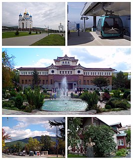
Krasnogorsk (Russian : Красногорск) is the name of several inhabited localities in Russia.
Russian is an East Slavic language, which is official in the Russian Federation, Belarus, Kazakhstan and Kyrgyzstan, as well as being widely used throughout Eastern Europe, the Baltic states, the Caucasus and Central Asia. It was the de facto language of the Soviet Union until its dissolution on 25 December 1991. Although nearly three decades have passed since the breakup of the Soviet Union, Russian is used in official capacity or in public life in all the post-Soviet nation-states, as well as in Israel and Mongolia.
The classification system of the types of inhabited localities in Russia, the former Soviet Union, and some other post-Soviet states has certain peculiarities compared with the classification systems in other countries.
Krasnogorsk is a city and the administrative center of Krasnogorsky District in Moscow Oblast, Russia, located on the Moskva River, adjacent to the northwestern boundary of Moscow. Population: 116,896 (2010 Census); 92,545 (2002 Census); 90,477 (1989 Census).
Krasnogorsky District is an administrative and municipal district (raion), one of the thirty-six in Moscow Oblast, Russia. It is located in the center of the oblast. The area of the district is 224.99 square kilometers (86.87 sq mi). Its administrative center is the city of Krasnogorsk. Population: 179,872 (2010 Census); 149,679 ; 51,823 (1989 Census). The population of Krasnogorsk accounts for 65.0% of the district's total population.
Moscow Oblast, or Podmoskovye, is a federal subject of Russia. With a population of 7,095,120 living in an area of 44,300 square kilometers (17,100 sq mi), it is one of the most densely populated regions in the country and is the second most populous federal subject. The oblast has no official administrative center; its public authorities are located in Moscow and across other locations in the oblast.
Tomarinsky District is an administrative district (raion) of Sakhalin Oblast, Russia; one of the seventeen in the oblast. Municipally, it is incorporated as Tomarinsky Urban Okrug. It is located in the southwest of the Island of Sakhalin. The area of the district is 3,169.3 square kilometers (1,223.7 sq mi). Its administrative center is the town of Tomari. Population: 9,457 (2010 Census); 11,678 (2002 Census); 17,823 (1989 Census). The population of Tomari accounts for 48.0% of the district's total population.
Sakhalin Oblast is a federal subject of Russia comprising the island of Sakhalin and the Kuril Islands in the Russian Far East. The oblast has an area of 87,100 square kilometers (33,600 sq mi). Its administrative center and the largest city is Yuzhno-Sakhalinsk. Population: 497,973. Besides people from other parts of the former Soviet Union and the Korean Peninsula, the oblast is home to Nivkhs and Ainu, with the latter having lost their language in Sakhalin recently. Sakhalin is rich in natural gas and oil, and is Russia's second wealthiest federal subject. It borders Khabarovsk Krai to the west and Hokkaido, Japan to the south.
This article includes a list of related items that share the same name (or similar names). If an internal link incorrectly led you here, you may wish to change the link to point directly to the intended article. |
Okha is a town and the administrative center of Okhinsky District of Sakhalin Oblast, Russia, located on the east coast of the far north of Sakhalin island, approximately 850 kilometers (530 mi) north of Yuzhno-Sakhalinsk, near the shoreline of the Sea of Okhotsk. Population: 23,008 (2010 Census); 27,963 (2002 Census); 36,104 (1989 Census).
Yuzhno-Sakhalinsk is a city in Sakhalin island, and the administrative center of Sakhalin Oblast, Russia. It is located in the Far East part of Russia, situated north of Japan. Gas and oil extraction as well as processing are amongst the main industrial manufactures on the island. It is also a place of working of major US oil companies such as ExxonMobil. It was called Vladimirovka (Влади́мировка) from 1882 to 1905, then Toyohara from 1905 to 1946. Population: 181,728 (2010 Census); 175,085 (2002 Census); 159,299 (1989 Census).
Alexandrovsk-Sakhalinsky is a town in Sakhalin Oblast, Russia, located near the Strait of Tartary on the western shores of Northern Sakhalin at the foot of the Western Sakhalin Mountains. Population: 10,613 (2010 Census); 12,826 (2002 Census); 19,166 (1989 Census); 21,000 (1968).
Yuzhno-Kurilsky District is an administrative district (raion) of Sakhalin Oblast, Russia; one of the seventeen in the oblast. Municipally, it is incorporated as Yuzhno-Kurilsky Urban Okrug. It is located on the southern Kuril Islands southeast of the Island of Sakhalin, comprising the islands of Kunashir, Shikotan, and the Habomai. The area of the district is 1,856.1 square kilometers (716.6 sq mi). Its administrative center is the urban locality of Yuzhno-Kurilsk, located on the Kunashir Island. Population: 9,501 (2010 Census); 9,727 (2002 Census); 13,597 (1989 Census). The population of Yuzhno-Kurilsk accounts for 61.4% of the district's total population.
Shakhtyorsk is a town in Uglegorsky District of Sakhalin Oblast, Russia, located on the western coast of the Sakhalin Island, 376 kilometers (234 mi) northwest of Yuzhno-Sakhalinsk, the administrative center of the oblast. Population: 8,382 (2010 Census); 10,643 (2002 Census); 12,945 (1989 Census).
Rybny, Rybnaya, or Rybnoye is the name of several inhabited localities in Russia.
Aniva is a coastal town and the administrative center of Anivsky District of Sakhalin Oblast, Russia, located on the coast of Aniva Bay in southern Sakhalin Island on the Lyutoga River, 37 kilometers (23 mi) south of Yuzhno-Sakhalinsk. Population: 9,115 (2010 Census); 8,084 (2002 Census); 8,905 (1989 Census).
Makarov is a coastal town and the administrative center of Makarovsky District of Sakhalin Oblast, Russia, located on the eastern coast of the Sakhalin Island, 235 kilometers (146 mi) north of Yuzhno-Sakhalinsk. Population: 6,705 (2010 Census); 7,271 (2002 Census); 11,351 (1989 Census).
Smirnykh is an urban locality and the administrative center of Smirnykhovsky District of Sakhalin Oblast, Russia, located in the central part of the Sakhalin Island. Population: 7,399 (2010 Census); 7,561 (2002 Census); 9,693 (1989 Census).
Ozyorsky, Ozyorskaya, or Ozyorskoye, alternatively spelled Ozersky (Озерский), Ozerskaya (Озерская), or Ozerskoye (Озерское), is the name of several rural localities in Russia:
Severo-Kurilsky District is an administrative district (raion) of Sakhalin Oblast, Russia; one of the seventeen in the oblast. Municipally, it is incorporated as Severo-Kurilsky Urban Okrug. It is located on the northern Kuril Islands to the east of the Island of Sakhalin and immediately southwest of the Kamchatka Peninsula. The area of the district is 3,501.2 square kilometers (1,351.8 sq mi). Its administrative center is the town of Severo-Kurilsk on Paramushir island. Population: 2,536 (2010 Census); 2,592 (2002 Census); 5,420 (1989 Census). The population of Severo-Kurilsk accounts for almost 100% of the district's total population, though there is often a seasonal population on the island of Shumshu.
Smirnykhovsky District is an administrative district (raion) of Sakhalin Oblast, Russia; one of the seventeen in the oblast. Municipally, it is incorporated as Smirnykhovsky Urban Okrug. It is located in the central part of the Island of Sakhalin. The area of the district is 10,457.43 square kilometers (4,037.64 sq mi). Its administrative center is the urban locality of Smirnykh. As of the 2010 Census, the total population of the district was 13,142, with the population of Smirnykh accounting for 56.3% of that number.
Krasnaya Gora is the name of several inhabited localities in Russia.
Chekhov is the name of several inhabited localities in Russia.
Chekhovsky, Chekhovskaya, or Chekhovskoye is the name of several rural localities in Russia:
Porechye is the name of several rural localities in Russia.