Related Research Articles

Oscar II Land is the land area between Isfjorden and Kongsfjorden on Spitsbergen, Svalbard. The 30 km (19 mi) long glacier Sveabreen divides Oscar II Land from James I Land.
James I Land is a land area on the northwestern part of Spitsbergen, Svalbard. It is named after King James I of England and Scotland. The 30 kilometer long glacier Sveabreen divides James I Land from Oscar II Land.

Platåberget is a mountain in Nordenskiöld Land on the island of Spitsbergen in Svalbard, Norway. It is 464 meters (1,522 ft) tall and has a distinct plateau shape, for which it is named. It is bordered to the west by the Bjørndalen valley and the Fuglefjella bird cliffs, to the east by the Blomsterdalen mountain and to the north by Hotellneset and Adventfjorden. The mountain is a few kilometers from Longyearbyen and is next to Svalbard Airport, Longyear. It is the site of Svalbard Satellite Station and Svalbard Global Seed Vault.

Trygghamna is a bay in Oscar II Land at Spitsbergen, Svalbard. It is about six kilometer long, located at the northern side of Isfjorden, east of Protektorfjellet, and separated from Ymerbukta by the mountain chain Värmlandryggen.
St. Jonsfjorden is a fjord in Oscar II Land at Spitsbergen, Svalbard. It has a length of 21 kilometer, and opens westwards into the strait of Forlandsundet. Several glaciers debouche into the fjord, including Gaffelbreen and Konowbreen from the north, a merge of Osbornebreen, Devikbreen, Vintervegen, Paulbreen and Bukkebreen at the bottom, and Vegardbreen, Charlesbreen and Bullbreen from the south.
Osbornebreen is a glacier in Oscar II Land at Spitsbergen, Svalbard, Norway. It has a length of 21 kilometers, merges with the glaciers Devikbreen, Klampebreen and Vintervegen, and debouches into St. Jonsfjorden. The mountain ridge Goldschmidtfjella forms a six kilometer long nunatak in the glacier.
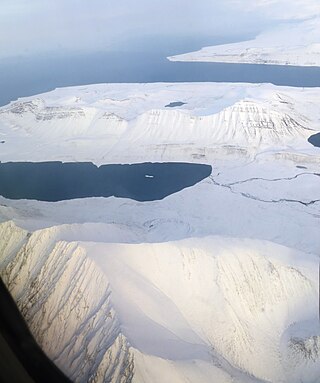
Devikbreen is a glacier in Oscar II Land at Spitsbergen, Svalbard. It is located between Devikfjellet and Krymlefjellet to the north/west, and Tispa, Kvelpane and Klampen to the south/east. Devikbreen merges with several other glaciers, including Osbornebreen, Klampebreen, and Vintervegen, and the merged glacier debouches into St. Jonsfjorden. The length of the glacier is six kilometers. The glacier is named after physicist Olaf Devik.
Devikfjellet is a mountain in Oscar II Land at Spitsbergen, Svalbard. It is located between the glaciers Osbornebreen and Devikbreen, northeast of the head of St. Jonsfjorden, and has an altitude of 860 meters. The mountain is named after physicist Olaf Devik. Nearby mountains are Krymlefjellet to the north and Klampen to the south.
Goldschmidtfjella is a mountain in Oscar II Land at Spitsbergen, Svalbard. It forms a 6 kilometer long nunatak in the glacier Osbornebreen, north of the head of St. Jonsfjorden, and reaches an altitude of 581 meters. The mountain is named after geologist and mineralogist Victor Moritz Goldschmidt. Nearby mountains are Carlsfjella to the west and Devikfjellet to the east.
Vintervegen is a glacier in Oscar II Land at Spitsbergen, Svalbard. It has a length of about 7.5 kilometers (4.7 mi). The glacier borders to the mountain of Klampen, merges with Osbornebreen and other glaciers, and the merged glacier stream debouches into the head of St. Jonsfjorden.
Kongsvegpasset is a glaciated mountain pass at Spitsbergen, Svalbard, between Oscar II Land, Haakon VII Land and James I Land. It divides the three glaciers Sveabreen, Osbornebreen and Kongsvegen, at an altitude of about 750 meter. An aircraft beacon is installed at the site. Nearby mountains are the nunataks Vegvaktaren, Gjerstadfjellet and Centralen. North of the pass is the mountain Kongsvegsåta.
Monacofjellet is a mountain in Prins Karls Forland, Svalbard. It has a height of 1,084 m.a.s.l., and is the highest mountain of Forlandet. Monacofjellet is part of the Grampianfjella mountain ridge.
Freemanbreen is a glacier on Barentsøya, Svalbard. It is an offshoot of Barentsjøkulen, reaching down to the sea in the southern direction, into Freeman Strait. The glacier is named after British Alderman Ralph Freeman. The mountain of Buklerimen separates Freemanbreen from the glacier of Hübnerbreen.
Svanbergfjellet is a mountain in Olav V Land at Spitsbergen, Svalbard. It has a height of 1,024 m.a.s.l. and is located east of Billefjorden and west of Akademikarbreen. The mountain is named after Swedish astronomer Jöns Svanberg. A point on the mountain was used as a trigonometric point during the Swedish-Russian Arc-of-Meridian Expedition.
Vegardfjella is a mountain in Oscar II Land at Spitsbergen, Svalbard, which is a Norwegian archipelago in the Arctic Ocean. It is located between the glaciers of Vegardbreen and Charlesbreen, and its highest peak is Larstoppen with a height of 859 m.a.s.l. The mountain is named after Norwegian physicist Lars Vegard.
Vittenburgfjella is a mountain range in Oscar II Land at Spitsbergen, Svalbard. It is located at the eastern side of St. Jonsfjorden, surrounding the glacier of Paulbreen, and its highest peak is 895 m.a.s.l. The mountain range is named after Russian paleontologist Paul Vittenburg.
Paulbreen is a glacier in Oscar II Land at Spitsbergen, Svalbard. It has a length of about four kilometers and is located at the eastern side of St. Jonsfjorden. The glacier is surrounded by Vittenburgfjella, and splits the range in a northern and southern part. The glacier, as well as the surrounding mountain range, is named after Russian paleontologist Paul Vittenburg.
Løvliebreen is a glacier in Oscar II Land at Spitsbergen, Svalbard. It has a length of about five kilometers, and is located between the mountain ranges of Gunnar Knudsenfjella and Holmesletfjella. The glacier debouches northwards towards St. Jonsfjorden. It is named after Norwegian businessperson Andreas Løvlie along with the nearby mountain of Løvliefjellet.
Svartfjella is a mountain area in Oscar II Land at Spitsbergen, Svalbard. It is located between the glacier of Bullbreen and the lowland of Svartfjellstranda, at the eastern side of Forlandsundet. The highest peak is 674 m.a.s.l., and the area extends over a length of about 4.5 kilometers.
Linnéfjella is a mountain ridge in Nordenskiöld Land at Spitsbergen, Svalbard. It is named after Swedish botanist Carl Linnaeus. The ridge contains the mountains of Solryggen, Aagaardtoppen, Griegfjellet and Griegaksla. East of the ridge is the valley of Linnédalen.
References
- ↑ "Krymlefjellet (Svalbard)". Norwegian Polar Institute . Retrieved 19 November 2013.
- ↑ "Devikbreen (Svalbard)". Norwegian Polar Institute . Retrieved 19 November 2013.
78°40′26″N13°25′12″E / 78.674°N 13.420°E
| | This Spitsbergen mountain, mountain range, or peak related article is a stub. You can help Wikipedia by expanding it. |