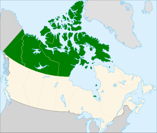
The Tree River (Kogluktualuk) is a river in Nunavut, Canada. It flows into Coronation Gulf, an arm of the Arctic Ocean.
The Duke of York Archipelago is an uninhabited island group in the Kitikmeot Region, Nunavut, Canada. It is located in the Coronation Gulf.
Ogden Bay is an Arctic waterway in Kitikmeot Region, Nunavut, Canada. It is located in the southern Queen Maud Gulf off Nunavut's mainland. Chester Bay is situated 32 km (20 mi) to the west, Armark is to the east, and the Keith Islands are to the north.
The Rae River (Pallirk) is a waterway that flows from Akuliakattak Lake into Richardson Bay, Coronation Gulf. Its mouth is situated northwest of Kugluktuk, Nunavut. Its shores were the ancestral home of Copper Inuit subgroups: the Kanianermiut and the Pallirmiut.

Albert Edward Bay is a bay on the southeast side of Victoria Island in the Canadian Arctic Archipelago. If faces Victoria Strait to the east. There are several islands in the bay, the largest of which is Admiralty Island at its mouth. Its north side is the Collinson Peninsula.
Ahiagmiut were a geographically defined Copper Inuit subgroup in the northern Canadian territory of Nunavut. They were located near Ogden Bay, on the Queen Maud Gulf, and inland towards Back River, then on towards the Akilinik River.
Akuliakattagmiut were a geographically defined Copper Inuit subgroup in the Canadian territory of Nunavut. They were located near Cape Bexley on the south shore, mainland side of Dolphin and Union Strait, and in the vicinity of the Melville Hills' Akuliakattak Lake, the source of the Rae River.
Ekalluktogmiut were a geographically defined Copper Inuit subgroup in Canada's Nunavut territory. They were located along the Ekalluk River near the center of Victoria Island, Albert Edward Bay in western Victoria Strait, and Denmark Bay. According to the Arctic explorer Vilhjalmur Stefansson, the Ekalluktogmiut winter hunt on Dease Strait.
Kogluktogmiut were a geographically defined Copper Inuit subgroup in the Canadian territory of Nunavut. They were located by Bloody Falls, a waterfall on the lower course of the Coppermine River in the Kugluk/Bloody Falls Territorial Park, notable for the Bloody Falls Massacre.
Sutton Island is located in northern Canada's territory of Nunavut. It is situated in the Dolphin and Union Strait immediately next to Liston/Listen Island. Rymer Point and Simpson Bay, on Victoria Island's Wollaston Peninsula are to the northeast. Bernard Harbour, on the mainland, is to the southwest, as is Chantrey Island.
Cape Bexley is a headland in the northern Canadian territory of Nunavut. It is located on the mainland, on the south shore of Dolphin and Union Strait, and bounded on the south by Souths Bay.
The Haningayogmiut were a Copper Inuit subgroup located on the Back River (Haningayok). According to Arctic explorer Vilhjalmur Stefansson, the Haningayogmiut were a small tribe. The Kaernermiut were also located on the Back River and may have been the same subgroup.
The Ugyuligmiut were a geographically defined Copper Inuit band in the Canadian Arctic's Northwest Territories. They were located on Victoria Island north of Minto Inlet, and on Banks Island in the Aulavik National Park region.
The Pingangnaktok are a geographically defined Copper Inuit band in the northern Canadian territory of Nunavut, on the mainland, in Kitikmeot Region. According to Arctic explorer Vilhjalmur Stefansson's 1908-1912 ethnographic journals, they numbered about 30 at the time. In the summer, they hunted to the west of Tree River, which flows into the Coronation Gulf, where they hunted during the winter, the same as other Copper Inuit of that region.
Tahiryuak Lake is a lake located in the Canadian Arctic's Northwest Territories. It is situated in northcentral Victoria Island, north of Prince Albert Sound, southeast of Minto Inlet.
Pallirmiut were a geographically defined Copper Inuit group in the Canadian Arctic territory of Nunavut. They were located by the mouth of the Rae River (Pallirk) during the spring. Some stayed there during summers, while others joined the Kogluktogmiut at the Bloody Falls summer salmon fishery. Pallirmiut wintered on west central Coronation Gulf, and went inland when the snow was gone, carrying packs rather than using sleds.
The Roscoe River is a waterway located above the Arctic Circle on the mainland of Northern Canada.
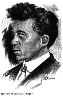
The Canadian Arctic Expedition 1913–1916 was a scientific expedition in the Arctic Circle organized and led by Vilhjalmur Stefansson. The expedition was originally to be sponsored by the (US) National Geographic Society and the American Museum of Natural History. Canada took over the sponsorship because of the potential for discovery of new land and Stefansson, who though born in Canada was now an American, re-established his Canadian citizenship. The expedition was divided into a Northern Party led by Stefansson, and a Southern Party led by R M. Anderson.
The Kilusiktogmiut were a Copper Inuit subgroup. They lived on Victoria Island, east of the Nagyuktogmiut who were known to inhabit the area northeast of Lady Franklin Point. They also lived on the mainland along the Coronation Gulf, particularly at the mouth of the Mackenzie River. They spent at least some time on the Banks Peninsula by Bathurst Inlet.