
The Tarma Province is a Peruvian province, making up one of the nine provinces that conform the Junín Region. To the north it borders with the Junín Province, the east with the Chanchamayo Province, the south with the Jauja Province and the west with the Yauli Province.
The Yauli Province is one of the nine provinces in Peru that form the Junín Region. It is bordered to the north by the Pasco Region and the Junín Province, to the east by the Tarma Province, to the south by the Jauja Province and to the west by the Lima Region. The population of the province was estimated at 66,093 inhabitants in 2002. The capital of the Yauli Province is La Oroya.
Jauja Province is a Peruvian province. It is one of the nine provinces of the Junín Region. To the north it borders with the Yauli, Tarma and Chanchamayo Provinces. To the east with the Satipo Province, to the south with the Concepción Province and to the west with the Lima Region. The capital of the Jauja Province is the city of Jauja. The city was founded by Francisco Pizarro as the first capital of Peru.

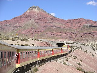
The Mantaro River is a long river running through the central region of Peru. Its Quechua name means "great river". The word "Mantaro" may be a word originally from the Ashaninka language, who live downstream along the Ene River. The Mantaro, along with the Apurimac River, are the sources of the Amazon River, depending on the criteria used for definition.
Pomacancha is one of thirty-four districts of the Jauja Province in Peru.

Condorsenja or Condorshenga is a mountain in the Raura mountain range in the Andes of Peru with 5,379 metres (17,648 ft) of elevation. It is located in the Lima Region, Oyón Province, Oyón District. Condorsenja lies south of the lakes T'inkiqucha and Puywanqucha and west of mount Santa Rosa.
Kuntur Sinqa is a viewpoint in Peru. It is situated in the Cusco Region, La Convención Province, Echarate District. The viewpoint is a kind of balcony made out of concrete and metal which runs around a rock. It lies about 500 metres (1,640 ft) above the Turuntuypata River (Torontoypata) and it is about 100 metres (328 ft) long. The balcony of Kuntur Sinqa is considered one of the outstanding works of engineering of the Cusco Region.
Kuntur Sinqa is a mountain in the Andes of Peru. It is located in the Ayacucho Region, Huanta Province, Luricocha District. Kuntur Sinqa lies on the right bank of the Mantaro River, east of San Miguel de Mayocc and southwest of San José de Secce.
Kuntur Sinqa may refer to:
Kuntur Sinqa is a mountain in the Cusco Region in Peru, about 4,256.8 metres (13,966 ft) high. It lies in the Paruro Province, Pillpinto District. Kuntur Sinqa is situated west of the Apurímac River.

Machu Kuntur Sinqa or Machu Kuntur Sankha is a mountain in the Cusco Region in Peru, about 4,200 metres (13,780 ft) high. It is situated in the Calca Province, on the border of the districts Pisac and San Salvador. Machu Kuntur Sinqa lies on the right bank of the Willkanuta River, near the archaeological park of Pisac.
Condorsenja is mountain in the northern extensions of the Vilcanota mountain range in the Andes of Peru, about 4,800 metres (15,748 ft) high. It is located in the Cusco Region, Quispicanchi Province, on the border of the districts of Ccarhuayo and Ocongate. The mountain lies southwest of Jolljepunco and Cinajara where the annual Quyllu Rit'i festival takes place. Yuracjaja and Jajachaca are southeast of Condorsenja.
Kuntur Sinqa is a mountain in the Cordillera Blanca in the Andes of Peru, about 4,630 m (15,190 ft) high. It is situated in the Ancash Region, Recuay Province, Catac District. Kuntur Sinqa lies west of Mururahu at a lake named Qishqiqucha.

Yuaytacondorsenja is a 5,345-metre-high (17,536 ft) mountain in the Chila mountain range in the Andes of Peru. It is located in the Arequipa Region, Castilla Province, Chachas District. Yuaytacondorsenja lies northwest of Chila and Chila Pillune. It is situated at the end of a valley named Puncuhuaico. Its stream flows to Chachas Lake.
Warmi Sinqa is a mountain in the Andes of Peru which reaches a height of approximately 4,000 m (13,000 ft). It lies in the Junín Region, Tarma Province, Tarma District.
Kuntur Sinqa is a mountain in the Andes of Peru which reaches a height of approximately 4,000 m (13,000 ft). It lies in the Junín Region, Tarma Province, Tarma District.
Kuntur Wayi or Kuntur Wayin may refer to:
Kuntur Punta is a mountain in the Andes of Peru which reaches a height of approximately 4,400 m (14,400 ft). It is located in the Junín Region, Tarma Province, Cajas District.
Kuntur Muyunan is a mountain in the Andes of Peru which reaches a height of approximately 4,200 m (13,800 ft). It is located in the Junín Region, Chanchamayo Province, Chanchamayo District. Kuntur Muyunan lies north of a lake named Hatunqucha.
Kuntur Tiyana is a mountain in the Cordillera Central in the Andes of Peru which reaches a height of approximately 4,600 metres (15,092 ft). It is located in the Junín Region, Chupaca Province, Yanacancha District.


