Mindanao is the second-largest island in the Philippines, after Luzon, and seventh-most populous island in the world. Located in the southern region of the archipelago, the island is part of an island group of the same name that also includes its adjacent islands, notably the Sulu Archipelago. According to the 2020 census, Mindanao had a population of 26,252,442, while the entire island group had an estimated population of 27,021,036.

Maguindanao was a province of the Philippines located in the Bangsamoro Autonomous Region in Muslim Mindanao (BARMM). From 2014 to 2022, its provincial capital was Buluan, but the legislative branch of government, the Maguindanao Provincial Board, convened at the old provincial capitol in Sultan Kudarat. It bordered Lanao del Sur to the north, Cotabato to the east, Sultan Kudarat to the south, and Illana Bay to the west.

South Cotabato, officially the Province of South Cotabato, is a province in the Philippines located in the Soccsksargen region in Mindanao. Its capital is Koronadal, and it borders Sultan Kudarat to the north and west, Sarangani to the south and northeast, and Davao del Sur to the far northeast. To the southeast lies Sarangani Bay.

Sarangani, officially the Province of Sarangani, is a province in the Philippines located in the Soccsksargen region. Its capital is Alabel while Glan is the most populous municipality in the province. With a 230-kilometer (140 mi) coastline along the Sarangani Bay and Celebes Sea, the province is at the southernmost tip of Mindanao island, and borders South Cotabato and Davao del Sur to the north, Davao Occidental to the east, and the Celebes Sea to the south.

Cotabato, formerly and still commonly referred to as North Cotabato and officially the Province of Cotabato, is a landlocked province in the Philippines located in the Soccsksargen region in Mindanao. Its capital is the city of Kidapawan, the most populous in the province. Some of its municipalities are under the jurisdiction of the nearby Bangsamoro Autonomous Region.

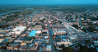
Cotabato City, officially the City of Cotabato, is a independent component city in the Bangsamoro Autonomous Region in Muslim Mindanao, Philippines. According to the 2020 census, it has a population of 325,079 people, making it as the most populated city under the independent component city status.

Intramuros is the 0.67-square-kilometer (0.26 sq mi) historic walled area within the city of Manila, the capital of the Philippines. It is administered by the Intramuros Administration with the help of the city government of Manila.

Libon, officially the Municipality of Libon, is a municipality in the province of Albay, Philippines. According to the 2020 census, it has a population of 75,073 people.

The Rio Grande de Mindanao, also known as the Mindanao River, is the second-largest river system in the Philippines. Located on the southern island of Mindanao, with a total drainage area of 23,169 km2 (8,946 sq mi), draining the majority of the central and eastern portion of the island, and a total length of approximately 373 km (232 mi). It is an important transportation artery, used mainly in transporting agricultural products and, formerly, timber.

Arakan, officially the Municipality of Arakan is a municipality in the province of Cotabato, Philippines. According to the 2020 census, it has a population of 50,558 people.

Kabacan officially the Municipality of Kabacan, is a municipality in the province of Cotabato, Philippines. According to the 2020 census, it has a population of 77,164 people.

President Roxas, officially the Municipality of President Roxas, is a municipality in the province of Cotabato, Philippines. According to the 2020 census, it has a population of 52,512 people.

San Miguel, officially the Municipality of San Miguel, is a municipality in the province of Bulacan, Philippines. According to the 2020 census, it has a population of 172,073 people.

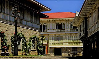
The báhay kúbo, kubo, or payág, is a type of stilt house indigenous to the Philippines. Often serving as an icon of Philippine culture, its design heavily influenced the Spanish colonial-era bahay na bato architecture.

The architecture of the Philippines reflects the historical and cultural traditions in the country. Most prominent historic structures in the archipelago are influenced by Austronesian and American architectures.

The Spanish fortifications of the Philippines, or fuerzas, are strongholds constructed by Filipinos and Spaniards primarily for protection against local and foreign aggressors during the Spanish colonial period, and during the subsequent American and Japanese occupations. Structures built included fortresses, watchtowers, and bastions. Many are badly damaged, either due to old age or past conflicts. Currently, there are initiatives for restorations of all forts, beginning when the Baluarte Luna of La Union and the Intramuros of Manila were restored in the 2010s. In 2013, a typhoon and earthquake hit Central Visayas and damaged numerous Spanish fortifications, leading to the largest restoration activity for fortifications in Philippine history.

Biak-na-Bato National Park is a protected area of the Philippines located almost entirely within Barangay Biak-na-Bato in San Miguel, Bulacan from where it derives its name. The park also extends to the nearby municipalities of San Ildefonso and Doña Remedios Trinidad covering a total area of 2,117 hectares. It was declared a national park in 1937 by President Manuel L. Quezon by virtue of its association with the history and site of the Biak-na-Bato Republic. The park consists of a cave network and a system of rivers and trails of both historical and ecological importance. Situated only 80 kilometers (50 mi) northeast from Manila, it is fast becoming a popular weekend eco-adventure destination for the city dwellers.

Angelito Rendon Lampon is a Philippine prelate of the Catholic Church who has been the Archbishop of Cotabato since 2019. He was Apostolic Vicar of Jolo from 1997 to 2018.

Fort Pikit is a historic fortification in Malidegao, Cotabato, Philippines.

Pedro Colina Hill, also known as PC Hill or Tantawan, is a hill in Cotabato City, Philippines.


