
San Salvador is the capital and the largest city of El Salvador and its eponymous department. It is the country's largest agglomeration, serving as the country's political, cultural, educational and financial center. The Municipality of San Salvador has 525,990 inhabitants (2024). The Metropolitan Area of San Salvador, which comprises the capital itself and 13 of its municipalities, has a population of 2,404,097. The urban area of San Salvador has a population of 1,600,000 inhabitants.

The Legislative Assembly is the legislative branch of the government of El Salvador.

Ahuachapán is a city, municipality, and the capital of the Ahuachapán Department in western El Salvador. The municipality, including the city, covers an area of 244.84 km2 and as of 2007 has a population of 110,511 people. Situated near the Guatemalan border, it is the westernmost city in the country and is the center of an agricultural region producing primarily coffee.

San Miguel is a city in eastern El Salvador. It is the country's third most populous city. It is located 138 km (86 mi) east of the capital, San Salvador. It is also the capital of the department of San Miguel and a municipality. The population of the city in 2024 was 290,612.

Mejicanos is a San Salvador municipality in the San Salvador department of El Salvador.
Soyapango is a municipality in the San Salvador department of El Salvador. Soyapango is the country's largest municipality with 284,700 residents. Soyapango is a satellite city of San Salvador and it is the main thoroughfare between San Salvador and the eastern part of the country, and nearly 70,000 vehicles travel through it every day. The nickname for this satellite city is Soya.

Agronomía is a barrio or district in the centre part of City of Buenos Aires, Argentina. It gets its name from the University of Buenos Aires Faculty of Agronomy based in the neighborhood. Its boundaries are Avenida San Martín, Campana, Avenida Salvador María del Carril, Avenida de los Constituyentes, and Avenida Chorroarín.

Miramar is a residential district of the municipality of Playa, in the city of Havana.

San Andrés is a pre-Columbian site in El Salvador, whose occupation began around the year 900 BC as an agricultural town in the valley of Zapotitán in the department of La Libertad. This early establishment was vacated by the year 250 because of the enormous eruption of the caldera of Lago Ilopango, and was occupied again in the 5th Century, along with many other sites in the valley of Zapotitán. Between 600 and 900 AD, San Andrés was the capital of a Maya polity with supremacy over the other establishments of Valle de Zapotitán.

The Cathedral of Zamora is a Catholic cathedral in Zamora, in Castile and León, Spain, located above the right bank of the Duero It remains surrounded by its old walls and gates.

Edificio Avante is a 64 m (210 ft) skyscraper located in the Santa Elena area of San Salvador, El Salvador. Construction started in early 2009 and was due to finish in mid-2010.

Colonia San Simón Tolnáhuac is a colonia in the Cuauhtémoc borough of Mexico City, just north of the city's historic center. The colonia's borders are marked by the following streets: Eje 1 Poniente to the south, Avenida Rio Consulado to the north, Lerdo Street and Calzada Vallejo to the east and Avenida de los Insurgentes Norte to the west.

Casa Blanca is a pre-Columbian Maya archeological site in Chalchuapa, El Salvador. The site possesses several pyramids dating to the Late Preclassic period and the Classic period. This ruin is part of the Chalchuapa archaeological zone and displays influences from the Olmecs and from Teotihuacan. It is closely related to the ruins of Tazumal and San Andrés. The government purchased the park in 1977 and it was given the name of the coffee plantation upon which it was situated. There are many pyramids at Casa Blanca but only two have been partially restored. Casa Blanca is located in the department of Santa Ana. Casa Blanca has been closed to the public and is undergoing restoration work; it has a site museum with exhibits that include Maya ceramics and other artifacts.

Colonia Tabacalera is a colonia or neighborhood in the Cuauhtémoc borough of Mexico City, on the western border of the city's historic center. It was created in the late 19th century along with other nearby colonias such as Colonia San Rafael and Colonia Santa María la Ribera. From the early 1900s, it became a mixture of mansions and apartment buildings, with major constructions such as the now Monument to the Revolution and the El Moro skyscraper built in the first half of the century. By the 1950s, the area had a bohemian reputation with writers, artists, and exiles living there. These included Fidel Castro and Ernesto “Che” Guevara, who met each other and began planning the Cuban Revolution there. Today, the colonia is in decline with problems such as prostitution, crime, street vending and traffic. However, the area is still home to some of the many traditional Mexican cantinas that populated it in its heyday.
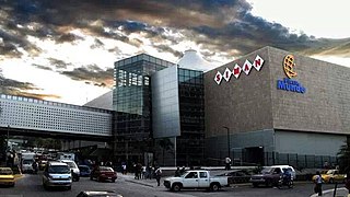
The Zona Rosa is an area in San Salvador, El Salvador.
The municipal districts of San Salvador, the capital city of El Salvador, are naturally delimited by the Acelhuate River on the east, the San Jacinto Hill on the south east, the lower highlands of the Balsam Range on the South, El Picacho Mountain and the Bicentennial Park on the West, and North by the San Antonio River. The municipality is further subdivided into Districts governed by the municipal mayor and by a district board. There are seven districts in San Salvador, districts 1-6 and the Historic Downtown.

The Chapel of San Bartolomé is a funerary chapel in the historic centre of Córdoba, Spain. It is dated between 1390 and 1410. Richly decorated, it is one of the city's finest examples of Mudéjar art.

Mixcoac is an area of southern Mexico City which used to be a separate town and municipality within the Mexican Federal District until it was made part of Mexico City proper in 1928.

Cihuatán is a major pre-Columbian archaeological site in central El Salvador. It was a very large city located in the extreme south of the Mesoamerican cultural area, and has been dated to the Early Postclassic period of Mesoamerican chronology.
