
The Arctic Archipelago, also known as the Canadian Arctic Archipelago, is an archipelago lying to the north of the Canadian continental mainland, excluding Greenland and Iceland.
This is a list of the extreme points of the United Kingdom: the points that are farther north, south, east or west than any other location. Traditionally the extent of the island of Great Britain has stretched "from Land's End to John o' Groats".

Alejandro Selkirk Island, previously known as Más Afuera and renamed after the marooned sailor Alexander Selkirk, is the largest and most westerly island in the Juan Fernández Archipelago of the Valparaíso Region of Chile. It is situated 180 km west of Robinson Crusoe Island in the southeastern Pacific Ocean.

Totanés is a municipality located in the province of Toledo, Castile-La Mancha, Spain. According to the 2006 census (INE), the municipality had a population of 417 inhabitants.

Pleitas is a municipality located in the province of Zaragoza, Aragon, Spain. According to the 2004 census (INE), the municipality has a population of 62 inhabitants.

Parambu, Ceará is a municipality in the state of Ceará in the Northeast region of Brazil.
Gobernador Duval is a village and rural locality (municipality) in La Pampa Province in Argentina.
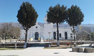
Anjullón is a municipality and village in La Rioja Province in northwestern Argentina.
Colpes is a village and municipality in Catamarca Province in northwestern Argentina, located in the Pomán Department.
La Carrera (Catamarca) is a municipality in Catamarca Province in northwestern Argentina. It is located within the Greater San Fernando del Valle de Catamarca area.
Santa Rosa (Valle Viejo) is a municipality in Catamarca Province in northwestern Argentina. It is located within the Greater San Fernando del Valle de Catamarca area.
Villa de Pomán is a town and municipality in Catamarca Province in northwestern Argentina.
On the continent of Antarctica, the Aramis Range is the third range south in the Prince Charles Mountains, situated 11 miles southeast of the Porthos Range and extending for about 30 miles in a southwest–northeast direction. It was first visited in January 1957 by Australian National Antarctic Research Expeditions (ANARE) southern party led by W.G. Bewsher, who named it for a character in Alexandre Dumas' novel The Three Musketeers, the most popular book read on the southern journey.

Widdowson Glacier is a glacier situated between Drummond and McCance Glaciers and flowing into Darbel Bay south of Sokol Point, on the west coast of Graham Land.
Drummond Glacier is a glacier 10 nautical miles (18 km) long and 2 nautical miles (4 km) wide, on the west coast of Graham Land, situated south of Hopkins Glacier and flowing west-northwest between Voit Peak and Sherba Ridge into Darbel Bay east of Sokol Point.

McCance Glacier is the 30-km long and 5 km wide glacier draining the Hutchison Hill area on the west slopes of Avery Plateau on Loubet Coast in Graham Land, Antarctica. It flows north-northwestwards along the west side of Osikovo Ridge, Kladnitsa Peak and Rubner Peak and enters Darbel Bay.
Bigoudine is a small town and rural commune in Taroudant Province of the Souss-Massa-Drâa region of Morocco. At the time of the 2004 census, the commune had a total population of 6465 people living in 1025 households.

The Altiplano–Puna volcanic complex, also known as APVC, is a complex of volcanic systems in the Puna of the Andes. It is located in the Altiplano area, a highland bounded by the Bolivian Cordillera Real in the east and by the main chain of the Andes, the Western Cordillera, in the west. It results from the subduction of the Nazca Plate beneath the South American Plate. Melts caused by subduction have generated the volcanoes of the Andean Volcanic Belt including the APVC. The volcanic province is located between 21° S–24° S latitude. The APVC spans the countries of Argentina, Bolivia and Chile.