Related Research Articles

Port of Spain, officially the City of Port of Spain, is the capital of Trinidad and Tobago and the third largest municipality, after Chaguanas and San Fernando. The city has a municipal population of 37,074 (2011), an urban population of 81,142 and a transient daily population of 250,000. It is located on the Gulf of Paria, on the northwest coast of the island of Trinidad and is part of a larger conurbation stretching from Chaguaramas in the west to Arima in the east with an estimated population of 600,000.

San Fernando, officially the City of San Fernando, is the most populous city and second most populous municipality in Trinidad and Tobago, after Chaguanas. Sando, as it is known to many local Trinidadians, occupies 19 km2 and is located in the southwestern part of the island of Trinidad. It is bounded to the north by the Guaracara River, the south by the Oropouche River, the east by the Sir Solomon Hochoy Highway, and the west by the Gulf of Paria. The former borough was elevated to the status of a city corporation on 18 November 1988. The motto of San Fernando is: "Sanitas Fortis" - In a Healthy Environment We Will Find Strength. San Fernando is called Trinidad and Tobago's "industrial capital" because of its proximity to the Pointe-à-Pierre oil refinery and many other petrochemical, LNG, iron and steel and aluminium smelters in places such as Point Lisas in Couva, Point Fortin, and La Brea.

The Borough of Chaguanas is the largest municipality and fastest-growing town in Trinidad and Tobago. Located in west-central Trinidad, south of Port of Spain, north of Couva and San Fernando, and named after the indigenous tribe who originally settled there, it grew in size due to its proximity to the Woodford Lodge sugar refinery. It remained a minor town until the 1980s when it began to grow rapidly as it drew people for its bargain shopping and moderately priced housing. Its rapid growth has seen property values increase dramatically, however.

Laventille is a Suburb of Port of Spain in Trinidad and Tobago. It is administered by the San Juan–Laventille Regional Corporation.

The East–West Corridor is the built-up area of north Trinidad stretching from the capital, Port of Spain, 24 kilometres (15 mi) east to Arima. The term was coined by economist and political philosopher Lloyd Best, after gleaning the works of a technocrat named Lynette Attwell. The Corridor includes such towns as Laventille, Morvant, Barataria, San Juan, St. Joseph, Champs Fleurs, Curepe, St. Augustine, Valsayn, Tunapuna, Macoya, Trincity, Tacarigua, Arouca, D'Abadie, and El Dorado. For the most part it runs along the Eastern Main Road, between the Churchill–Roosevelt Highway and the foothills of the Northern Range. It is a densely populated and fairly congested strip of development along some of the best agricultural soils in the country.
The Churchill–Roosevelt Highway, sometimes refers to as CRH, is the major east–west highway on Trinidad island in Trinidad and Tobago.
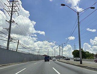
The Beetham Highway is a major highway in Trinidad and Tobago. It runs from downtown Port of Spain where it meets Wrightson Road to Barataria. It was constructed between 1955 and 1956.
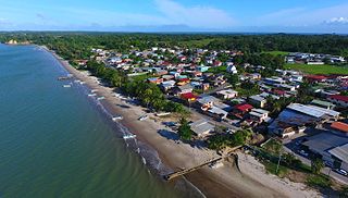
Cedros is a coastal area that lies on a peninsula at the South-Western end of the island of Trinidad. Named by Spanish sailors due to the once heavy presence of cedar trees, it is located at the tip of the peninsula which lies mere miles off the coast of Venezuela and is the most southern point in the Caribbean. The main area is known as Bonasse which is of French origin meaning "easy-going."

Morvant is a community in Trinidad and Tobago located east of Port of Spain and west of Barataria.
Queen's Park Savannah (QPS) is a park in Port of Spain, Trinidad and Tobago. Known locally as simply "the Savannah", it is Port of Spain's largest open space. It occupies about 260 acres (110 ha) of level land, and the distance around the perimeter is about 2.2 mi (3.5 km).

Maraval is one of the northern suburbs of Trinidad's capital, Port of Spain, a valley in northern Trinidad in Trinidad and Tobago. It is situated at the bottom of the hills of Paramin and located east of the Diego Martin valley to which it is connected directly by Morne Coco Road, and west of Santa Cruz valley, to which it is connected by Saddle Road.

The University of Trinidad and Tobago, also known as UTT, is a state owned university in Trinidad and Tobago established in 2004. Its main campus, currently under construction, will be located at Wallerfield in Trinidad. Presently, its campuses are an amalgamation of several former technological colleges throughout the country.
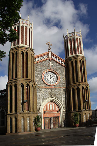
The Roman CatholicMetropolitan Archdiocese of Port of Spain is a metropolitan diocese of the Latin Church of the Roman Catholic Church in the Caribbean. The archdiocese encompasses the entirety of the former Spanish dependency of Trinidad, including the islands of Trinidad and Tobago. The archdiocese is the Metropolitan responsible for the suffragan Dioceses of Bridgetown, Georgetown, Paramaribo and Willemstad, and is a member of the Antilles Episcopal Conference.

Westmoorings is a residential area in the region of Diego Martin on the island Trinidad, west of Port of Spain, the capital of Trinidad and Tobago. This suburb consists of mainly lower middle class to upper-class families and is generally known throughout the country for its upscale housing and expatriate population. This area mainly consists of small apartments and large upscale houses. It also has a few offshore moorings, a mall, a government college, the International School of Port of Spain, and a private primary school, Dunross Preparatory School. It is bordering the sea and Diego Martin river.

Gasparillo is a small island in the Republic of Trinidad and Tobago. It is one of the Bocas Islands, which lie in the Bocas del Dragón between the main island of Trinidad and Venezuela. The island is currently uninhabited.

Caledonia Island is an island in the Republic of Trinidad and Tobago. It is one of "The Five Islands" group of six small islands lying west of Port of Spain in the Gulf of Paria. It has an approximate area of just 1.9 hectares.

Lenagan Island is a small island in the Republic of Trinidad and Tobago. At only 0.27 hectares, it is one of The Five Islands lying west of the Port of Spain in the Gulf of Paria.

Trinidad and Tobago Newsday is a daily newspaper in Trinidad and Tobago. Newsday is the newest of the three daily papers after the Trinidad and Tobago Guardian and the Trinidad and Tobago Express respectively. The newspaper was founded in 1993 by Daniel Chookolingo, Therese Mills became the first editor-in-chief she was the former editor-in-chief of the Guardian. Newsday bills itself as "The People's Newspaper". The week-end edition is known as the Saturday Newsday.

The Magnificent Seven is a group of seven mansions located west of the Queen's Park Savannah in northern Port of Spain, Trinidad and Tobago on Maraval Road in the St Clair neighborhood. They were built between 1902 and 1910 on land that was previously used as a government stock farm and are listed as heritage sites at the National Trust of Trinidad and Tobago. Stollmeyer's Castle was the first building in the neighborhood and took several years to complete, as was typical of the Magnificent Seven.
References
- ↑ Newsday (2018-03-04). "Lady Young Road to open Monday - Trinidad and Tobago Newsday". Trinidad and Tobago Newsday. Retrieved 2023-03-01.
- Polly Thomas. The Rough Guide to Trinidad & Tobago. Penguin, Nov 1, 2010. pg. 79