
Slovenia is situated at the crossroads of central and southeast Europe, touching the Alps and bordering the Adriatic Sea. The Alps—including the Julian Alps, the Kamnik-Savinja Alps and the Karawank chain, as well as the Pohorje massif—dominate northern Slovenia along its long border to Austria. Slovenia's Adriatic coastline stretches approximately 47 km (29 mi) from Italy to Croatia. Its part south of Sava river belongs to Balkan peninsula – Balkans.

Austria is a small, predominantly mountainous country in Central Europe, approximately between Germany, Italy and Hungary. It has a total area of 83,871 square kilometres (32,383 sq mi), about twice the size of Switzerland.

Burgenland is the easternmost and least populous state of Austria. It consists of two statutory cities and seven rural districts, with a total of 171 municipalities. It is 166 km (103 mi) long from north to south but much narrower from west to east. The region is part of the Centrope Project.
Upper Austria is one of the nine states or Länder of Austria. Its capital is Linz. Upper Austria borders on Germany and the Czech Republic, as well as on the other Austrian states of Lower Austria, Styria, and Salzburg. With an area of 11,982 km2 (4,626 sq mi) and 1.49 million inhabitants, Upper Austria is the fourth-largest Austrian state by land area and the third-largest by population.

Lower Austria is one of the nine states of Austria, located in the northeastern corner of the country. Since 1986, the capital of Lower Austria has been Sankt Pölten, replacing Vienna which became a separate state in 1921. With a land area of 19,186 km2 (7,408 sq mi) and a population of 1.685 million people, Lower Austria is the second most populous federal state. Other large cities are Amstetten, Klosterneuburg, Krems an der Donau and Wiener Neustadt.

The Mur or Mura is a river in Central Europe rising in the Hohe Tauern national park of the Central Eastern Alps in Austria with its source being 1,898 m (6,227 ft) above sea level. It is a tributary of the Drava and subsequently the Danube.

Fürstenfeld is a town and a district in southeastern Austria. It is situated within the Austrian federal state of Styria, near the border of Hungary.

The Pinka is a river in Central Europe with a length of approximately 100 km (60 mi). Its basin area is 1,299 km2 (502 sq mi). Its source is located in Styria, eastern Austria, next to the provincial border of Burgenland. It passes into Hungary between the villages of Burg and Felsőcsatár, and crosses the Austrian-Hungarian border five times. Further it flows into the Rába river near Körmend. Its main tributary is the Strem.

Ybbs is a river in Lower Austria.

Heiligenkreuz im Lafnitztal is a town in the district of Jennersdorf in the Austrian state of Burgenland close to the Austria/Hungary border.

The March of Styria, originally known as Carantanian march, was a southeastern frontier march of the Holy Roman Empire. It was broken off the larger March of Carinthia, itself a march of the Duchy of Bavaria, around 970 as a buffer zone against the Hungarian invasions. Under the overlordship of the Carinthian dukes from 976 onwards, the territory evolved to be called Styria, so named for the town of Steyr, then the residence of the Otakar margraves. It became an Imperial State in its own right, when the Otakars were elevated to Dukes of Styria in 1180.

Burgau is a municipality in the district of Hartberg-Fürstenfeld in Styria, Austria. It is in the south-east of the country, near the border with Hungary.

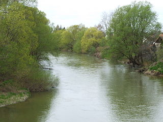
Lafnitz is a municipality in the district of Hartberg-Fürstenfeld in Styria, Austria. It is situated on the upper course of the river Lafnitz.

Rohrbach an der Lafnitz is a municipality in Styria, Austria. It is in the judicial district of Hartberg and the political district of Hartberg-Fürstenfeld.

The Ledava is a river of Styria, Austria and of Goričko, Prekmurje, northeastern Slovenia.

The Pesnica is a river in Styria, southeastern Austria and in Styria, northeastern Slovenia.
Rohrbrunn is a village in Burgenland, Austria. It belongs to Deutsch Kaltenbrunn in the district of Jennersdorf. Rohrbrunn is located near the border of Styria by the river Lafnitz.
The Rába is a river in southeastern Austria and western Hungary and a right tributary of the Danube.
The East Styrian Hill Country or East Styrian Hills, is a rolling, hill country region, known as Hügelland, in the southeast of the Austrian state of Styria.
