| Lagarto River Rio Lagarto | |
|---|---|
 Location of mouth | |
| Location | |
| Country | Costa Rica |
| Physical characteristics | |
| Mouth | |
• coordinates | 10°03′23″N84°56′30″W / 10.05633°N 84.941751°W |
• elevation | 0 m (0 ft) |
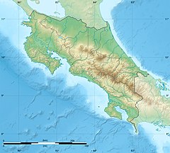
Lagarto River is a river of Costa Rica. [1] [2]
| Lagarto River Rio Lagarto | |
|---|---|
| Location of mouth | |
| Location | |
| Country | Costa Rica |
| Physical characteristics | |
| Mouth | |
• coordinates | 10°03′23″N84°56′30″W / 10.05633°N 84.941751°W |
• elevation | 0 m (0 ft) |
Lagarto River is a river of Costa Rica. [1] [2]

Costa Rica, officially the Republic of Costa Rica, is a country in the Central American region of North America, bordered by Nicaragua to the north, the Caribbean Sea to the northeast, Panama to the southeast, the Pacific Ocean to the southwest, and maritime border with Ecuador to the south of Cocos Island. It has a population of around five million in a land area of 51,060 km2 (19,710 sq mi). An estimated 333,980 people live in the capital and largest city, San José, with around two million people in the surrounding metropolitan area.

Costa Rica is located on the Central American Isthmus, surrounding the point 10° north of the equator and 84° west of the prime meridian. It has 212 km of Caribbean Sea coastline and 1,016 on the North Pacific Ocean.

Alajuela is a province of Costa Rica. It is located in the north-central part of the country, bordering Nicaragua to the north. It also borders the provinces of Heredia to the east, San José to the south, Puntarenas to the southwest and Guanacaste to the west. As of 2011, the province had a population of 885,571. Alajuela is composed of 16 cantons, which are divided into 111 districts. It covers an area of 9,757.53 square kilometers.

Liberia is a district and the largest city in the Guanacaste Province of Costa Rica, located 215 kilometres (134 mi) northwest of the national capital, San José, which is also in the Guanacaste canton. It is a major center for the country's tourism industry.
Barra del Colorado Airport is an airport serving the Barra del Colorado Wildlife Refuge in Limón Province, Costa Rica. The airport is on the Colorado River, near the Caribbean coast.

Costa Rica is administratively divided into seven provinces which are subdivided into 84 cantons, and these are further subdivided into districts. Cantons are the only administrative division in Costa Rica that possess local government in the form of municipalities. Each municipality has its own mayor and several representatives, all of them chosen via municipal elections every four years.

The bobo mullet, is a species of ray-finned fish of the mullet family Mugilidae. It is the only species in the genus Joturus, one of 17 mullet genera containing altogether about 80 species of ray-finned fish. It occurs in rivers, including brackish waters, in much of the Gulf of Mexico basin from Mexico as far south as Panama and the Caribbean coast of Colombia, as well as the West Indies and the United States state of Florida. The specific name honours the Cuban lexicographer and geographer Esteban Pichardo (1799-1879).
Territorial disputes of Nicaragua include the territorial dispute with Colombia over the Archipelago de San Andres y Providencia and Quita Sueno Bank. Nicaragua also has a maritime boundary dispute with Honduras in the Caribbean Sea and a boundary dispute over the Rio San Juan with Costa Rica.

Zarcero is a canton in the Alajuela province of Costa Rica.
Turrialba is a canton in the Cartago province of Costa Rica. The head city is in Turrialba district.
Aserrí is the sixth canton in the San José province of Costa Rica. The head city of the canton is the homonymous Aserrí.
Abangares is a canton in the Guanacaste province of Costa Rica. The head city is in Las Juntas district.

The following outline is provided as an overview of and topical guide to Costa Rica:

Tourism in Costa Rica has been one of the fastest growing economic sectors of the country and by 1995 became the largest foreign exchange earner. Since 1999, tourism has earned more foreign exchange than bananas, pineapples and coffee exports combined. The tourism boom began in 1987, with the number of visitors up from 329,000 in 1988, through 1.03 million in 1999, over 2 million in 2008, to a historical record of 2.66 million foreign visitors in 2015. In 2012, tourism contributed with 12.5% of the country's GDP and it was responsible for 11.7% of direct and indirect employment. In 2009, tourism attracted 17% of foreign direct investment inflows, and 13% in average between 2000 and 2009. In 2010, the tourism industry was responsible for 21.2% of foreign exchange generated by all exports. According to a 2007 report by ECLAC, tourism contributed to a reduction in poverty of 3% in the country.

Laura Chinchilla Miranda is a Costa Rican political scientist and politician who served as President of Costa Rica from 2010 to 2014. She was one of Óscar Arias Sánchez's two Vice-Presidents and his administration's Minister of Justice. She was the governing PLN candidate for president in the 2010 general election, where she won with 46.76% of the vote on 7 February. She was the eighth woman president of a Latin American country and the first woman to become President of Costa Rica. She was sworn in as President of Costa Rica on 8 May 2010.
Costa Rica is divided into three major drainage basins encompassing 34 watersheds with numerous rivers and tributaries, one major lake used for hydroelectric generation, and two major aquifers that serve to store 90% of the municipal, industrial, and agricultural water supply needs of Costa Rica. Agriculture is the largest water user demanding around 53% of total supplies while the sector contributes 6.5% to the Costa Rica GDP. About a fifth of land under cultivation is being irrigated by surface water. Hydroelectric power generation makes up a significant portion of electricity usage in Costa Rica and much of this comes from the Arenal dam.

The Nicaragua–Costa Rica San Juan River border dispute was a series of periodical conflicts between the Costa Rica and Nicaragua over the correct delimitation of their common border at its east-end, and the interpretation of the navigation rights on the San Juan River established in the Cañas-Jerez Treaty of 1858.

Marcos Danilo Ureña Porras, known as Marco Ureña, is a Costa Rican professional footballer who plays as a striker for C.S. Cartaginés. He has also played for the Costa Rica national team.
According to the Territorial Administrative Division the cantons of Costa Rica are subdivided into 488 districts (distritos), each of which has a unique five digit postal code.

Costa Rica, officially the Republic of Costa Rica, is a country in Central America, bordered by Nicaragua to the north, the Caribbean to the northeast, Panama to the southeast, the Pacific Ocean to the southwest, and Ecuador to the south of Cocos Island. It has a population of around 5 million in a land area of 51,060 square kilometers. Hurricanes are uncommon in the country, as only eighteen have been recorded in history.