
Southern Norway is the geographical region (landsdel) along the Skagerrak coast of southern Norway. The region is an informal description since it does not have any governmental function. It roughly corresponds to the old petty kingdom of Agder as well as the two former counties of Vest-Agder and Aust-Agder. From New Year 2020, the two counties have been merged into one county, Agder. The total combined area of Vest-Agder and Aust-Agder counties is 16,493 square kilometres (6,368 sq mi). The name is relatively new, having first been used in Norway around 1900.

Fredriksvern was an important Norwegian naval base, just south of Larvik in Vestfold. It is named after Fredrik V Denmark-Norway. The town of Stavern has in many ways come to be because of this naval base.

Staverns Fortress was a military facility located on the island of Citadelløya at Stavern in Vestfold, Norway.

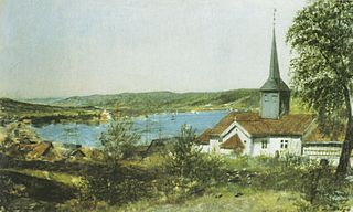
Stavern is a small water-side town in Larvik municipality in Vestfold County, Norway. It is south of the city of Larvik. Currently there are around 3,000 inhabitants in Stavern. It is a small town where tourism is one of the most important sources of income. During summer, the population increases to around 30,000-40,000 people, due to camping sites and cottages around the town centre as well as boats visiting the harbour.

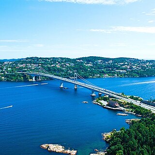
Tromsøya (Norwegian) or Romssasuolu (Northern Sami) is an island in Tromsø Municipality in Troms og Finnmark county, Norway. It lies in the Tromsøysundet strait between the mainland and the larger island of Kvaløya. The city of Tromsø is located on the 21.7-square-kilometre (8.4 sq mi) island, which has 39,882 residents. The island is connected to the Tromsdalen area on the mainland to the east by the Tromsø Bridge and Tromsøysund Tunnel, and to the village of Kvaløysletta on Kvaløya island to the west by the Sandnessund Bridge.
Oddernes is a borough in the city of Kristiansand which lies in the municipality of Kristiansand in Agder county, Norway. The borough covers eastern Kristiansand on the east side of the Topdalsfjorden and the Varodd Bridge. The borough includes the former municipalities of Randesund and Tveit. There was a municipality of Oddernes from 1838 until 1965, but its boundaries were very different from those of the present-day borough.
Strømsø is a borough of Drammen, Viken, Norway.
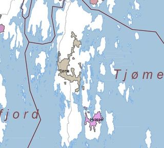
Hvasser is a populated island and a village in Færder municipality, Norway, connected to mainland and the city of Tønsberg via the islands Brøtsø, Tjøme and Nøtterøy. The name comes from the Norwegian word "hvass", meaning sharp, which is owed to sharp cliffs on the island. The island is 3.6 km2 and the village of Hvasser is located on the center of the island. It is on the western shore of the Oslo Fjord, 25 km (15.5 mi.) south of Tønsberg. The island is a popular summer holiday destination. It is home to various hiking trails and bathing beaches. In Sandøsund is a harbor, restaurant, gallery, and general store.
Huftarøy is the largest island in the municipality of Austevoll in Vestland county, Norway. The 50.4-square-kilometre (19.5 sq mi) island lies in the Austevoll archipelago, just west of the Bjørnafjorden, south of the Korsfjorden, east of the Mokstrafjorden, and north of the Selbjørnsfjorden. The largest settlement on the island is the municipal centre of Storebø on the northern part of the island.
Hans Tostrup was a Norwegian politician, civil servant and government official.
Bulandet is an archipelago in the sea off the mainland coast of Western Norway. The island group is part of Askvoll Municipality in Vestland county, Norway. It sits about 20 kilometres (12 mi) west of the mainland coast of Askvoll. The islands of Værlandet and Alden lie immediately east of Bulandet. The Geita Lighthouse lies about 10 kilometres (6.2 mi) southeast of Bulandet.

Skardsøya is an island in Aure Municipality in Møre og Romsdal county, Norway. The 52.3-square-kilometre (20.2 sq mi) island is located along the Trondheimsleia strait in the northeastern part of the municipality, just east of the island of Grisvågøya and north and west of the mainland. The island is connected to the mainland to the east by the Dromnessund Bridge and to the south by the Torsetsund Bridge. In 2015, the island had about 332 residents living on it.
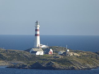
Oksøy Lighthouse is a coastal lighthouse in the municipality of Kristiansand in Agder county, Norway. The lighthouse sits on the islet of Oksøy which is located in the Kristiansandsfjorden, just east of the island of Flekkerøya. The lighthouse marks the western side of the main shipping channel that leads inland to the port of the city of Kristiansand. The other lighthouse, which marks the eastern entrance, Grønningen Lighthouse, lies about 2.2 kilometres (1.4 mi) to the east. The lighthouse has a racon signal, emitting a morse code "O".

Ny-Hellesund is a village area and outport in Kristiansand municipality in Agder county, Norway. The village area is located on a cluster of three main islands about 3 kilometres (1.9 mi) south of the main harbour at Høllen. The three islands are Monsøya, Helgøya, and Kapelløya. The islands formed an outport because they all have good harbors and approach conditions. Historically, it was part of the old municipality of Søgne, until 2020 when it became part of Kristiansand.

Odderøya is an island and neighborhoods in Kristiansand municipality in Agder county, Norway. The 0.7-square-kilometre (170-acre) island lies immediately to the south of the city centre of Kristiansand and it is connected to the mainland by four bridges. The island creates a natural division between the eastern and western parts of the port of Kristiansand.

Grønningen Lighthouse is a coastal lighthouse in the municipality of Kristiansand in Agder county, Norway. The lighthouse was built in 1878 to improve the marking of the shipping lane into Kristiansand harbor. In 1842, the Russian ship-of-the-line Ingermanland had collided with the Grønningen islet, leading to a catastrophe. The current lighthouse sits on Grønningen, a bare islet in the Kristiansandsfjord, and it marks the eastern side of the main shipping channel that leads inland to the port of the city of Kristiansand. The other lighthouse, which marks the western entrance, Oksøy Lighthouse, lies about 2.2 kilometres (1.4 mi) to the west.
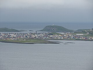
Vardø is a town and the administrative centre of Vardø Municipality in Troms og Finnmark county, Norway. The town is located on the island of Vardøya in the Barents Sea, just off the coast of the large Varanger Peninsula. The 1.19-square-kilometre (290-acre) town has a population (2017) of 1,875 which gives the town a population density of 1,576 inhabitants per square kilometre (4,080/sq mi).

Vadsøya is an island in Vadsø Municipality in Troms og Finnmark county, Norway. The island lies in the Varangerfjorden, just south of the coast of the mainland Varanger Peninsula. The island is part of the town of Vadsø. The 0.8-square-kilometre island is connected to the mainland by a bridge that branches off the European route E75 highway in the centre of the town of Vadsø. The Hurtigruten coastal express boats dock on Vadsøya.

Kristiansund is a town in Kristiansund Municipality in Møre og Romsdal county, Norway. The town is the administrative centre of the municipality. it is located on the islands of Kirkelandet, Innlandet, and Nordlandet in the Nordmøre region of the county.

Nærøysund is a municipality in Trøndelag county, Norway. It is located in the traditional district of Namdalen. The municipality was established on 1 January 2020 after the merger of the old municipalities of Vikna and Nærøy. The municipality is unique in that it has two equal administrative centre: Kolvereid and Rørvik. The other main population centres of Nærøysund include Abelvær, Foldereid, Gravvik, Ottersøy, Salsbruket, Steine, Torstad, Austafjord, Garstad, and Valøya.


