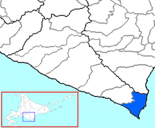
Horoizumi is a district located in Hidaka Subprefecture, Hokkaido, Japan.

Soltszentimre is a village in Bács-Kiskun County, in the Southern Great Plain region of southern Hungary.

The Shire of Colac was a local government area about 150 kilometres (93 mi) west-southwest of Melbourne, the state capital of Victoria, Australia. The shire covered an area of 1,458.2 square kilometres (563.0 sq mi), and existed from 1859 until 1994.

Brăduleț, formerly Brătieni, is a commune in Argeș County, in southern central Romania. It is composed of nine villages: Alunișu, Brădetu, Brăduleț, Cosaci, Galeșu, Piatra, Slămnești, Uleni and Ungureni.
Ghimpețeni is a commune in Olt County, Romania. It is composed of two villages, Ghimpețeni and Ghimpețenii Noi. These were part of Nicolae Titulescu Commune until 2004, when they were split off.

Święcany is a village in the administrative district of Gmina Skołyszyn, within Jasło County, Subcarpathian Voivodeship, in south-eastern Poland. It lies approximately 5 kilometres (3 mi) north-west of Skołyszyn, 14 km (9 mi) west of Jasło, and 60 km (37 mi) south-west of the regional capital Rzeszów.
Mbulo is an island in Western Province, Solomon Islands. Lying in the eastern part of the New Georgia Islands, Mbulo is heavily forested with a volcanic center. The estimated terrain elevation above sea level is some 125 metres.

Czuchów-Pieńki is a village in the administrative district of Gmina Platerów, within Łosice County, Masovian Voivodeship, in east-central Poland. It lies approximately 4 kilometres (2 mi) south-west of Platerów, 9 km (6 mi) north-east of Łosice, and 121 km (75 mi) east of Warsaw.
Rozdziały is a village in the administrative district of Gmina Obryte, within Pułtusk County, Masovian Voivodeship, in east-central Poland. It lies approximately 6 kilometres (4 mi) north of Obryte, 16 km (10 mi) north-east of Pułtusk, and 64 km (40 mi) north of Warsaw.
Rostki Bajtkowskie is a village in the administrative district of Gmina Ełk, within Ełk County, Warmian-Masurian Voivodeship, in northern Poland. It lies approximately 8 kilometres (5 mi) south-west of Ełk and 118 km (73 mi) east of the regional capital Olsztyn.
Tuấn Đạo is a commune (xã) and village in Sơn Động District, Bắc Giang Province, in northeastern Vietnam.

Las Tablas District is a district (distrito) of Los Santos Province in Panama. The population according to the 2000 census was 24,298. The district covers a total area of 698 km². The capital lies at the city of Las Tablas.
Tama, Niger is a village and rural commune in Niger.
Janawad is a village in Belgaum district in the southern state of Karnataka, India.

Nezuci is a village in the municipality of Višegrad, Bosnia and Herzegovina.
Såta Nunatak is a nunatak, 0.5 nautical miles (0.93 km) north of Kista Nunatak, standing at the east side of Fletta Bay along the southwest shore of Lützow-Holm Bay. It was mapped by Norwegian cartographers from air photos taken by the Lars Christensen Expedition, 1936–37, and named Såta.

This is a list of the extreme points of Bhutan.
Kandep is the district headquarters of Kandep District in the southern Enga Province of Papua New Guinea. It is a rural station located in the southern part of the district.
Karnaman is a village in Batala in Gurdaspur district of Punjab State, India. It is located 14 kilometres (8.7 mi) from sub district headquarter, 49 kilometres (30 mi) from district headquarter and 8 kilometres (5.0 mi) from Sri Hargobindpur. The village is administrated by Sarpanch an elected representative of the village.