Related Research Articles

The Virunga Mountains are a chain of volcanoes in East Africa, in the area where Rwanda, the Democratic Republic of the Congo (DRC), and Uganda meet. The mountain range is a branch of the Albertine Rift Mountains, which border the western branch of the East African Rift. They are located between Lake Edward and Lake Kivu. The name "Virunga" is an English version of the Kinyarwanda word ibirunga, which means "volcanoes".

The Bwindi Impenetrable National Park is a national park in southwestern Uganda. It is part of the Bwindi Impenetrable Forest and is situated along the Democratic Republic of the Congo border next to the Virunga National Park and on the edge of the Albertine Rift. Composed of 321 km2 (124 sq mi) of both lowland and montane forest, it is accessible only on foot. It is a United Nations Educational, Scientific and Cultural Organization-designated World Heritage Site.

Kisoro District is a district in the Western Region of Uganda. The town of Kisoro is the site of the district headquarters.

Queen Elizabeth National Park is a national park in the Western Region of Uganda.
Kisoro is a town in the Western Region of Uganda. It is the chief town of Kisoro District and the site of the district headquarters.

Kigezi District once covered what are now Kabale District, Kanungu District, Kisoro District and Rukungiri District, in southwest Uganda. Its terraced fields are what gives this part of Uganda its distinctive character. Kigezi was popularly known as the Switzerland of Africa. The coordinates for the region are: Latitude:01 13 20S, 29 53 20E.

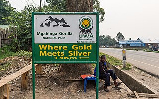
Mgahinga Gorilla National Park is a national park in southwestern Uganda. It was created in 1991 and covers an area of 33.9 km2 (13.1 sq mi).

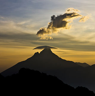
Mount Gahinga is a dormant/extinct volcano in the Virunga Mountains on the Rwanda-Uganda border. Gahinga lies between Muhabura and Sabyinyo, but is the smallest of these three valcanoes. Mount Gahinga, also known in the local Kinyarwanda/Rufumbira dialect as "a small pile of stones", has a swampy caldera on its peak. The caldera is believed to be about 180 m (591 ft) wide. Mgahinga Gorilla National Park got its name from this volcano. Mount Gahinga, whose elevation is 3,473 m (11,394 ft), is part of a chain of eight volcanic mountains of the Mufumbiro ranges. The volcano chain spans across Uganda, Rwanda and the Democratic Republic of Congo.

The wildlife of Uganda is composed of its flora and fauna. Uganda has a wide variety of different habitats, including mountains, hills, tropical rainforest, woodland, freshwater lakes, swamps and savanna with scattered clumps of trees. The country has a biodiverse flora and fauna reflecting this range of habitats and is known for its primates, including gorillas and chimpanzees. There are ten national parks and thirteen wildlife reserves; some 345 species of mammal and 1020 species of bird have been recorded in the country.

Mount Sabyinyo is an extinct volcano in eastern Africa in the Virunga Mountains. Mount Sabyinyo is the oldest volcano of the range. It is north-east of Lake Kivu, one of the African Great Lakes, and west of Lake Bunyonyi in Uganda. The summit of the mountain, at 3,669 metres (12,037 ft), marks the intersection of the borders of the Democratic Republic of the Congo (DRC), Rwanda, and Uganda, and holds religious significance for local tribes. It also is within the adjoining national parks established by these countries: Virunga National Park in the DRC, the Volcanoes National Park in Rwanda, and Mgahinga Gorilla National Park in Uganda.

Tourism in Uganda is focused on Uganda's landscape and wildlife. It is a major driver of employment, investment and foreign exchange, contributing USh 4.9 trillion to Uganda's GDP in the financial year 2012–2013.
Kisoro Airport is an airport serving the town of Kisoro in Uganda and nearby Bwindi Impenetrable National Park and Mgahinga Gorilla National Park. It is in extreme southwestern Uganda, 6 kilometres (4 mi) north of the Rwanda border, and approximately 343 kilometres (213 mi) by air southwest of Entebbe International Airport, the country's largest civilian and military airport. It is one of twelve upcountry airports administered by the Civil Aviation Authority of Uganda.

Lake Mutanda is a small freshwater lake in Uganda.

The Great Lakes Twa, also known as Batwa, Abatwa or Ge-Sera, are a Bantu speaking group native to the African Great Lakes region on the border of Central and East Africa. As an indigenous pygmy people, the Twa are generally assumed to be the oldest surviving population of the Great Lakes region. Current populations of Great Lakes Twa people live in the states of Rwanda, Burundi, Uganda and the eastern portion of the Democratic Republic of Congo. In 2000 they numbered approximately 80,000 people, making them a significant minority group in these countries. The largest population of Twa is located in Burundi estimated in 2008 at 78,071 people.
The Kabale–Lake Bunyonyi Road in Uganda connects the town of Kabale to Lake Bunyonyi, reported to be the second-deepest lake in the world.
The Echuya Central Forest Reserve is a forest reserve in Uganda. This typical tropical rainforest covers approximately 34 km2 and is located at the intersection of Kisoro and Rubanda districts. It is one of the few remaining tropical rain forests in Uganda.

Lake Bujuku is a crater lake in the Rwenzori Mountains, Kasese district, western Uganda. Its a tourist destination. The hiking trail to Lake Bujuku takes at least 3 days. The lake is 1.37 kilometres (0.85 mi) long and is situated at 3,963 metres (13,002 ft) above sea level, at the head of Bujuku valley.

Lake Mulehe is a crater lake situated in the Kisoro District of southwestern Uganda, close to the border with Rwanda. This lake is a part of the Albertine Rift, which is well known for its biological diversity and visually striking landscapes.

Lake Kayumbu, also known as Lake Kayumba, is a lake in Kisoro District, South Western Uganda, north of the Rwanda border at an altitude of 1,897 metres (6,224 ft) above sea level. The lake acts as a tourist destination which earns the country foreign exchange. The lake has a variety of fish species.

Lake Kamunzuku is a Ugandan lake in Rubirizi district, Western Uganda, bordering Queen Elizabeth National Park. The lake is traditionally believed to have healing properties by the surrounding community. Lake Kamunzuku is a protected area managed by Uganda Wildlife Authority and Ministry of Tourism, Wildlife and Antiquities. It has clear fresh waters with active aquatic life.
References
- ↑ "Visit Lake Chahafi". Inside Mgahinga National Park. Retrieved 2024-06-06.
- ↑ "Lake Chahafi - Nearby Places to Visit | Mgahinga National Park". 2018-04-06. Retrieved 2024-06-06.
- ↑ "Visit Lake Chahafi". Inside Mgahinga National Park. Retrieved 2024-06-06.