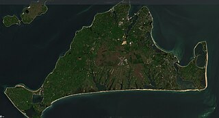
Martha's Vineyard, often simply called the Vineyard, is an island in the Northeastern United States, located south of Cape Cod in Dukes County, Massachusetts, known for being a popular, affluent summer colony. Martha's Vineyard includes the smaller adjacent Chappaquiddick Island, which is usually connected to the Vineyard. The two islands have sometimes been separated by storms and hurricanes, which last occurred from 2007 to 2015. It is the 58th largest island in the U.S., with a land area of about 96 square miles (250 km2), and the third-largest on the East Coast, after Long Island and Mount Desert Island. Martha's Vineyard constitutes the bulk of Dukes County, which also includes the Elizabeth Islands and the island of Nomans Land.
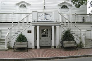
Dukes County is a county located in the U.S. state of Massachusetts. As of the 2020 census, the population was 20,600, making it the second-least populous county in Massachusetts. Its county seat is Edgartown.

Aquinnah is a town located on the western end of Martha's Vineyard island, Massachusetts. From 1870 to 1997, the town was incorporated as Gay Head. At the 2020 U.S. census, the population was 439. Aquinnah is known for its beautiful clay cliffs and natural serenity, as well as its historical importance to the native Wampanoag people. In 1965, Gay Head Cliffs were designated as a National Natural Landmark by the National Park Service.
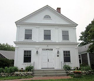
Chilmark is a town located on Martha's Vineyard in Dukes County, Massachusetts, United States. The population was 1,212 at the 2020 census. The fishing village of Menemsha is located on the western side of the town along its border with the town of Aquinnah. Chilmark had the highest median home sale price of any town or city in Massachusetts in 2013.
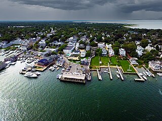
Edgartown is a town on the island of Martha's Vineyard in Dukes County, Massachusetts, United States, for which it is the county seat. The town's population was 5,168 at the 2020 census.

Oak Bluffs is a town located on the island of Martha's Vineyard in Dukes County, Massachusetts, United States. The population was 5,341 at the 2020 United States Census. It is one of the island's principal points of arrival for summer tourists, and is noted for its "gingerbread cottages" and other well-preserved mid- to late-nineteenth-century buildings. The town has been a historically important center of African American culture since the eighteenth century.
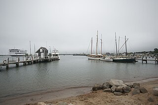
Tisbury is a town located on Martha's Vineyard in Dukes County, Massachusetts, United States. The population was 4,815 at the 2020 census.

Vineyard Haven is a community within the town of Tisbury, Massachusetts on the island of Martha's Vineyard. It is listed as a census-designated place (CDP) by the U.S. Census Bureau with a population of 2,114 as of the 2010 census.

West Tisbury is a town located on Martha's Vineyard in Dukes County, Massachusetts, United States. The population was 3,555 at the 2020 census. Along with Chilmark and Aquinnah, West Tisbury forms "Up-Island" Martha's Vineyard.

Chappaquiddick Island, a part of the town of Edgartown, Massachusetts, is a small island off the eastern end of Martha's Vineyard. Norton Point, a narrow barrier beach, sometimes connects Martha's Vineyard and Chappaquiddick between Katama and Wasque. Breaches occur due to hurricanes and strong storms separating the islands for periods of time, most recently on December 22, 2022. While both land forms have mostly been connected to one another in modern history, Chappaquiddick is nevertheless referred to as an island.
Watch Hill is an affluent coastal neighborhood and census-designated place in the town of Westerly, Rhode Island. The population was 154 at the 2010 census. It sits at the most-southwestern point in Rhode Island. It came to prominence in the late 19th and early 20th century as an exclusive summer resort, with wealthy families building sprawling Victorian-style "cottages" along the peninsula. Watch Hill is characterized by The New York Times as a community "with a strong sense of privacy and of discreetly used wealth," in contrast with "the overpowering castles of the very rich" in nearby Newport.
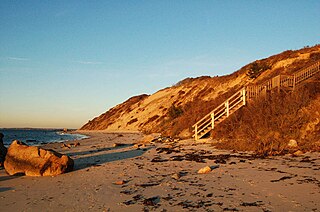
Makonikey is a rural neighborhood on Martha's Vineyard, Massachusetts, that lies on the border of Tisbury and West Tisbury. The Tisbury section is called Lower Makonikey, and the West Tisbury section is called Upper Makonikey. The neighborhood lies between Lambert's Cove Road and the Vineyard Sound, near Makonikey Point. It is a 5- to 10-minute drive from the center of Vineyard Haven.

Martha's Vineyard Regional High School or MVRHS is a high school in Oak Bluffs on the island of Martha's Vineyard, Massachusetts, United States.
Katama is a residential area in the town of Edgartown, Massachusetts, on the south shore of the island of Martha's Vineyard. It is bordered on the west by Edgartown Great Pond, on the east by Katama Bay and on the south by the Atlantic Ocean. It starts at a fork in the road when you head south on Katama Road out of central Edgartown; Katama Road leads to the left and Herring Creek Road leads to the right.

West Chop is a residential area located in the town of Tisbury, Massachusetts on the north end of the island of Martha's Vineyard. It is a peninsula surrounded on the north and west by Vineyard Sound and on the east by Vineyard Haven Harbor. A lighthouse, West Chop Light, stands at the north end of the chop. It is accessible by car from Vineyard Haven by two roads, Franklin Street and Main Street.
East Chop, also known as the Vineyard Highlands, is a residential area located in the town of Oak Bluffs, Massachusetts on the north end of the island of Martha's Vineyard. It is a peninsula surrounded on the North and East by Vineyard Sound and on the West by Vineyard Haven Harbor, and features the high, prominent bluffs that gave Oak Bluffs its name. A lighthouse, East Chop Light, stands at the north end of the chop on Telegraph Hill.

Lambert's Cove is a region in Tisbury and West Tisbury, Massachusetts, on the island of Martha's Vineyard. It extends from Upper Lambert's Cove in west Tisbury to Lower Lambert's Cove in Tisbury. Lambert's Cove Road accesses several roads of note, including Makonikey and Longview. It is known for its views of the hilly region of "up island." The road is one of the only access to West Tisbury's north shore coastline, and accesses the only public beach of the town. Some sites of note found along Lambert's Cove include Lambert's Cove Beach, Makonikey beach, Cottle's lumberyard, the old cranberry bog, Duarte's Pond and Seth's Pond. It also accesses the FOCUS Study Center, a faith-based summer camp near Seth's Pond. Lambert's Cove is also mentioned in popular folk artist James Taylor's song "Terra Nova", sung by then wife Carly Simon.
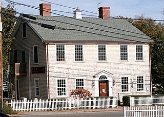
The Ritter House is an historic house on Beach Street in Vineyard Haven, Massachusetts, USA, and is listed on the National Register of Historic Places. The house is one of the few remaining Federal period buildings in Vineyard Haven. It has had a succession of occupants and uses, and as of 2007 served as a retail establishment.
Wasque ("way-squee") or Wasque Beach is a 200-acre (0.81 km2) nature reserve on Chappaquiddick Island, Martha's Vineyard, Massachusetts. The site was established as a reservation for the public in 1967 and is one of five conservation areas on "the Vineyard" managed by the Trustees of Reservations. Wasque contains a sandy strand the Boston Globe calls "a magnificent beach." Travel + Leisure named Wasque Beach the number one beach in New England and WHDH-TV reports "It's pristine, serene, and rain or shine, it's a beach-goers' delight." Off the shore of Wasque Beach is Katama Bay, "a vast and pristine salt water bay that includes many acres of productive shellfish beds."

Martha's Vineyard Transit Authority(VTA) is a bus transportation system serving Martha's Vineyard, Massachusetts. In addition to diesel buses, it has 12 electric buses charged at several points. The Edgartown facility has 700 kW solar panels and a 1.5 MWh battery adding to the bus power.


