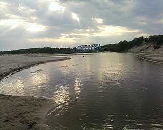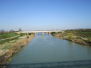
The Savio is a river in the Emilia-Romagna region of northern Italy. Its source is in the province of Forlì-Cesena near Montecoronaro on Mount Castelvecchio which is near the western side of Mount Fumaiolo. The source is at an elevation of 1,126 metres (3,694 ft) and is marked by an iron monument. A wolf and the rings of the "caveja" are on this monument. The river flows near Verghereto and Bagno di Romagna as it winds through the mountains before entering Lago di Quarto. After leaving the lake, the river flows northeast near Sarsina and Mercato Saraceno before flowing north. The river winds for 96 kilometres (60 mi) along the valley. Its natural track has been preserved relatively well and, in the territory of Cesena, it shows an environment which is one of the purest of the whole Romagna. North of Cesena, the river crossed the border into the province of Ravenna. After a total course of 126 kilometres (78 mi) the river enters the Adriatic Sea north of Cervia by Lido di Classe and Lido di Savio.

The province of Ferrara is a province in the Italian region of Emilia-Romagna. Its capital is the city of Ferrara. As of May 2023, it has a population of 338,143 inhabitants over an area of 2,635.12 square kilometres (1,017.43 sq mi). It contains 23 cities (comuni), listed in the list of communes of the Province of Ferrara. The current President is Gianni Michele Padovani.

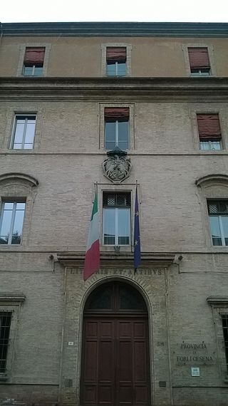
The province of Forlì-Cesena is a province in the Emilia–Romagna region of Italy. Its capital is the city of Forlì. The province has a population of 394,273 as of 2016 over an area of 2,378.4 square kilometres (918.3 sq mi). It contains 30 comuni and the provincial president is Davide Drei. Although located close to the independent Republic of San Marino, Forlì-Cesena does not share a land border with the sovereign state.

The province of Ravenna is a province in the Emilia-Romagna region of Italy. Its capital is the city of Ravenna. As of 2015, it has a population of 391,997 inhabitants over an area of 1,859.44 square kilometres (717.93 sq mi), giving it a population density of 210.81 inhabitants per square kilometre. Its provincial president is Claudio Casadio.

The province of Florence was a province in the northeast of Tuscany region of Italy. The city or comune of Florence was both the capital of the province of Florence, and of the Region of Tuscany. It had an area of 3,514 square kilometres (1,357 sq mi) and a population of 1,012,180 as of 31 December 2014. The territory of the province was the birthplace of the Italian Renaissance.

The Ofanto, known in ancient times as Aufidus or Canna, is a 134 or 170 km river in southern Italy that flows through the regions of Campania, Basilicata, and Apulia, into the Gulf of Manfredonia near Barletta.

The Basento is a river in the Basilicata region of southern Italy. It rises at Monte Arioso in the southern Apennine Mountains, southwest of Potenza in the province of Potenza. The river flows northeast near Pignola and Potenza before curving east near Vaglio Basilicata. It curves southeast and flows near Brindisi Montagna, Trivigno, and Albano di Lucania. A right tributary coming from Lago di Ponte Fontanelle flows into the river in this area. The river forms the border between the province of Potenza and the province of Matera for a short distance before flowing into the province of Matera. It flows eastward near Tricarico, Calciano, and Grassano before curving southeast. The river flows near Grottole, Miglionico, Pomarico, Ferrandina, and Monte Finese before curving eastward. It flows near Pisticci and Bernalda before flowing into the Gulf of Taranto, which is part of the Ionian Sea, near Metaponto. The main city on the Basento is Potenza, the capital of Basilicata.

The Senio is a 92-kilometre (57 mi) river of Romagna in Italy, the final right-sided tributary of the river Reno. The source of the river is in the province of Florence in the Appennino Tosco-Emiliano mountains. The river flows northeast into the province of Ravenna and flows near Casola Valsenio, Riolo Terme, Castel Bolognese, Cotignola, Lugo, Bagnacavallo, Fusignano and Alfonsine before entering the Reno. The river has a tributary called the Sintria that flows into it east of Riolo Terme. The river is along the road to Imola.

The Montone is a river in the historical region of Romagna, which is in the present-day region of Emilia-Romagna in northern Italy. It is the northernmost river on the east-facing slopes of the Apennines to flow directly into the Adriatic Sea rather than entering the Po. Its Latin name was Utis or Vitis.

The Santerno is a river in Romagna in northern Italy. It is a major tributary of the river Reno. In Roman times, it was known as the Vatrenus, although, in the Tabula Peutingeriana, it was already identified as the Santernus.

The Cesano is a river in the Marche region of Italy. Its source is near Monte Catria on the border between the province of Perugia and the province of Pesaro e Urbino. The river flows northeast through Pesaro e Urbino before forming the border between Pesaro e Urbino and the province of Ancona for a short distance. It continues flowing northeast through Pesaro e Urbino and flows past Pergola before becoming the border with Ancona again near San Lorenzo in Campo. The river flows northeast near Mondavio, Corinaldo and Monte Porzio before the province of Ancona extends westward beyond the bank of the river for a short distance near Mondolfo. Finally, the river flows into the Adriatic Sea north of Senigallia and south of Marotta and Fano.

The Foglia is the northernmost river of the Marche region of Italy. In ancient times it was known as Pisaurus, as it debouched into the Adriatic Sea at Pisaurum. It was also known as the Isaurus. The source of the river is west of Sestino in the province of Arezzo in the Umbrian-Marchean Apennines mountains. It flows east through an extension of the province of Pesaro e Urbino and then back into Arezzo before forming the border between Arezzo and Pesaro e Urbino. The river then flows into the province of Pesaro e Urbino past Piandimeleto and curves northeast and flows past Sassocorvaro before curving east again. The river meanders south of Montecalvo in Foglia before curving northeast and flowing near Colbordolo, Saludecio, Sant'Angelo in Lizzola, Montecchio, Montelabbate and Tavullia before entering the Adriatic Sea near Pesaro.

The Bidente-Ronco is a river in the Emilia-Romagna region of Italy. The first portion of the river is called the Bidente. Once the river passes under the Ponte dei Veneziani in Meldola, the river is called the Ronco. The source of the river is near the border between the province of Forlì-Cesena, the province of Arezzo, and the province of Florence in the Foreste Casentinesi, Monte Falterona, Campigna National Park. The river flows northeast through the mountains in the province of Forlì-Cesena and flows near Santa Sofia, Galeata, Civitella di Romagna and Meldola. Beyond Meldola, the river flows north near Bertinoro, Forlimpopoli, and Forlì before crossing the border into the province of Ravenna. The river flows northeast until it joins the Montone south of Ravenna, and the resulting river is known as the Uniti. The Battle of Ronco took place here.

The Sillaro is a 66-kilometre (41 mi) long Italian stream, whose headwaters are by the village of Piancaldoli, in Tuscany. It runs northeast through the city of Castel San Pietro Terme, Province of Bologna in Emilia Romagna. The river runs through a short extension of the province of Ravenna extending into the province of Bologna before re-entering the province of Bologna. It then forms the border between the province of Ferrara and the province of Ravenna for a short distance before entering the province of Ferrara. The river ends as a tributary of the Reno River by the village of San Biagio di Argenta and near where the Idice enters the Reno. Historically its course formed the boundary between Emilia and Romagna.

The Esino is a river in the Marche region of central Italy.

The Chienti is a river in the Marche region of Italy. Its source is near Serravalle di Chienti in the Appennino Umbro-Marchigiano mountains in the province of Macerata. The river flows northeast through the mountains past Muccia and enters and exits a small reservoir before entering Lago di Pievefavera. After exiting Lago di Pievefavera, the river continues flowing northeast before being joined by the Fiastrone at Belforte del Chienti. The river continues flowing northeast past Tolentino before being joined by the Fiastra south of Macerata. The river flows east near Corridonia and forms the border between the province of Macerata and the province of Fermo before flowing into the Adriatic Sea near Civitanova Marche.

The Port of Ravenna is an Italian seaport on the North Adriatic Sea in Ravenna, Italy. It is one of the top twenty Italian ports and top forty European ports.

The Lato is a river in the province of Taranto in the Apulia region of southern Italy. Its source is north of Laterza near the border with the province of Bari. The river flows south near Laterza and Ginosa before curving southeast. It flows near Case Perrone before flowing into the Gulf of Taranto near Castellaneta Marina.
The Carapelle is a river in the province of Foggia in the Apulia region of Italy. The source of the river is north of Anzano di Puglia near the border with the province of Avellino in the Daunian Mountains, along the Campanian Apennine. The river flows northeast near Monteleone di Puglia before curving eastward and flowing near Accadia and Sant'Agata di Puglia before being joined by a right tributary, the Calaggio. The river then curves northeast and is joined by a left tributary, the Carapellotto, before flowing past Ordona and Carapelle. The river connects with the Saline di Margherita di Savoia salt marsh via two branches on the south bank of the river before emptying into the Gulf of Manfredonia in the Adriatic Sea northwest of Zapponeta.

The Fiumi Uniti is a river in the province of Ravenna in the Emilia-Romagna region of Italy. The source of the river is the confluence of the rivers Montone and Ronco south of Ravenna. The river flows east 12 kilometers before entering the Adriatic Sea south of Lido Adriano.


