In aviation, instrument flight rules (IFR) is one of two sets of regulations governing all aspects of civil aviation aircraft operations; the other is visual flight rules (VFR).
In aviation, visual flight rules (VFR) are a set of regulations under which a pilot operates an aircraft in weather conditions generally clear enough to allow the pilot to see where the aircraft is going. Specifically, the weather must be better than basic VFR weather minima, i.e., in visual meteorological conditions (VMC), as specified in the rules of the relevant aviation authority. The pilot must be able to operate the aircraft with visual reference to the ground, and by visually avoiding obstructions and other aircraft.

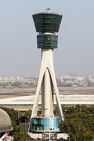
Air traffic control (ATC) is a service provided by ground-based air traffic controllers who direct aircraft on the ground and through a given section of controlled airspace, and can provide advisory services to aircraft in non-controlled airspace. The primary purpose of ATC is to prevent collisions, organize and expedite the flow of traffic in the air, and provide information and other support for pilots.

According to the International Civil Aviation Organization (ICAO), a runway is a "defined rectangular area on a land aerodrome prepared for the landing and takeoff of aircraft". Runways may be a human-made surface or a natural surface. Runways, taxiways and ramps, are sometimes referred to as "tarmac", though very few runways are built using tarmac. Takeoff and landing areas defined on the surface of water for seaplanes are generally referred to as waterways. Runway lengths are now commonly given in meters worldwide, except in North America where feet are commonly used.

In aviation, the instrument landing system (ILS) is a precision radio navigation system that provides short-range guidance to aircraft to allow them to approach a runway at night or in bad weather. In its original form, it allows an aircraft to approach until it is 200 feet (61 m) over the ground, within a 1⁄2 mile (800 m) of the runway. At that point the runway should be visible to the pilot; if it is not, they perform a missed approach. Bringing the aircraft this close to the runway dramatically increases the range of weather conditions in which a safe landing can be made. Other versions of the system, or "categories", have further reduced the minimum altitudes, runway visual ranges (RVRs), and transmitter and monitoring configurations designed depending on the normal expected weather patterns and airport safety requirements.

An airfield traffic pattern is a standard path followed by aircraft when taking off or landing while maintaining visual contact with the airfield.

In aviation, visual meteorological conditions (VMC) is an aviation flight category in which visual flight rules (VFR) flight is permitted—that is, conditions in which pilots have sufficient visibility to fly the aircraft maintaining visual separation from terrain and other aircraft. They are the opposite of instrument meteorological conditions (IMC). The boundary criteria between IMC and VMC are known as the VMC minima and are defined by: visibility, cloud ceilings, and cloud clearances.

A taxiway is a path for aircraft at an airport connecting runways with aprons, hangars, terminals and other facilities. They mostly have a hard surface such as asphalt or concrete, although smaller general aviation airports sometimes use gravel or grass.

Laughlin/Bullhead International Airport is a public use airport located 1.15 miles north of the central business district of Bullhead City, in Mohave County, Arizona, United States. It is owned by Mohave County. The airport is across the Colorado River and one block away from Laughlin, Nevada. Many of the rooms at Laughlin's casino-hotels offer a view of the airport. It was named 2011 Airport of the Year by the Arizona Department of Transportation.

In aviation, an instrument approach or instrument approach procedure (IAP) is a series of predetermined maneuvers for the orderly transfer of an aircraft operating under instrument flight rules from the beginning of the initial approach to a landing, or to a point from which a landing may be made visually. These approaches are approved in the European Union by EASA and the respective country authorities and in the United States by the FAA or the United States Department of Defense for the military. The ICAO defines an instrument approach as "a series of predetermined maneuvers by reference to flight instruments with specific protection from obstacles from the initial approach fix, or where applicable, from the beginning of a defined arrival route to a point from which a landing can be completed and thereafter, if landing is not completed, to a position at which holding or en route obstacle clearance criteria apply."

Pellston Regional Airport, also known as Pellston Regional Airport of Emmet County, is a public airport located one mile (1.6 km) northwest of the central business district of Pellston, a village in Emmet County, Michigan, United States. It is included in the Federal Aviation Administration (FAA) National Plan of Integrated Airport Systems for 2017–2021, in which it is categorized as a non-hub primary commercial service facility.

Perth Airport is a general-aviation airport located at New Scone, 3 nautical miles northeast of Perth, Scotland. The airport is used by private and business aircraft, and for pilot training. There are no commercial scheduled flights from the airport.

An approach lighting system (ALS) is a lighting system installed on the approach end of an airport runway and consisting of a series of lightbars, strobe lights, or a combination of the two that extends outward from the runway end. ALS usually serves a runway that has an instrument approach procedure (IAP) associated with it and allows the pilot to visually identify the runway environment and align the aircraft with the runway upon arriving at a prescribed point on an approach.

Hillsdale Municipal Airport is a public use airport located three nautical miles (6 km) east of the central business district of Hillsdale, in Hillsdale County, Michigan, United States. It is included in the Federal Aviation Administration (FAA) National Plan of Integrated Airport Systems for 2017–2021, in which it is categorized as a local general aviation facility.

Landing lights are lights, mounted on aircraft, that illuminate the terrain and runway ahead during takeoff and landing, as well as being used as a collision avoidance measure against other aircraft and bird strikes. Landing lights must be activated when the aircraft is under 10,000 feet in altitude.

The Spartanburg Downtown Memorial Airport is a general aviation airport located in the city of Spartanburg, South Carolina. The airport is 3 miles (4.8 km) from downtown Spartanburg, which makes it popular for private and corporate aircraft.

Modern United States Navy aircraft carrier air operations include the operation of fixed-wing and rotary aircraft on and around an aircraft carrier for performance of combat or noncombat missions. The flight operations are highly evolved, based on experiences dating back to 1922 with USS Langley.

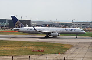
Continental Airlines Flight 1883 was a Boeing 757 that mistakenly landed on a taxiway at Newark Liberty International Airport on the evening of October 28, 2006. There were no reported injuries or damage, but the narrowly averted disaster was investigated by the National Transportation Safety Board, and caused the Federal Aviation Administration to reevaluate and modify air and ground safety procedures at and around Newark Airport.

On July 7, 2017, an Airbus A320-211 operating as Air Canada Flight 759 was nearly involved in an accident at San Francisco International Airport in San Mateo County, California, United States. The flight, which originated at Toronto Pearson International Airport, had been cleared by air traffic control to land on runway 28R and was on final approach to land on that runway; however, instead of lining up with the runway, the aircraft had lined up with the parallel taxiway, on which four fully loaded and fueled passenger airplanes were stopped awaiting takeoff clearance. The flight crew initiated a go-around prior to landing, after which it landed on 28R without further incident. The aircraft on the taxiway departed for their intended destinations without further incident. The subsequent investigation by the National Transportation Safety Board (NTSB) determined that the Air Canada airplane descended to 59 feet (18 m) above the ground before it began its climb, and that it missed colliding with one of the aircraft on the taxiway by 14 feet (4.3 m).

On 23 December 1983, Korean Air Lines Flight 084 (KAL084), a McDonnell Douglas DC-10-30CF performing a cargo flight, collided during its takeoff roll with SouthCentral Air Flight 59 (SCA59), a Piper PA-31-350, on runway 06L/24R at Anchorage International Airport, as a result of the KAL084 flight crew becoming disoriented while taxiing in dense fog and attempting to take off on the wrong runway. Both aircraft were destroyed, but no fatalities resulted.


