Related Research Articles

Light rail transit (LRT) is a form of passenger urban rail transit characterized by a combination of tram and rapid transit features. While its rolling stock is similar to that of a traditional tram, it operates at a higher capacity and speed and often on an exclusive right-of-way. In many cities, light rail transit systems more closely resemble, and are therefore indistinguishable from, traditional underground or at-grade subways and heavy-rail metros.

A curb extension is a traffic calming measure which widens the sidewalk for a short distance. This reduces the crossing distance and allows pedestrians and drivers to see each other when parked vehicles would otherwise block visibility. The practice of banning car parking near intersections is referred to as daylighting the intersection.

A hook turn or two-stage turn, also known as a Copenhagen Left, is a road cycling manoeuvre or a motor vehicle traffic-control mechanism in which vehicles that would normally turn from the innermost lane of an intersection instead turn from the outermost lane, across all other lanes of traffic.

Bike lanes (US) or cycle lanes (UK) are types of bikeways (cycleways) with lanes on the roadway for cyclists only. In the United Kingdom, an on-road cycle-lane can be firmly restricted to cycles or advisory. In the United States, a designated bicycle lane or class II bikeway (Caltrans) is always marked by a solid white stripe on the pavement and is for 'preferential use' by bicyclists. There is also a class III bicycle route, which has roadside signs suggesting a route for cyclists, and urging sharing the road. A class IV separated bike way (Caltrans) is a bike lane that is physically separate from motor traffic and restricted to bicyclists only.

Intermodal passenger transport, also called mixed-mode commuting, involves using two or more modes of transportation in a journey. Mixed-mode commuting is often used to combine the strengths of various transportation options. A major goal of modern intermodal passenger transport is to reduce dependence on the automobile as the major mode of ground transportation and increase use of public transport. To assist the traveller, various intermodal journey planners such as Rome2rio and Google Transit have been devised to help travellers plan and schedule their journey.

A bus lane or bus-only lane is a lane restricted to buses, often on certain days and times, and generally used to speed up public transport that would be otherwise held up by traffic congestion. The related term busway describes a roadway completely dedicated for use by buses, whilst bus gate describes a short bus lane often used as a short cut for public transport. Bus lanes are a key component of a high-quality bus rapid transit (BRT) network, improving bus travel speeds and reliability by reducing delay caused by other traffic.

Vehicular cycling is the practice of riding bicycles on roads in a manner that is in accordance with the principles for driving in traffic, and in a way that places responsibility for safety on the individual.

Bicycle transportation planning and engineering are the disciplines related to transportation engineering and transportation planning concerning bicycles as a mode of transport and the concomitant study, design and implementation of cycling infrastructure. It includes the study and design of dedicated transport facilities for cyclists as well as mixed-mode environments and how both of these examples can be made to work safely. In jurisdictions such as the United States it is often practiced in conjunction with planning for pedestrians as a part of active transportation planning.
In transport engineering nomenclature, a counterflow lane or contraflow lane is a lane in which traffic flows in the opposite direction of the surrounding lanes.

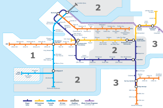
Transportation in Vancouver, British Columbia, has many of the features of modern cities worldwide. Unlike many large metropolises, Vancouver has no freeways into or through the downtown area. A proposed freeway through the downtown was rejected in the 1960s by a coalition of citizens, community leaders and planners. This event "signalled the emergence of a new concept of the urban landscape" and has been a consistent element of the city's planning ever since.

Cycling is the second-most common mode of transport in the Netherlands, with 36% of Dutch people listing the bicycle as their most frequent way of getting around on a typical day, as opposed to the car (45%) and public transport (11%). Cycling has a modal share of 27% of all trips nationwide. In cities this is even higher, such as Amsterdam which has 38%, and Zwolle 46%. This high frequency of bicycle travel is enabled by excellent cycling infrastructure such as cycle paths, cycle tracks, protected intersections, ample bicycle parking and by making cycling routes shorter and more direct than car routes.

A cycle track or cycleway (British) or bikeway, sometimes historically referred to as a sidepath, is a separate route for cycles and not motor vehicles. In some cases cycle tracks are also used by other users such as pedestrians and horse riders. A cycle track can be next to a normal road, and can either be a shared route with pedestrians or be made distinct from both the pavement and general roadway by vertical barriers or elevation differences.

Transport in Winnipeg involves various transportation systems, including both private and public services, and modes of transport in the capital city of Manitoba.

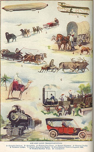
The following outline is provided as an overview of and topical guide to transport:

Cycling in New York City is associated with mixed cycling conditions that include dense urban proximities, relatively flat terrain, congested roadways with stop-and-go traffic, and streets with heavy pedestrian activity. The city's large cycling population includes utility cyclists, such as delivery and messenger services; cycling clubs for recreational cyclists; and increasingly commuters. Cycling is increasingly popular in New York City; in 2018 there were approximately 510,000 daily bike trips, compared with 170,000 daily bike trips in 2005.

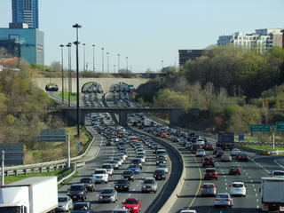
Toronto, Ontario, like many North American cities, has slowly been expanding its purpose-built cycling infrastructure. The number of cyclists in Toronto has been increasing progressively, particularly in the city's downtown core. As cycling conditions improve, a cycling culture has grown and alternatives such as automobiles are seen as less attractive. The politics of providing resources for cyclists, particularly dedicated bike lanes, has been contentious, particularly since the 2010s.

Cycling infrastructure is all infrastructure cyclists are allowed to use. Bikeways include bike paths, bike lanes, cycle tracks, rail trails and, where permitted, sidewalks. Roads used by motorists are also cycling infrastructure, except where cyclists are barred such as many freeways/motorways. It includes amenities such as bike racks for parking, shelters, service centers and specialized traffic signs and signals. The more cycling infrastructure, the more people get about by bicycle.

A protected intersection or protected junction, also known as a Dutch-style junction, is a type of at-grade road junction in which cyclists and pedestrians are separated from cars. The primary aim of junction protection is to help pedestrians and cyclists be and feel safer at road junctions.

Terminology related to road transport—the transport of passengers or goods on paved routes between places—is diverse, with variation between dialects of English. There may also be regional differences within a single country, and some terms differ based on the side of the road traffic drives on. This glossary is an alphabetical listing of road transport terms.

Cycling is a popular mode of transport and recreational sport in the Philippines.
References
- ↑ Bambrick, Yvonne (2015-03-01). Urban Cycling Survival Guide, The: Need-to-Know Skills and Strategies for Biking in the City. ECW Press. pp. 49–50. ISBN 978-1-77090-710-2.
- ↑ Llorico, Abby (September 27, 2022). "There's a right way to share the road with bikers. Here's how". wusa9.com. Retrieved 2022-11-10.
- ↑ Raimondi, Michael (September 22, 2022). "Arizona to become fourth state to allow some lane filtering for motorcyclists". KOLD. Retrieved 2022-11-10.
- ↑ "Trams". VicRoads. Retrieved November 10, 2022.
- ↑ Alta (October 17, 2008). "Bicycle Interactions and Streetcars: Lessons Learned and Recommendations" (PDF). Altago.
- ↑ Mastre, Brian (September 19, 2022). "Concerns raised over Omaha street car's route intersecting with bike lanes". WOWT. Retrieved 2022-11-10.
- ↑ North, B. H. (1990). Light Transit Systems: Proceedings of the Symposium on the Potential of Light Transit Systems in British Cities Organized by the Institution of Civil Engineers and Held in Nottingham on 14-15 March 1990. Thomas Telford. pp. 22–26. ISBN 978-0-7277-1590-6.
- ↑ Gentile, Guido; Nökel, Klaus (2016-02-03). Modelling Public Transport Passenger Flows in the Era of Intelligent Transport Systems: COST Action TU1004 (TransITS). Springer. pp. 96–97. ISBN 978-3-319-25082-3.