Related Research Articles

Clinton County is a county in the U.S. state of Michigan. As of the 2020 Census, the population was 79,128. The county seat is St. Johns. The county was created in 1831 and organized in 1839. It is named after early American politician DeWitt Clinton. Clinton County is included in the Lansing-East Lansing, MI Metropolitan Statistical Area.

Allegan County is a county in the U.S. state of Michigan. As of the 2020 United States Census, the population was 120,502. The county seat is Allegan. The name was coined by Henry Rowe Schoolcraft to sound like a Native American word. Allegan County comprises the Holland, Michigan Micropolitan Statistical Area, which is included in the Grand Rapids–Kentwood–Muskegon Combined Statistical Area. It is primarily an agricultural area that is rapidly becoming urbanized as the population centers of Grand Rapids on the northeast and Kalamazoo to the southeast expand into Allegan County.
Ganges Township is a civil township of Allegan County in the U.S. state of Michigan. The population was 2,574 at the 2020 census.

M-89 is an east–west state trunkline highway in the US state of Michigan that runs from near Ganges to Battle Creek. M-89 starts at an interchange with Interstate 196/US Highway 31 (I-196/US 31) and passes through Allegan, Kalamazoo County, Michigan, and Calhoun counties. The highway also briefly crosses the southwest corner of Barry County before it terminates an at intersection with Business Loop I-94 on the northwestern side of downtown Battle Creek. In between the trunkline runs parallel to the Kalamazoo River through rural southwestern Michigan farmlands while also running through the middle of several smaller towns in the area.

Interstate 496 (I-496) is an auxiliary Interstate Highway that passes through downtown Lansing in the US state of Michigan. Also a component of the State Trunkline Highway System, the freeway connects I-96 to the downtown area. It has been named the R.E. Olds Freeway for Ransom E. Olds, the founder of Oldsmobile and the REO Motor Car Company. I-496 runs east–west from I-96/I-69 near the downtown area and north–south along a section that runs concurrently with US Highway 127 (US 127). The trunkline also passes a former assembly plant used by Oldsmobile and runs along or crosses parts of the Grand and Red Cedar rivers.

M-40 is a north–south state trunkline highway in the Lower Peninsula of the US state of Michigan. The highway runs from US Highway 12 (US 12) near the Indiana state line in Porter Township north through Paw Paw and Allegan to end in the outskirts of Holland. The current northern end is near Interstate 196 (I-196) at an intersection with US 31/Business Loop I-196 (BL 196). In between, M-40 runs through mixed agricultural and forest lands and along lakes and rivers through Southwest Michigan.
The Lansing Craft Center (LCC) was a specialized General Motors automobile assembly factory in Lansing Township, Michigan, located at 2801 West Saginaw Street across from GM's Lansing Metal Center.

M-179 is a 16.963-mile-long (27.299 km) state trunkline highway in the western portion of the US state of Michigan. It runs from US Highway 131 (US 131) at exit 61 outside of Bradley to M-43 just west of Hastings in the Lower Peninsula. The highway crosses through forest land and provides access to state recreational areas. M-179 has been given the Chief Noonday Recreational Heritage Route designation by the Michigan Department of Transportation (MDOT). Prior to October 1998, this highway was the eastern portion of county road A-42. The number was formally assigned by the next year. This is not the first time the number was used in Michigan, an unrelated M-179 previously existed in the 1930s through the 1950s farther north.

The Capitol Loop was a state trunkline highway running through Lansing, Michigan, in the United States that was commissioned on October 13, 1989. It formed a loop route off Interstate 496 (I-496) through downtown near the Michigan State Capitol complex, home of the state legislature and several state departments. The Michigan Department of Transportation (MDOT) had labeled it as Capitol Loop I-496 or CL I-496 on some maps, similar to the Business Loop Interstate nomenclature. However, unlike other business loops in Michigan, it had unique reassurance markers—the signs that served as regular reminders of the name and number of the highway. It was known internally at MDOT as Connector 496 for inventory purposes. The route followed a series of one-way and two-way streets through downtown Lansing, directing traffic downtown to the State Capitol and other government buildings. Unlike the other streets downtown, the seven streets comprising the Capitol Loop were under state maintenance and jurisdiction.
Pullman is an unincorporated community in Lee Township, Allegan County, in the U.S. state of Michigan. It is in a predominantly rural area of Western Michigan, about 150 miles (240 km) east of Chicago. It is centered on the junction of 109th Avenue and 56th Street between sections eight and nine of Lee Township at 42°29′01″N86°05′29″W. It is approximately 10 miles (16 km) northeast of South Haven, about 13 miles (21 km) southeast of Saugatuck–Douglas, and six miles (9.7 km) west-southwest of Allegan. The Upper, Lower, and Western Scott Lakes are nearby, which empty into the Scott Creek Drain, a tributary of the Middle Branch of the Black River.
Waverly Community Schools is a school district managing six schools within Waverly, Michigan, United States since 1961 with the consolidation of the Stoner, Millett, Bretton Woods, and Windemere Schools.
The MSU Pavilion for Agriculture and Livestock Education is a convention center located in East Lansing, Michigan on the campus of Michigan State University. It was built in 1996. It has 101,527 square feet (9,432 m2) of exhibit space.

M-222 is the current designation of a state trunkline highway in Allegan County of the US state of Michigan. It runs between the city of Allegan, where it connects with M-40/M-89, and the US Highway 131 (US 131) freeway near Martin. The highway runs along a series of streets in Allegan and through rural farm fields and woods between the two communities along 116th Avenue. The roadway was a state highway back in 1919 when the system was initially signed. It was assigned as part of M-89 and M-40 before being given its own number, M-118. That designation was applied to the highway until 1988 when that was retired in favor of the current M-222.

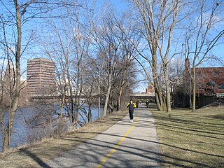
Lansing River Trail is a multiple use trail approximately 13 miles (21 km) long. It runs along the Grand River and the Red Cedar River between Michigan State University and Dietrich Park in northern Lansing. The first segment of trail opened in 1975. It was designated a National Recreation Trail in 1981.
The Summit at the Capital Centre was a 1,000-seat hockey arena located in Dimondale, Michigan, a suburb of Lansing, Michigan. It was primarily used for high school and youth hockey.
The Lansing Metal Center was a General Motors foundry located in Lansing Township, Michigan, directly across Saginaw Street from the Lansing Craft Center. It was originally built as a jet engine manufacturing plant in 1952 and shuttered in 2006.
Lansing Redistribution Center is a General Motors automobile parts warehouse located in Delta charter Township, Michigan at West Mount Hope Highway and Lansing Road along GTW-operated railway. The 2,300,000 sq ft (210,000 m2) was originally constructed in 1959, opened in 1960 and expanded in 1964, 1965, 1969 and 1979.
Ralph William Crego was an American politician who served as Mayor of Lansing, Michigan from 1943 to 1961.
Shuto Con was an annual three day anime convention held during March at the Radisson Hotel Lansing at the Capitol in Lansing, Michigan. The convention's name stands for Capital City Convention. The organizers have also hosted Random Battle Con, a video game convention.

A-2 is a county-designated highway in the US state of Michigan running about 42 miles (68 km) along the shores of Lake Michigan in the southwestern part of the Lower Peninsula. The county highway starts near the town of Lake Michigan Beach in Berrien County at an intersection with M-63 and follows Blue Star Highway through rural coastal areas. Running roughly parallel to its modern freeway replacement, Interstate 196 (I-196), A-2 passes through the cities of South Haven and Saugatuck before ending at an interchange with Business Loop Interstate 196/US Highway 31 in Holland.
References
- ↑ Journal of the Constitutional Convention 1961-1962, p 1
- ↑ From the Archives: Lansing Civic Center was entertainment central Lansing State Journal.1 March 2014. Retrieved 4 July 2014