The Arctic Archipelago, also known as the Canadian Arctic Archipelago, is an archipelago lying to the north of the Canadian continental mainland, excluding Greenland and Iceland.

Padilla de Abajo is a small village and municipality located in the province of Burgos, in the kingdom of Spain. It has a romanic chapel that hosts a figure of the Virgin Mary called Nuestra Señora del Torreon. Many of its inhabitants still have "Padilla" as their family name.

The Camp is the term used in the Falkland Islands to refer to any part of the islands outside the islands' only significant town, Stanley, and often the large RAF base at Mount Pleasant. It is derived from the Spanish word campo, for "countryside".

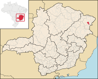
Felisburgo is a Brazilian municipality located in the northeast of the state of Minas Gerais.

Rodeio Bonito is a municipality in the state of Rio Grande do Sul, Brazil. As of 2020, the estimated population was 5,868.

Sierra Island is a narrow island which is marked by a series of small elevations throughout its length, lying 0.5 miles (0.8 km) northwest of Dee Island and north of Greenwich Island in the South Shetland Islands, Antarctica. Surface area 14 hectares.
The Findlay Group is a group of islands in the Arctic Archipelago in Qikiqtaaluk Region, Nunavut. This Arctic Ocean group consists of Lougheed Island, Stupart Island, Edmund Walker Island, Grosvenor Island and Patterson Island.

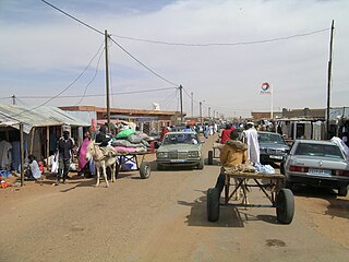
Tintane (Arabic:طينطان) is a town and commune in Mauritania. It is located in the Hodh El Gharbi region of Mauritania, and is an important stop on the "Road of Hope", the largest and most important road in Mauritania, which links Nouakchott to Néma.
São Valério da Natividade is a municipality in the state of Tocantins in the Northern region of Brazil.

Guesalaga Peninsula is a small, L-shaped, low-lying shingle covered peninsula on the east side of Discovery Bay, Greenwich Island in the South Shetland Islands, Antarctica forming the northwest coast of Iquique Cove and the north side of its entrance. The feature is projecting 700 m (766 yd) southwestwards and 300 m (328 yd) wide, with the narrow shingle Reyes Spit extending 400 m (437 yd) southwestwards from its west extremity Reyes Point into Discovery Bay. The Chilean Antarctic base Arturo Prat is situated on the peninsula.
Mount Nipha is a hill, 760 m, standing almost precisely in the center of White Island, in the Ross Archipelago. Nipha is a Greek word for snow. So named by the New Zealand Geological Survey Antarctic Expedition (NZGSAE) (1958–59) because the hill is surrounded by ice and snow.

The Flowers Hills are a triangular shaped group of hills, 34.6 kilometres (21.5 mi) long and 11.5 kilometres (7.1 mi) wide, with peaks of 1,240 metres (4,070 ft) and 1,504 metres (4,934 ft), extending along the eastern edge of the Sentinel Range, Ellsworth Mountains, Antarctica. The hills are bounded by Hansen Glacier and Dater Glacier to the west and north, Rutford Ice Stream to the east and Sikera Valley to the southwest, and separated from Doyran Heights to the west-southwest by Kostinbrod Pass. Their interior is drained by Lardeya Ice Piedmont and Valoga Glacier.
McMorrin Glacier is a glacier flowing west from Mount Metcalfe to Marguerite Bay in Graham Land, Antarctica. it was named by the UK Antarctic Place-Names Committee for Ian McMorrin, a British Antarctic Survey general assistant at Stonington Island, 1961–63, who helped survey this area in 1962.
Awei is a small uninhabited island in Malampa Province of Vanuatu in the Pacific Ocean. It is a part of the Maskelyne Islands archipelago.
SS Tolten was a Chilean Cargo ship that was torpedoed by the German submarine U-404 in the Atlantic Ocean 32 nautical miles (59 km) off Barnegat, New Jersey, United States on 13 March 1942 while she was travelling from Baltimore, United States to New York City, New York (state), United States in ballast.


