The Lugano District is a district of Canton of Ticino, southern Switzerland. The capital is the city of Lugano.
The Locarno District is a district of Canton Ticino, Switzerland. It has a population of 63,774.
The Blenio District is a district of the canton of Ticino in Switzerland. It has a population of 5,656. The capital of the district is Acquarossa.

Acquarossa is the capital of the district of Blenio in the canton of Ticino in Switzerland.
Corzoneso is a village and former municipality in the canton of Ticino, Switzerland.
Dongio is a village and former municipality in the canton of Ticino, Switzerland.

Leontica is a village and former municipality in the canton of Ticino, Switzerland.

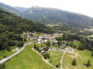
Lottigna is a village and former municipality in the canton of Ticino, Switzerland.
Marolta is a village and former municipality in the canton of Ticino, Switzerland.

Ponto Valentino is a village and former municipality in the canton of Ticino, Switzerland.
Prugiasco is a village and former municipality in the canton of Ticino, Switzerland.
Castro is a village and former municipality in the canton of Ticino, Switzerland.

Tesserete is a village and former municipality in the canton of Ticino, Switzerland.
Cassarate is a village on the northern shore of Lake Lugano, to the east of the outfall of the Cassarate River, in the Swiss canton of Ticino. Politically the village forms part of the Castagnola-Cassarate quarter of the city of Lugano, although until 1972 Castagnola-Cassarate was an independent municipality under the name Castagnola.

Aurigeno is a village and former municipality in the district of Vallemaggia in the canton of Ticino, Switzerland.
Giumaglio is a village and former municipality in the district of Vallemaggia in the canton of Ticino, Switzerland.
Lodano is a village and former municipality in the district of Vallemaggia in the canton of Ticino, Switzerland.

Italian Grisons or Italian Grigioni or sometimes also called Lombard Grisons, is the region of the Canton of Grisons, Switzerland, in which Italian is the dominant language.

The Rein da Medel is the longest headwater of the Rhine. It is located in the Swiss cantons of Ticino and Graubünden and flows through the valleys Val Cadlimo and Val Medel. Rein da Medel is the local Sursilvan, name in Graubünden, which is commonly used to denote the ticinese part as well.

Molino Nuovo is a quarter of the city of Lugano, in the Swiss canton of Ticino. It lies to the north of the city center, and is the most populous quarter of the city. In 2012, it had a population of 9,258.
