Latrop | |
|---|---|
 | |
Location of Latrop  | |
 Latrop  Latrop | |
| Coordinates: 51°6′44″N8°19′34″E / 51.11222°N 8.32611°E | |
| Country | Germany |
| State | North Rhine-Westphalia |
| Admin. region | Arnsberg |
| District | Hochsauerlandkreis |
| Town | Schmallenberg |
| Elevation | 430 m (1,410 ft) |
| Population (2021-12-31) | |
• Total | 176 |
| Time zone | UTC+01:00 (CET) |
| • Summer (DST) | UTC+02:00 (CEST) |
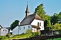
Latrop is a locality in the municipality Schmallenberg in the High Sauerland District in North Rhine-Westphalia, Germany.
Contents
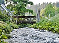
The village has 176 inhabitants [1] and lies in the south of the municipality of Schmallenberg at a height of around 430 m. The river Latrop flows through the village. Latrop borders on the villages of Grafschaft, Störmecke, Schanze, Jagdhaus, Waidmannsruh and Fleckenberg.
In 1257 a Johannes von Latroph was named for the first time in a document. The village used to belong to the municipality of Grafschaft in Amt Schmallenberg until the end of 1974. [2]
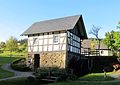
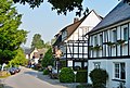
Latrop was awarded gold for its beauty in the national competition “Our village has a future”.