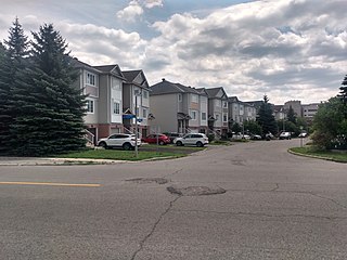
Westboro is an area in the west end of Ottawa, Ontario, Canada. Located along the Ottawa River, Island Park Drive defines Westboro's eastern border, while the Ottawa River defines its northern border. Under this definition, the population of the area is 22,725.
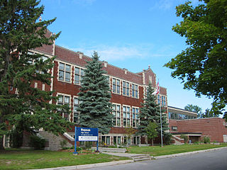
Nepean High School is a high school in Ottawa, Ontario, Canada. It is located in the Westboro neighbourhood, at 574 Broadview Avenue. There were 1160 students enrolled for 2011–2012. Alan Johnson is the current principal replacing Kristy MacNamara, the principal from 2018 to 2019. The two current vice principals are Christy Armstrong and Peter Campbell.

The Kichi Zībī Mīkan, formerly the Sir John A. Macdonald Parkway, and previously the Ottawa River Parkway, is a four-lane scenic parkway along the Ottawa River in Ottawa, Ontario, Canada. It runs from Carling Avenue near Connaught Avenue, to Booth Street at the Canadian War Museum and National Holocaust Monument. It is maintained by the National Capital Commission. The speed limit is 60 km/h (37 mph). Bicycles are allowed on the road and on a parallel recreational path along the parkway.

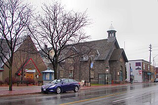
Westboro currently serves as a bus station in Ottawa, Ontario. It is located in the Westboro neighbourhood, on Scott Street between Athlone and Tweedsmuir avenues.

Dominion is a station on the transitway in Ottawa, Ontario. It is located north of the western edge of Westboro village, where the below-grade transitway segment joins the Kichi Zībī Mīkan. The station is named after nearby Dominion Avenue.
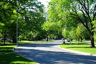
Island Park Drive is a scenic parkway in Ottawa, Ontario, Canada.

Kitchissippi Ward is a city ward in the city of Ottawa, Ontario, Canada. It gets its name from the Algonquin name for the Ottawa River, meaning Great River. The ward is slightly west of downtown, and covers the neighbourhoods of Champlain Park, Civic Hospital, Hampton Park, Highland Park, Hintonburg, Island Park, McKellar Heights, McKellar Park, Mechanicsville, Westboro Beach, Westboro, Wellington Village, and Wellington Street West.
Shawn William Little was a political consultant and Ottawa City Councillor in Ottawa, Ontario, Canada, for the urban Kitchissippi Ward, consisting of neighbourhoods west of the City Centre. He was born in Ottawa and raised in its Westboro neighbourhood, where he attended Woodroffe Avenue and Broadview Public elementary schools followed by Nepean High School. He earned a bachelor's degree in history and political science from Carleton University, and a diploma in health sciences from Humber College. He wrote articles for the Newswest community paper in its early days. He died in November 2012 while vacationing in Cuba.

Carlington is a neighbourhood located in River Ward in the west-end of Ottawa, Ontario, Canada.

Civic Hospital is a neighbourhood in Kitchissippi Ward in central Ottawa, Canada. It is named after the Ottawa Civic Hospital, which is located in the neighbourhood.
Hampton Park is a park and neighbourhood in Kitchissippi Ward, in the west end of Ottawa, Ontario, Canada. It is directly north of the Queensway at Island Park Drive. The park is maintained by the National Capital Commission.
Highland Park is a sub-neighbourhood of Westboro, in the Kitchissippi Ward in Ottawa, Ontario, Canada. It is located between Carling Avenue and Richmond Road, Churchill Avenue and Denbury Ave. It is a mixed-income neighbourhood, with some large luxury homes closer to Richmond Road, middle-income homes built in the last two centuries, and a large number of lower-income low-rise apartment buildings closer to Carling Avenue. The population of the neighbourhood according to the Canada 2011 Census was 4,070.
Newswest is a community publication serving a number of communities within Canada's National Capital Region. Newswest is a wholly Canadian publication and not related to the 1980s U.S. newspaper NewsWest, previously owned by Tab Communications.
Central Park is a neighbourhood in River Ward in the west end of Ottawa, Ontario, Canada. It is bounded on the east by Merivale Road, on the south by Baseline Road, on the west by Clyde Avenue and on the north by the Carlington neighbourhood. The population of the neighbourhood in 2016 was 3,888 in an area of 0.91 km2. It more than doubled its population between 2001 and 2006 as the neighbourhood expanded. Excluding the residences south of Baseline which are included in the Census Tract, the population of the neighbourhood is 3,760.
Katherine Hobbs is a former Ottawa city councillor of Kitchissippi Ward. She won the ward in the 2010 Ottawa municipal election, defeating the incumbent Christine Leadman, and was defeated by Jeff Leiper in 2014.

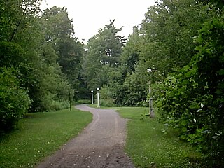
The Capital Pathway, also known informally as the Bike Path, is a 220-kilometre (140 mi) recreational pathway interlinking many parks, waterways and sites in Ottawa, Ontario and Gatineau, Quebec. Most of the pathway is paved, and allows an almost continuous route through the National Capital Region.
McKellar Heights is a small neighbourhood located in Kitchissippi Ward, in the west end of Ottawa, Ontario, Canada. The neighbourhood is generally triangular in shape, and is generally bounded on the north by Westboro, on the west by Glabar Park, and on the south by Carlington. The population as of the Canada 2016 Census was 575.

Champlain Park is an older urban neighbourhood in Kitchissippi Ward in Ottawa, Ontario, Canada. It was considered in the 1930s as the west end of town. The boundaries of the neighbourhood are the Ottawa River and Scott Street. To the east is Tunney's Pasture and to the west is Island Park Drive. Westboro Beach is also to the west. The population as of the 2016 Census was 1090.

Byron Linear Tramway Park is a municipal park in Kitchissippi Ward and Bay Ward in Ottawa, Ontario, Canada. The park forms a narrow strip of park land that runs westward from Holland Avenue to Richardson Avenue in Woodpark, with the exception of Westboro Village. Running through the entirety of the park is a path through grass and trees. The park forms a narrow 2.5 km strip, but has a width varies between 5 and 15 metres.