Related Research Articles

The Waal is the main distributary branch of the river Rhine flowing approximately 80 km (50 mi) through the Netherlands. It is the major waterway connecting the port of Rotterdam to Germany. Before it reaches Rotterdam, it joins with the Afgedamde Maas near Woudrichem to form the Boven Merwede. Along its length, Nijmegen, Tiel, Zaltbommel and Gorinchem are towns of importance with direct access to the river.

West Maas en Waal is a municipality in the Dutch province of Gelderland.

Raiguer is a comarca (county) located in the north-central part of Majorca, one of the Balearic Islands. It runs parallel to the Serra de Tramuntana district from the town of Marratxí to the town of Sa Pobla. Like the rest of the Majorcan districts, it is only recognized at a geographic level.

Bundesautobahn 862 was an autobahn in Germany. Its purpose was to connect the French Autoroute 36 with the German Bundesautobahn 5 via a bridge over the Rhine. At 400 metres, the A 862 was Germany's shortest autobahn; it was later integrated as an onramp into the A 5.

Acaraú is a municipality in the Ceará state of Brazil. The city lies on the Acaraú River near the northern Atlantic coast. In 2020 the population was estimated at 63,104. The municipality is a major producer of Brazilian lobster and its economy depends heavily on fishing, agriculture and cattle breeding.

The Arnhem–Nijmegen metropolitan area is a former Dutch plusregio, public body and intermunicipal institution. It was founded in 1988 for co-operation in the areas of housing, transport and economics for the Dutch cities of Nijmegen and Arnhem and the surrounding municipalities of Berg en Dal, Beuningen, Doesburg, Duiven, Heumen, Lingewaard, Montferland, Mook en Middelaar, Overbetuwe, Renkum, Rheden, Rijnwaarden, Rozendaal, Westervoort, Wijchen, and Zevenaar. All except Mook en Middelaar (Limburg) are in the province of Gelderland. In 2022, a total of 774,506 people lived in the municipalities (1,000 km2).

Major Isidoro is a municipality located in the center of the Brazilian state of Alagoas. Its population is 19,864 (2020) and its area is 454 km².
Kalafalıq is a village in the Lachin Rayon of Azerbaijan.

Burg Kammerstein/ Ehrenfels is a castle in the town of Kammern im Liesingtal in Styria, Austria. Burg Kammerstein is 129 metres (423 ft) above sea level.
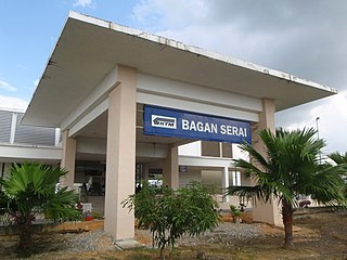
The Bagan Serai railway station is a Malaysian train station located at and named after the town of Bagan Serai, Perak. It was later relocated and upgraded to an elevated station as part of the double-tracking and electrification project of the railway.
Ichirnawa is a village and rural commune in Niger. As of 2012, it had a population of 42,582.
Lehtmetsa is a village in Põhja-Pärnumaa Parish, Pärnu County in southwestern Estonia.
Nerići is a village in the Republika Srpska, Bosnia and Herzegovina. According to the 1991 census, the village is located in the municipality of Han Pijesak.
Dubnica is a village in the municipality of Vranje, Serbia. According to the 2002 census, the village has a population of 819 people.
Žlijeb is a village in the municipality of Višegrad, Bosnia and Herzegovina.

Seitajärvi was a community located in the Savukoski municipality of Finland.
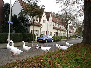
Vreewijk is a neighborhood of Rotterdam, Netherlands.
Trebotin is a village in the municipality of Kruševac, Serbia. According to the 2002 census, the village has a population of 681 people.

Jazovik is a village in the municipality of Valjevo, Serbia. According to the 2002 census, the village has a population of 144 people.

Lentävänniemi is a district in the western part of Tampere on the shores of Lake Näsijärvi in Pirkanmaa, Finland. It belongs to the northwestern part of the city and borders the Niemi and Niemenranta borders on the southwest. There are jogging paths along the lake and its shores surrounding the apartment-based Lentävänniemi. In 2014, the population of Lentävänniemi was 4,309.
References
- ↑ Ad van der Meer and Onno Boonstra, Repertorium van Nederlandse gemeenten , KNAW, 2011.
51°53′9″N5°31′55″E / 51.88583°N 5.53194°E
| | This Gelderland location article is a stub. You can help Wikipedia by expanding it. |