
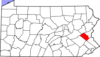
Carbon County is a county located in the U.S. state of Pennsylvania. As of the 2010 census, the population was 65,249. Its county seat is Jim Thorpe, which was founded in 1818 as Mauch Chunk, a company town of the Lehigh Coal & Navigation Company (LC&N) along a new wagon road the company was constructing nine miles long to their coal mine, in the area now known as Summit Hill. LC&N also constructed the Lehigh Canal navigations during this time in the area.

Penn State Lehigh Valley is a commonwealth campus of Pennsylvania State University and it is located in Center Valley, outside of Allentown in the Lehigh Valley region of Pennsylvania. Founded in 1912, Penn State Lehigh Valley is the oldest of Penn State's commonwealth campuses.

The Reading Blue Mountain and Northern Railroad, sometimes shortened to Reading and Northern Railroad, is a regional railroad operating in eastern Pennsylvania, with headquarters located in Port Clinton. The RBMN provides freight service on 300 miles (480 km) of track, with its mainline consisting of the Reading Division between Reading and Packerton and the Lehigh Division between Lehighton and Dupont. In addition to freight service, passenger excursions also run along the RBMN system. The Lehigh Gorge Scenic Railway (LGSR) is a tourist railroad that operates passenger excursions along the RBMN between Jim Thorpe and Lehigh Gorge State Park. The RBMN also operates passenger excursions from Reading and Port Clinton to Jim Thorpe.
Rittenhouse Gap is the name of a village in Longswamp Township, Berks County, Pennsylvania, at 40°28′04″N75°37′47″W.

Summit Lawn is a small unincorporated village in Lehigh County, Pennsylvania, in the Lehigh Valley region of the state. Parts of Summit Lawn are in Upper Saucon Township while others are in Salisbury Township. The Salisbury Township government offices are located in Summit Lawn.
Black Creek is a 7.6-mile-long (12.2 km) brook tributary of the Lehigh River in Carbon County, Pennsylvania, in the United States,. Its waters start at the very south edge of Weatherly, Pennsylvania at the confluence of Beaver and Hazle Creeks, then runs nearly due east to its mouth on the Lehigh River in Maple Hollow at the former railroad depot of Penn Haven Junction just east of Hinkles Valley. The confluence was a waypoint along the 19th-century Lehigh & Susquehanna Turnpike Black Creek has two major tributaries joining within Weatherly, the 7 miles (11 km) long Beaver Creek The tributary Quakake Creek, is the more dispersed and disorganized source waters, originating in over half-a-dozen small streams; it is also listed by the Geographic Names Information System (GNIS) as a variant name for Black Creek.

Lehigh Gorge State Park is a 4,548 acres (1,841 ha) Pennsylvania state park in Luzerne and Carbon Counties, Pennsylvania in the United States. The park encompasses the Lehigh Gorge, which stretches along the Lehigh River from a U.S. Army Corps of Engineers flood control dam in Luzerne County to Jim Thorpe in Carbon County. The primary recreational activity at Lehigh Gorge State Park is white water rafting.

The Lehigh Gorge Trail is a 26-mile (42 km) multi-use rail trail that winds along the valley of the Lehigh River Gorge from White Haven, to Jim Thorpe, Pennsylvania. Much of the trail runs through the Lehigh Gorge State Park, and was originally developed into a railroad corridor after an extension of the Lehigh Canal was first built under the great push of Main Line of Public Works to connect the Delaware Valley to Pittsburgh.

Lehigh Carbon Community College (LCCC) is a public community college in Schnecksville, Pennsylvania, in the Lehigh Valley region of the state. The school serves as the primary granter of associate degrees in the Allentown area.
Powder Valley is a village in southern Upper Milford Township, Lehigh County, Pennsylvania, United States. It is located on the Indian Creek, which comes from the NW, turns south, and flows through a gorge starting there into the Hosensack Creek The village uses the Zionsville zip code of 18092. Stahl's Pottery was located in Powder Valley off Corning Road.
Walbert, Pennsylvania is a small village that hosts the municipal offices of South Whitehall Township, Lehigh County, Pennsylvania. It is located on Route 309 and has easy access to 22, 78, and 476. It is split between the Allentown zip code of 18104 and the Orefield zip code of 18069. It is drained by the Jordan Creek into the Lehigh River.
Ironton is a village in North Whitehall Township, Lehigh County. It uses the Coplay zip code of 18037 and is drained by the Coplay Creek into the Lehigh River.

Schoenersville is a suburban village located in Hanover Township, Lehigh County and Hanover Township, Northampton County, in the U.S. state of Pennsylvania. It is pronounced "SHAY-nerz-vil." NW-to-SE Schoenersville Road serves as the county line, coming up from Bethlehem and meeting NE-to-SW Airport Road in the village, and beyond there it becomes Weaversville Road. Schoenersville is split between the Allentown zip code of 18109 and the Bethlehem zip code of 18017.
Colesville is a suburban village located on Route 378 in Upper Saucon Township, Lehigh County and Lower Saucon Township, Northampton County, in the U.S. state of Pennsylvania. It is on the south side of Lehigh Mountain from Bethlehem. Interstate 78 passes through the village but does not interchange there. Colesville is split between the Bethlehem zip code of 18015 and the Center Valley zip code of 18034.

Andreas is a village in the southeast corner of Schuylkill County, Pennsylvania, in West Penn Township on Route 895. A small part of Andreas is also in East Penn Township in Carbon County. The Lizard Creek flows eastward through the village to the Lehigh River. Andreas lies at the northern foot of Blue Mountain in ZIP code 18211.

Seidersville is a suburban Lehigh Valley village on Route 378 in Lower Saucon Township, Northampton County, Pennsylvania. It is on Lehigh Mountain just south of Bethlehem, of which it uses the zip code of 18015. Lehigh Valley PBS affiliate WLVT-TV-39 is based at 839 Sesame Street just east of Seidersville and has moved its studio to the BethWorks complex this year.
Christian Springs is an unincorporated community in Upper Nazareth Township, Northampton County, Pennsylvania, located between the boroughs of Bath and Nazareth at the junction of Routes 248 and 946. It is drained by the Monocacy Creek southward into the Lehigh River. Italcementi Group operates a cement facility, which is a remnant of a once-burgeoning Lehigh Valley cement industry, in Christian Springs. The village is served by the Nazareth post office, which uses the zip code of 18064.
Treichlers is an unincorporated community along the Lehigh River in Lehigh Township, Northampton County, Pennsylvania. It is pronounced "TRYKE-lerz" and is located where Route 145 crosses the river on its path northward from Allentown to the Lehigh Gap. It is served by the Treichlers post office which uses the ZIP code of 18086.
East Mauch Chunk, organized as a Pennsylvania township when a part of 19th century Northampton County, Pennsylvania, was originally settled in the 1820s as a cross river bedroom community from both vanished Lausanne Landing and the explosively growing Mauch Chunk which it served as an upscale bedroom community, where company managers and officers were known to build homes, along with the housing built in what is known as upper Mauch Chunk. The community became a township in [TBDL: date and County] and was later organized [TBDL: 1850s? Cite History of Carbon County] as a formerly independent borough in Carbon County, Pennsylvania.

Bear Mountain, in the Lehigh Valley of Pennsylvania several miles above the Lehigh Gap, is an steep-sided east bank ridgeline running about 9.96 miles (16.03 km) between the hairpin turn in the Lehigh the Lenape Amerindian people visualized as a Bear's snout, along many water gap gorges, to the steep face dropping down to the Penn Forest Reservoir. The sparsely settled mountain ridge is part of the ridge-and-valley Appalachians, oriented ENE towards the Delaware River climbing rapidly from the Lehigh left bank shoreline from about 580 feet (180 m) over an overhanging knob opposite the mouth of Mauch Chunk Creek to more than 1,200 feet (370 m) in less than 1.01 miles (1.63 km) and to over 1,480 feet (450 m) in just 1.34 miles (2.16 km) the tourism & business district of Jim Thorpe. Bear Mountain is the prominent peak opposite the business district of the tourist attractions of Jim Thorpe in Carbon County, once termed being in the heart of "Switzerland of the United States". The former township and borough of East Mauch Chunk was settled outside the hustle and confusion of cross-river boomtown Mauch Chunk ited on the north Overlooking the long slack water pool of the Lehigh River after it exits the wilderness countryside around the Lehigh Gorge as the Lehigh runs along the northwest flanks of Bear Mountain,