
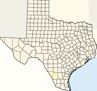
Uvalde is a city in and the county seat of Uvalde County, Texas, United States. The population was 15,751 at the 2010 census.
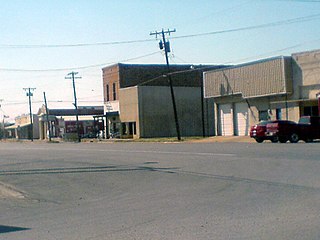
Newcastle is a city in Young County, Texas, United States. Following the beginning of coal mining in 1908, the town was established and named for the English coal town, Newcastle upon Tyne. Coal mining had ended by 1942. The population was 585 at the 2010 census.

Kinikinik is a small unincorporated community in western Larimer County, Colorado in the United States. It is located along State Highway 14 in the upper Poudre Canyon west of Fort Collins on the east side of Cameron Pass. The community consists of a general store and neighboring summer mountain resorts and vacation homes. The activities include fishing in the Cache la Poudre River and hiking in the nearby mountains in the Roosevelt National Forest. The community was named for the kinnikinick plant by early settlers.

San Antonio Bay is a bay on the Texas Gulf coast situated between Matagorda and Aransas Bay. It consists mainly of the combined waters of the San Antonio and Guadalupe rivers, and is located at the mouth of the Guadalupe River, about 55 miles (89 km) northeast of Corpus Christi and 130 miles (209 km) southeast of San Antonio. It is protected from the Gulf of Mexico by Matagorda Island, leaving only relatively small and distant outlets to the Gulf for little mixing of bay and Gulf waters. The remoteness of the bay has prevented the establishment of major ports as seen on Aransas and Corpus Christi Bay, to the south.
The Beaver River is the historic name for an intermittent river in Oklahoma that drains most of the Oklahoma Panhandle. It is also known as the North Canadian River; both names are in common use. The Beaver River flows from Union County, New Mexico, entering the Oklahoma Panhandle in Cimarron County, then flowing out of state through Sherman County in the Texas Panhandle for about 15 miles (24 km), then back to the Oklahoma panhandle in Texas County, where it is impounded in Optima Lake near Guymon. Downstream of the dam, it continues through the Oklahoma counties of Beaver and Harper before ending in Woodward County.
The Middle Branch of the Dead Diamond River is a 9.0-mile (14.5 km) long river in northern New Hampshire in the United States. It is a tributary of the East Branch of the Dead Diamond River, located in the Androscoggin River watershed of Maine and New Hampshire.
Sweetwater Creek is a stream in northern Texas and western Oklahoma. It is a tributary to the North Fork of the Red River.
Chacon Creek is a small stream of water located in Webb County, Texas, USA, which runs through Laredo. The creek is formed 6 miles from Webb and runs southwest for 20 miles until it connects to the Rio Grande. Chacon was dammed in 1951 in east Laredo to form Lake Casa Blanca, a 1,680 acres (6.8 km²) lake. The terrain surrounding the creek is mostly clay. The vegetation surrounding the creek is mostly made up of mesquite, cacti and grasses. Chacon Creek is cross by several highways in Laredo, including United States Route 59, Texas State Highway Loop 20, Texas State Highway Spur 400, Texas State Highway 359 and United States Route 83
Santa Isabel Creek is a small stream of water located in Webb County, Texas which runs through Laredo, Texas. The creek is formed 32 miles from Callaghan, Texas and runs southwest for 33 mi (53 km) until the creek connects to the Rio Grande. The terrain surrounding the creek is mostly clay. The vegetation surrounding the creek is mostly made up of mesquite, cacti, and grasses. Santa Isabel Creek crosses Three major highways in Laredo, Texas among them are: Farm to Market Road 1472, Texas State Highway 255, and United States Route 83.
Armand Bayou is a bayou in U.S. State of Texas. It runs near Galveston Bay in Pasadena and the Clear Lake Area.

The Delaware River (Texas) or Delaware Creek is an intermittent stream that rises in Guadalupe Mountains National Park about 8 kilometres (5.0 mi) west of Pine Springs and 3 kilometres (1.9 mi) north of Guadalupe Peak in northwestern Culberson County, Texas. It flows into the Pecos River in New Mexico, 5 kilometres (3.1 mi) north of the border with Texas.
The Sabinal River, formerly Arroyo de la Soledad, is a stream in Uvalde and Bandera counties of the U.S. state of Texas. The upper part of the river runs through the Lost Maples State Natural Area. In its lower section, it runs underground in some regions. The Sabinal River is fed by Hale, Hollow, and Can Creeks within Lost Maples State Natural Area and Mill, Little, Onion, Rancheros, Nolton, and East Elm Creeks in the lower region.
Wanderers Creek is a river in Texas.
Simmons is an unincorporated community in Texas County, in the U.S. state of Missouri. The community is located at the intersection of US Route 63 and Missouri Route Z, approximately seven miles south of Houston. The Big Piney River flows past the east side of the community.
Service is an unincorporated community in eastern Crawford County, in the U.S. state of Missouri. The community is located on a small tributary along the east bank of Courtois Creek, approximtealy 2.5 miles west of the Crawford-Washington county line. Missouri Route 8 passes on the ridge about one-half mile to the southwest. The community of Butts lies about 1.5 miles downstream (northwest) and Berryman is about four miles to the southeast (upstream). The old Service School was located at the site in the 1940s.
Capps Creek is a stream in Ripley County, in the U.S. state of Missouri. It is a tributary of the Current River.
Nile is an unincorporated community in eastern Texas County, in the U.S. state of Missouri. The community is situated on the floodplain of Big Creek, approximately one mile west of the Texas-Shannon county line. The old Nile Schoolhouse was about one mile east (upstream) and on the opposite side of the river across a stream ford.
Prescott is an unincorporated community in northern Texas County, in the U.S. state of Missouri. The community lies approximately 4.5 miles southwest of Licking and the Big Piney River flows about 1.5 miles to the west of the location. The Prescott Church and cemetery lie one-half mile south.
Raftville is an extinct town in Texas County, in the U.S. state of Missouri. The community was located on the west side of the Big Piney River, south of Boiling Spring.
Venable is an unincorporated community in northwest Texas County, in the U.S. state of Missouri.


