Related Research Articles
The Amazon River in South America is the largest river by discharge volume of water in the world, and the disputed longest river system in the world in comparison to the Nile.

The country of Brazil occupies roughly half of South America, bordering the Atlantic Ocean. Brazil covers a total area of 8,514,215 km2 (3,287,357 sq mi) which includes 8,456,510 km2 (3,265,080 sq mi) of land and 55,455 km2 (21,411 sq mi) of water. The highest point in Brazil is Pico da Neblina at 2,994 m (9,823 ft). Brazil is bordered by the countries of Argentina, Bolivia, Colombia, Guyana, Paraguay, Peru, Suriname, Uruguay, Venezuela, and France.

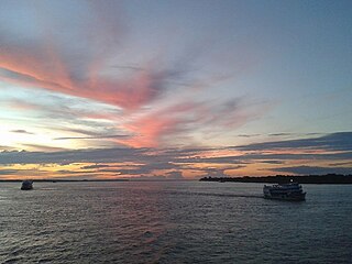
The Tocantins River is a river in Brazil, the central fluvial artery of the country. In the Tupi language, its name means "toucan's beak". It runs from south to north for about 2,450 km. It is not really a branch of the Amazon River, since its waters flow into the Atlantic Ocean alongside those of the Amazon. It flows through four Brazilian states and gives its name to one of Brazil's newest states, formed in 1988 from what was until then the northern portion of Goiás.

Tocantins is one of the 26 states of Brazil. It is the newest state, formed in 1988 and encompassing what had formerly been the northern two-fifths of the state of Goiás. Tocantins covers 277,620.91 square kilometres (107,190.03 sq mi) and had an estimated population of 1,496,880 in 2014. Construction of its capital, Palmas, began in 1989; most of the other cities in the state date to the Portuguese colonial period. With the exception of Araguaína, there are few other cities with a significant population in the state. The government has invested in a new capital, a major hydropower dam, railroads and related infrastructure to develop this primarily agricultural area. The state has 0.75% of the Brazilian population and is responsible for 0.5% of the Brazilian GDP.

Maranhão is a state in Brazil. Located in the country's Northeast Region, it has a population of about 7 million and an area of 332,000 km2 (128,000 sq mi). Clockwise from north, it borders on the Atlantic Ocean for 2,243 km and the states of Piauí, Tocantins and Pará. The people of Maranhão have a distinctive accent inside the common Northeastern Brazilian dialect. Maranhão is described in books such as The Land of the Palm Trees by Gonçalves Dias and Casa de Pensão by Aluísio Azevedo.

Bananal Island is a large river island formed from the bisection of the Araguaia River, in southwestern Tocantins, Brazil. The island is formed by a fork in a very flat section of the Araguaia River. Bananal Island is the second largest river island in the world and the largest without an ocean coastline, at 350 kilometres (220 mi) long and 55 kilometres (34 mi) wide. Its total area is 19,162.25 square kilometres (7,398.59 sq mi). The rivers within the island flow parallel to the Araguaia, and the Jaburu do Bananal is the longest river within a river.

Marabá is a municipality in the state of Pará, Brazil. Its greatest geographic reference is the confluence of two large rivers near the historic city center, the Itacaiunas River and the Tocantins River, forming a "Y" if seen from space. It basically consists of six urban centers linked by five highways.

The Araguaia River is one of the major rivers of Brazil though it is almost equal in volume at its confluence with the Tocantins. It has a total length of approximately 2,627 km.
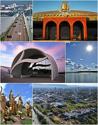
Palmas is the capital and largest city of the state of Tocantins, Brazil. According to IBGE estimates from 2020, the city had 306,296 inhabitants.
The Araguaia National Park is a national park located in Tocantins state in the north of Brazil, between 09º51’—11º11’S and 49º57’—50º27’W. Bananal Island, on which the park is located, is believed to be the largest inland river island in the world.

Monte Alegre de Goiás is a municipality in northeastern Goiás state, Brazil.
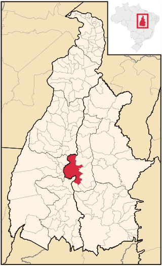
Porto Nacional is a Brazilian municipality in the state of Tocantins. The population was 53,316 (2020) in an area of 4,450 km2 (1,720 sq mi), including both rural and urban areas.
The Chapada das Mangabeiras is a mountain range in central Brazil. The range runs northwest–southeast, and separates the basin of the Tocantins River to the southwest from the upper basin of the Parnaiba River to the northeast. The range also forms the boundary between Tocantins state and the states of Maranhão and Piauí. The highest points of both states are located there. The points are unnamed locations, one measuring 804 meters (Maranhão), and the other, 860 meters (Piauí).
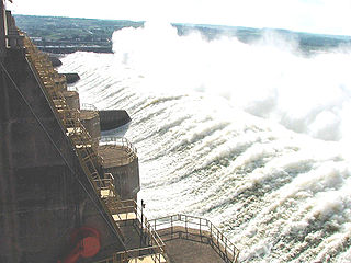
The Tucuruí Dam is a concrete gravity dam on the Tocantins River located on the Tucuruí County in the State of Pará, Brazil. The main purpose of the dam is hydroelectric power production and navigation. It is the first large-scale hydroelectric project in the Brazilian Amazon rainforest. The installed capacity of the 25-unit plant is 8,370 megawatts (11,220,000 hp). Phase I construction began in 1980 and ended in 1984 while Phase II began in 1998 and ended in 2010. The dam was featured in the 1985 film The Emerald Forest.
Muricilândia is a municipality in the state of Tocantins in the Northern region of Brazil.
Santa Fé do Araguaia is a municipality in the state of Tocantins in the Northern region of Brazil.
Santa Rita do Tocantins is a municipality in the state of Tocantins in the Northern region of Brazil.
Divinópolis do Tocantins is a municipality in the state of Tocantins in the Northern region of Brazil.
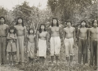
The Krahô are an indigenous Timbira Gê people of northeastern Brazil. The Krahô historically inhabited a portion of modern Maranhão along the Balsas River, but were pushed west by pioneer settlement and cattle farmers. Currently, the Krahô live on the Terra Indígena Kraolândia reservation in Tocantins.

The Tocantins basin, or Araguaia-Tocantins basin, is a Brazilian river basin, almost entirely located between the 2ºS and 18ºS parallels and the 46ºW and 56ºW meridians. The main rivers in the basin are Tocantins and Araguaia.
References
Coordinates: 10°00′S50°07′W / 10.000°S 50.117°W