Related Research Articles

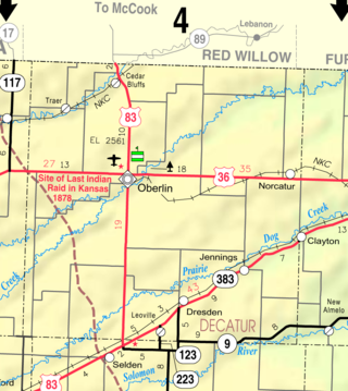
Jennings is a city in Decatur County, Kansas, United States. As of the 2020 census, the population of the city was 81.
The Battle of Dry Wood Creek, also known as the Battle of the Mules, was fought on September 2, 1861, in Vernon County, Missouri, during the American Civil War. After his victory at the Battle of Wilson's Creek on August 10, Sterling Price and the Missouri State Guard moved further north into Missouri. A force of Union troops under James H. Lane moved from Fort Scott, Kansas to attempt an interception of Price's army, and set an ambush along Dry Wood Creek. Price's Missouri State Guard troops outnumbered Lane's Kansas troops, and after a two hour skirmish forced Lane to retreat to Fort Scott. In their retreat, Lane's troops abandoned their supplies and mules to the Missourians. Price followed up his victory by continuing his northward march, culminating in another victory at the siege of Lexington, September 13 to 20, before returning south shortly afterwards.

Smoky Hill City is a ghost town in Lookout Township, Ellis County, Kansas, United States. It lies approximately 12 miles (19 km) southwest of Hays.
Cofachique is a ghost town situated along the Neosho River near the present-day city of Iola in Allen County, Kansas, United States. Being the first town established in Allen County in 1855, it was the original county seat. However, within five years the greater part of the town was moved to the new town of Iola, while the old site of Cofachique became farm land. The town was named in honor of an Osage chief known as Cofachique, who is said to have been particularly helpful to early settlers, bringing aid to the distressed and homeless. The name "Cofachique" appears to have origins with the Cofachiqui tribe in South Carolina, who were Siouan speakers, and the Osage who settled this area were closely affiliated with the Siouan.
Point Anne is a ghost town on the Bay of Quinte approximately four miles east of downtown Belleville, Ontario. It is now part of Belleville. It was the birthplace of hockey greats Bobby Hull and Dennis Hull. Point Anne was established in 1837, and it was home to various cement companies starting with Portland cement in 1905. The final cement plant operated by Lafarge was closed in 1973, and operations transferred to Bath, Ontario. LaFarge still operates a quarry in the area.

Wellsford is an unincorporated community in Kiowa County, Kansas, United States. It is located along Highway 54.
Nettleton is an unincorporated community in Edwards County, Kansas, United States.
Oil Hill, Kansas is a ghost town in Butler County, Kansas, United States.
Upola is a ghost town in Elk County, Kansas, United States.
Cave Springs is a ghost town in Elk County, Kansas, United States.
Fiat is a ghost town in Paw Paw Township, Elk County, Kansas, United States.
Ivanpah is a ghost town in Greenwood County, Kansas, United States.
Utopia is a ghost town in Greenwood County, Kansas, United States.
Chetolah is a ghost town in Lookout Township of Ellis County, Kansas, United States.

Ewell is a ghost town in Sumner County, Kansas, United States. It is located about 3.5 miles southwest of Conway Springs at 0.25 mile southeast of the intersection of N Bluff Rd and W 60th Ave N, next to an abandoned railroad.
Wingate is a ghost town in Butler County, Kansas, United States. No buildings remain at this former community site.

Turkville is a ghost town in Buckeye Township, Ellis County, Kansas, United States.
Albion is a ghost town in Harper County, Kansas, United States.
Roselle is an unincorporated community in northwest Madison County, in the U.S. state of Missouri.
Yates is an unincorporated community in Randolph County, in the U.S. state of Missouri.
References
- ↑ U.S. Geological Survey Geographic Names Information System: Lexington, Kansas
- ↑ "Kansas Post Offices, 1828-1961". Kansas Historical Society. Archived from the original on October 9, 2013. Retrieved August 2, 2014.
