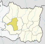
Daha is a former village development committee in Jajarkot District in the Karnali province of Nepal. At the time of the 1991 Nepal census it had a population of 3276 residing in 628 individual households.
Lapsiphedi is a village and former Village Development Committee that is now part of Shankharapur Municipality in Kathmandu District in Province No. 3 of central Nepal. At the time of the 1991 Nepal census it had a population of 5040 and had 919 households in it.
Mahuwa is a village development committee in Dhanusa District in the Janakpur Zone of south-eastern Nepal. At the time of the 1991 Nepal census it had a population of 5,194.
Basantapur is a town and Village Development Committee in Bara District in the Narayani Zone of south-eastern Nepal. At the time of the 1991 Nepal census it had a population of 4,435 persons residing in 740 individual households.
Bishnupurwa is a town and Village Development Committee in Bara District in the Narayani Zone of south-eastern Nepal. At the time of the 1991 Nepal census it had a population of 3,606 persons living in 617 individual households.
Dharmanagar is a village and Village Development Committee in Bara District in the Narayani Zone of south-eastern Nepal. At the time of the 2011 Nepal census it had a population of 5,357 persons living in 770 individual households. There were 2,786 males and 2,571 females at the time of census.
South Jhitakaiya is a town and Village Development Committee, near by Dewapur- Chowk/Pokhara/Mandir/School/Police Station and Pashah River, Bara District in the Narayani Zone of south-eastern Nepal. At the time of the 1991 Nepal census it had a population of 7,235.

Chhorambu is a village and Village Development Committee in Khotang District in the Sagarmatha Zone of eastern Nepal. At the time of the 1991 Nepal census it had a population of 2,376 persons living in 428 individual households.
Bijaya Kharka is a village and Village Development Committee in Khotang District in the Sagarmatha Zone of eastern Nepal. At the time of the 1991 Nepal census it had a population of 2,590 persons living in 493 individual households.
Damarkhu Shivalaya is a town and Village Development Committee in Khotang District in the Sagarmatha Zone of eastern Nepal. At the time of the 1991 Nepal census it had a population of 3,237 persons living in 602 individual households.
Ghitung is a village and Village Development Committee in Khotang District in the Sagarmatha Zone of eastern Nepal. At the time of the 1991 Nepal census it had a population of 2,515 persons living in 482 individual households.
Indrayani Pokhari is a town and Village Development Committee in Khotang District in the Sagarmatha Zone of eastern Nepal. At the time of the 1991 Nepal census it had a population of 3,589 persons living in 697 individual households.
Khartamchha is a village and Village Development Committee in Khotang District in the Sagarmatha Zone of eastern Nepal. At the time of the 1991 Nepal census it had a population of 2,387 persons living in 497 individual households.

Simpani is a town and Village Development Committee in Khotang District in the Sagarmatha Zone of eastern Nepal. At the time of the 1991 Nepal census it had a population of 3,597 persons living in 676 individual households. According to Simpani VDC record in 2008, its total population is 5713.

Waplukha is a Village Development Committee in Khotang District in the Sagarmatha Zone of eastern Nepal. At the time of the 1991 Nepal census it had a population of 2,571 persons living in 484 individual households.
Gagal Bhadaure is a village development committee in Ramechhap District in the Janakpur Zone of north-eastern Nepal. At the time of the 1991 Nepal census it had a population of 2596 people living in 468 individual households.
Pawai, Nepal is a village development committee in Solukhumbu District in the Sagarmatha Zone of north-eastern Nepal. At the time of the 1991 Nepal census it had a population of 2180 people living in 425 individual households.
Baigundhura is a village development committee in Jhapa District in the Mechi Zone of south-eastern Nepal. At the time of the 1991 Nepal census it had a population of 5409 people living in 983 individual households.
Bagahi is a Village Development Committee in Rautahat District in the Narayani Zone of south-eastern Nepal. At the time of the 1991 Nepal census it had a population of 2217 people residing in 429 individual households.


