Related Research Articles

Interstate 95 (I-95) is the main north–south Interstate Highway on the East Coast of the United States, running from U.S. Route 1 (US 1) in Miami, Florida, north to the Houlton–Woodstock Border Crossing between Maine and the Canadian province of New Brunswick. The highway largely parallels the Atlantic coast and US 1, except for the portion between Savannah, Georgia, and Washington, D.C., and the portion between Portland and Houlton in Maine, both of which follow a more direct inland route.
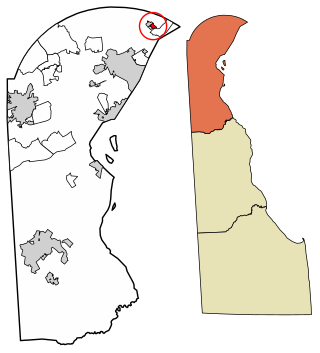
Ardentown is a village in New Castle County, Delaware, United States. According to the 2010 Census, the population of the village is 264.
Claymont is a census-designated place (CDP) in New Castle County, Delaware, United States. As of the 2020 U.S. census, the population of Claymont was 9,895.

U.S. Route 13 or U.S. Highway 13 (US 13) is a north–south United States Numbered Highway established in 1926 that runs for 518 miles (834 km) from Interstate 95 (I-95) just north of Fayetteville, North Carolina, to US 1 in the northeastern suburbs of Philadelphia, Pennsylvania, near Morrisville. In all, it traverses five states in the Atlantic coastal plain region. It follows the Atlantic coast more closely than does the main north–south U.S. Highway of the region, US 1. Because of this, its number is out of place on the general U.S. Highway numbering grid, as it should be running west of US 11 but does not. Its routing is largely rural, the notable exceptions being the Hampton Roads area in Virginia and the northern end of the highway in Delaware and Pennsylvania. It is also notable for being the main thoroughfare for the Delmarva Peninsula and carrying the Chesapeake Bay Bridge–Tunnel to it in Virginia.

Interstate 495 (I-495) is an 11.47-mile-long (18.46 km) auxiliary Interstate Highway in the US state of Delaware. The highway, named the Vietnam Veterans Memorial Highway, serves as a six-lane bypass of I-95 around the city of Wilmington. I-495 begins at an interchange with I-95 and I-295 near Newport to the southwest of Wilmington. From here, the road heads east to the Port of Wilmington, where it turns northeast and crosses the Christina River as it heads to the east of downtown Wilmington. Upon reaching Edgemoor, I-495 runs between the Delaware River to the east and U.S. Route 13 (US 13) to the west, continuing to Claymont. In Claymont, I-495 turns north and merges into northbound I-95 at an interchange with Delaware Route 92 (DE 92) just south of the Pennsylvania state line.
Interstate 95 (I-95) is an Interstate Highway running along the East Coast of the United States from Miami, Florida, north to the Canadian border in Houlton, Maine. In the state of Delaware, the route runs for 23.43 miles (37.71 km) across the Wilmington area in northern New Castle County from the Maryland state line near Newark northeast to the Pennsylvania state line in Claymont. I-95 is the only primary Interstate Highway that enters Delaware, although it also has two auxiliary routes within the state. Between the Maryland state line and Newport, I-95 follows the Delaware Turnpike, a toll road with a mainline toll plaza near the state line. Near Newport, the Interstate has a large interchange with Delaware Route 141 (DE 141) and the southern termini of I-295 and I-495. I-95 becomes the Wilmington Expressway from here to the Pennsylvania state line and heads north through Wilmington concurrently with U.S. Route 202 (US 202). Past Wilmington, I-95 continues northeast to Claymont, where I-495 rejoins the route right before the Pennsylvania state line.

Delaware Route 2 (DE 2) is a 10.81-mile-long (17.40 km) east–west state highway located in the northern part of New Castle County in the U.S. state of Delaware. It runs from DE 72 and DE 273 on the eastern edge of Newark east to DE 52 in Wilmington. Between Newark and Wilmington, the route is a four- to six-lane divided highway called Capitol Trail and Kirkwood Highway that passes through suburban areas, running through Marshallton, Prices Corner, and Elsmere. In Wilmington, DE 2 is routed along the one-way pair of Lincoln Street eastbound and Union Street westbound, passing through urban areas.

Delaware Route 896 (DE 896) is a state highway located in New Castle County, Delaware. The route runs from U.S. Route 13 (US 13) in Boyds Corner north to the Maryland border northwest of Newark, where the road becomes unsigned Maryland Route 896 (MD 896) briefly before heading into Pennsylvania as Pennsylvania Route 896 (PA 896). The route heads west from US 13 before turning north along with DE 71 in Mount Pleasant, crossing the Chesapeake & Delaware Canal on the Summit Bridge. After the bridge, DE 71 splits off to the east and the road continues to Glasgow, where it comes to an intersection with US 40. DE 896 continues north and interchange with Interstate 95 (I-95) before reaching Newark, where it bypasses the University of Delaware to the west by following DE 4, Elkton Road, and South Main Street. DE 896 comes to downtown Newark and continues northwest to the Maryland border. DE 896 has a business route, DE 896 Business, that passes through Glasgow, and had an alternate alignment south of Glasgow called DE 896 Alternate.

Delaware Route 273 (DE 273) is a state highway in New Castle County, Delaware. The route runs from Maryland Route 273 (MD 273) at the Maryland border near Newark east to DE 9 and DE 141 in New Castle. The route heads through suburban areas between Newark and New Castle as a multilane road, passing through Ogletown and Christiana. DE 273 intersects DE 896 in downtown Newark; DE 2/DE 72 on the eastern edge of Newark; DE 4 in Ogletown; Interstate 95 (I-95), DE 7, and DE 1 in Christiana; DE 37 in Pleasantville; and DE 58 and U.S. Route 13 (US 13)/US 40 in Hares Corner.

U.S. Route 301 (US 301) is a US Highway running from Sarasota, Florida, north to Biddles Corner, Delaware. In the state of Delaware, the route runs 11.9 mi (19.2 km) across New Castle County from the Maryland state line southwest of Middletown northeast to its northern terminus at the Delaware Route 1 (DE 1) freeway in Biddles Corner, just south of the Senator William V. Roth Jr. Bridge that carries DE 1 over the Chesapeake & Delaware Canal in St. Georges. US 301 in Delaware is a controlled-access toll road that is designated as the First Responders Memorial Highway. The freeway has interchanges with DE 299 west of Middletown, DE 71 north of Middletown, and Jamison Corner Road, and uses all-electronic tolling, with tolls paid by E-ZPass or toll-by-plate. A mainline toll gantry is located north of the Maryland state line while there are ramp tolls on the southbound exits and northbound entrances at the three interchanges.

Delaware Route 92 (DE 92) is a 8.83-mile-long (14.21 km) road in northern New Castle County, Delaware, that runs a short distance to the south of the Pennsylvania/Delaware state line for most of its length. The route runs from DE 100 near Montchanin east to U.S. Route 13 (US 13) in Claymont. The road is a two-lane rural road between the western terminus and US 202, passing through Brandywine Creek State Park and the Brandywine Valley section of First State National Historical Park. East of US 202, DE 92 is a four-lane divided highway called Naamans Road that passes through suburban areas to the north of Wilmington, with an interchange at Interstate 95 (I-95) in Claymont. DE 92 was first built as a state highway east of US 202 during the 1920s and 1930s. By 1968, the route was designated onto its current alignment. In the 1990s, DE 92 east of US 202 was widened into a divided highway.

Delaware Route 4 (DE 4) is a state highway in New Castle County, Delaware. The route runs from DE 279 and DE 896 in Newark east to DE 48 in downtown Wilmington. The route passes through suburban areas in northern New Castle County between Newark and Wilmington, intersecting DE 72 in the eastern part of Newark, DE 273 in Ogletown, DE 58 in Christiana, DE 7 in Stanton, DE 141 in Newport, DE 62 and DE 100 between Newport and Wilmington, and Interstate 95 (I-95)/U.S. Route 202 (US 202) in Wilmington. DE 4 is a four-lane road for much of its length.
U.S. Route 13 Business is an 8.19-mile (13.18 km) business route of US 13 that runs through the heart of the city of Wilmington in New Castle County, Delaware, where US 13 bypasses downtown Wilmington to the east, running near Interstate 495 (I-495) and the Delaware River. US 13 Bus. begins at I-495 and US 13 at the southern border of Wilmington and heads north toward the downtown area, where it splits into a one-way pair. Past downtown, the business route heads through the northeastern part of the city on North Market Street before continuing through suburban Brandywine Hundred on Philadelphia Pike. US 13 Bus. reaches its northern terminus at US 13 in Claymont. US 13 Bus. is a four-lane road for much of its length.
U.S. Route 13 (US 13) is a U.S. highway running from Fayetteville, North Carolina, north to Morrisville, Pennsylvania. In the U.S. state of Delaware, the route runs for 103.33 mi (166.29 km). It traverses the entire north–south length of the state from the Maryland state line in Delmar, Sussex County, north to the Pennsylvania state line in Claymont, New Castle County. US 13 connects many important cities and towns in Delaware, including Seaford, Dover, and Wilmington. The entire length of US 13 in Delaware is a multilane divided highway with the exceptions of the segment through Wilmington and parts of the route in Claymont. Between the Maryland state line and Dover, US 13 serves as one of the main north–south routes across the Delmarva Peninsula. From Dover north to Tybouts Corner, the route is followed by the controlled-access Delaware Route 1 (DE 1) toll road, which crosses the route multiple times and has multiple interchanges with it. US 13 bypasses downtown Wilmington to the east before it heads northeast of the city parallel to Interstate 495 (I-495) and the Delaware River to Claymont. US 13 is the longest numbered highway in the state of Delaware.

Pennsylvania Route 491 (PA 491) and Delaware Route 491 (DE 491) is a state highway starting in Delaware County, Pennsylvania and ending in New Castle County, Delaware. Also known as Naamans Creek Road, the route runs from U.S. Route 202 (US 202) in Concord Township east to the Delaware border in Lower Chichester Township. In the state of Delaware, the highway runs for 0.36 mi (0.58 km) as a connector between the Pennsylvania border and DE 92 near Claymont, Delaware. PA 491 runs closely parallel to the Delaware border throughout its route. It intersects PA 261 in the Booths Corner section of Bethel Township. The western portion of PA 491 was first designated as part of Legislative Route 135 in 1911. In the 1920s, the Delaware portion of road was built as a state highway while PA 491 was created in 1928.
U.S. Route 13 (US 13) runs along the Atlantic coastline for over 500 miles (800 km), passing through five states. Along its route, it possessed numerous special routes, which are all loops off the mainline US 13. At present, there are at least 15 special routes in existence: two in North Carolina, five in Virginia, two in Maryland, four in Delaware, and two in Pennsylvania. 13 others have existed in the past but have been deleted.
Stanton is an unincorporated community in New Castle County, Delaware, United States, near the confluence of the Red Clay and White Clay Creeks. It is located in the southern end of Mill Creek Hundred.

Delaware Route 279 (DE 279) is a 1.05-mile (1.69 km) long state highway located in northern New Castle County, Delaware. It is signed north-south and runs from the Maryland state line southwest of Newark, where the road continues as Maryland Route 279 (MD 279), northeast to DE 4 and DE 896 in Newark. DE 279 follows a four-lane divided highway called Elkton Road and serves as part of the route connecting Elkton, Maryland with Newark. The roadway is maintained by the Delaware Department of Transportation (DelDOT). DE 279 was originally the westernmost portion of DE 2, designated in the 1930s. This portion of road was widened into a divided highway in 1972. In 2013, DE 2 was truncated from the Maryland state line to east of Newark to simplify the route designations through Newark, resulting in DE 279 being designated to its current alignment.
The Delaware State Route System consists of roads in the U.S. state of Delaware that are maintained by the Delaware Department of Transportation (DelDOT). The system includes the portions of the Interstate Highway System and United States Numbered Highways system located in the state along with state routes and other roads maintained by DelDOT. All roads maintained by the state are assigned a maintenance road number that is only marked on little white markers at intersections and on auxiliary plates below warning signs approaching intersections. These numbers are only unique in a specific county; some roads can be designated with multiple road numbers, and numbers do not necessarily correspond to the signed Interstate, U.S., or state route numbers. DelDOT maintains a total of 5,386.14 miles (8,668.15 km) of roads, comprising 89 percent of the roads within the state. Some large bridges in the state are maintained by other agencies including the U.S. Army Corps of Engineers and the Delaware River and Bay Authority. Roads in the system include multilane freeways, multilane surface divided highways, and two-lane undivided roads serving urban, suburban, and rural areas. Some of the roads maintained by DelDOT are toll roads, in which motorists must pay to use.
References
- ↑ Francis, William (2014). Along the Kirkwood Highway. Images of America. Charleston, SC: Arcadia Publishing. p. 9. ISBN 9781439645444 . Retrieved December 23, 2016.
- ↑ Delaware State Highway Department (1920). Official Road Map (PDF) (Map). Dover: Delaware State Highway Department. Retrieved November 24, 2015.