Linear earthwork

Last updated

In archaeology, a linear earthwork is a long bank of earth, sometimes with a ditch alongside. There may also be a palisade along the top of the bank. Linear earthworks may have a ditch alongside which provides the source of earth for the bank and an extra obstacle. There may be a single ditch, a ditch on both sides or no ditch at all. Earthworks range in length from a few tens of metres to more than 80 km. Linear earthworks are also known as dykes (also spelt dike), or "ranch boundaries".

Archaeology, or archeology, is the study of human activity through the recovery and analysis of material culture. The archaeological record consists of artifacts, architecture, biofacts or ecofacts and cultural landscapes. Archaeology can be considered both a social science and a branch of the humanities. In North America archaeology is a sub-field of anthropology, while in Europe it is often viewed as either a discipline in its own right or a sub-field of other disciplines.

Palisade defensive structure; typically a fence or wall made from wooden stakes

A palisade, sometimes called a stakewall or a paling, is typically a fence or defensive wall made from iron or wooden stakes, or tree trunks and used as a defensive structure or enclosure. Palisades can form a stockade.

Contents

Functions

Linear earthworks may function as defences, as boundary markers to define a territory, to mark out agricultural land, to control movement of people or animals, to levy customs duties or as a combination of some or all of these. [1]

A cross dyke is a type of linear earthwork believed to be a prehistoric land boundary.

Cross dyke Linear earthwork

A cross dyke or cross-dyke is a linear earthwork believed to be a prehistoric land boundary that usually measures between 0.2 and 1 kilometre in length. A typical cross dyke consists of one or more ditches running in parallel with one or more raised banks. Univallate cross dykes typically have a flat-bottomed ditch while the ditches of multivallate cross dykes possess a V-shaped cross-section. A defining characteristic of a cross dyke is that it cuts across the width of an upland ridge or the neck of an upland spur. Cross dykes generally occur at altitudes over 150 metres (490 ft) above mean sea level.

Date and distribution

Linear earthworks are found around the world. The earliest dated linear earthwork in the United Kingdom dates to around 3600 BC near Hambleton Hill in Dorset. [1] The Scots' Dike was built in 1552 to mark the border between England and Scotland.

Dorset County of England

Dorset is a county in South West England on the English Channel coast. The ceremonial county comprises the unitary authority areas of Bournemouth, Christchurch and Poole and Dorset. Covering an area of 2,653 square kilometres (1,024 sq mi), Dorset borders Devon to the west, Somerset to the north-west, Wiltshire to the north-east, and Hampshire to the east. The county town is Dorchester which is in the south. After the reorganisation of local government in 1974 the county's border was extended eastward to incorporate the Hampshire towns of Bournemouth and Christchurch. Around half of the population lives in the South East Dorset conurbation, while the rest of the county is largely rural with a low population density.

Scots Dike Cross dyke built as a Scotland-England border mark

The Scots' Dike or dyke is a three and a half mile / 5.25 km long linear earthwork, constructed by the English and the Scots in the year 1552 to mark the division of the Debatable lands and thereby settle the exact boundary between the Kingdom of Scotland and the Kingdom of England.

Examples

In Ireland, the Black Pig's Dyke is an example of an Iron Age linear earthwork. In the United Kingdom, Offa’s Dyke and the Wansdyke are examples of early medieval linear earthworks, while the Antonine Wall is a Roman example.

Black Pigs Dyke Linear earthworks in Ireland

The Black Pig's Dyke or Worm's Ditch is a series of discontinuous linear earthworks in southwest Ulster and northeast Connacht, Ireland. Remnants can be found in north County Leitrim, north County Longford, County Cavan, County Monaghan and County Fermanagh. Sometimes, the Dorsey enclosure in County Armagh and the Dane's Cast in County Down are considered to be part of the dyke.

Offas Dyke Ancient earthwork in the United Kingdom

Offa's Dyke is a large linear earthwork that roughly follows the current border between England and Wales. The structure is named after Offa, the Anglo-Saxon king of Mercia from AD 757 until 796, who is traditionally believed to have ordered its construction. Although its precise original purpose is debated, it delineated the border between Anglian Mercia and the Welsh kingdom of Powys.

Wansdyke (earthwork) ancient trackway

Wansdyke is a series of early medieval defensive linear earthworks in the West Country of England, consisting of a ditch and a running embankment from the ditch spoil, with the ditching facing north. There are two main parts: an eastern dyke which runs between Savernake Forest and Morgan's Hill in Wiltshire, and a western dyke which runs from Monkton Combe to the ancient hill fort of Maes Knoll in historic Somerset. Between these two dykes there is a middle section formed by the remains of the London to Bath Roman road. There is also some evidence in charters that it extended west from Maes Knoll to the coast of the Severn Estuary but this is uncertain. It may possibly define a post-Roman boundary.

In Africa, the Walls of Benin and Sungbo's Eredo (both in Nigeria) are also examples of linear earthworks; in China some parts of the fortifications that make up the Great Wall are built of earth.

The Walls of Benin are a series of earthworks made up of banks and ditches, called Iya in the Edo language in the area around present-day Benin City, the capital of present-day Edo, Nigeria. They consist of 15 kilometres of city iya and an estimated 16,000 kilometres in the rural area around Benin. Connah estimated that the walls of Benin may have been constructed between the thirteenth and mid-fifteenth century CE. Darling estimated that the walls of Benin may have been constructed during the first millennium CE.

Sungbos Eredo

Sungbo's Eredo is a system of defensive walls and ditches that is located to the southwest of the Yoruba town of Ijebu Ode in Ogun State, southwest Nigeria. It was built in honour of the Ijebu noblewoman Oloye Bilikisu Sungbo. The location is on Nigeria's tentative list of potential UNESCO World Heritage Sites.

Great Wall of China wall along the historical northern borders of China

The Great Wall of China is the collective name of a series of fortification systems generally built across the historical northern borders of China to protect and consolidate territories of Chinese states and empires against various nomadic groups of the steppe and their polities. Several walls were being built from as early as the 7th century BC by ancient Chinese states; selective stretches were later joined together by Qin Shi Huang (220–206 BC), the first Emperor of China. Little of the Qin wall remains. Later on, many successive dynasties have built and maintained multiple stretches of border walls. The most well-known sections of the wall were built by the Ming dynasty (1368–1644).

Danevirke in Schleswig-Holstein, Germany and the Götavirke in Sweden are early medieval linear earthworks while the Silesian Walls in Poland and Scots' Dike were built in the later medieval period.

See also

Related Research Articles

Levee Ridge or wall to hold back water

A levee, dike, dyke, embankment, floodbank or stopbank is an elongated naturally occurring ridge or artificially constructed fill or wall, which regulates water levels. It is usually earthen and often parallel to the course of a river in its floodplain or along low-lying coastlines.

Ditch small to moderate trench created to channel water

A ditch is a small to moderate depression created to channel water. A ditch can be used for drainage, to drain water from low-lying areas, alongside roadways or fields, or to channel water from a more distant source for plant irrigation. Ditches are commonly seen around farmland, especially in areas that have required drainage, such as The Fens in eastern England and much of the Netherlands.

Dyke or dike may refer to:

Rathcroghan Complex of archaeological sites in Roscommon, Ireland

Rathcroghan is a complex of archaeological sites near Tulsk in County Roscommon, Ireland. It is identified as the site of Cruachan, the traditional capital of the Connachta, the prehistoric and early historic rulers of the western territory. The Rathcroghan Complex is a unique archaeological landscape with many references found in early Irish medieval manuscripts.

Dry stone construction method

Dry stone, sometimes called drystack or, in Scotland, drystane, is a building method by which structures are constructed from stones without any mortar to bind them together. Dry stone structures are stable because of their unique construction method, which is characterized by the presence of a load-bearing façade of carefully selected interlocking stones.

Berm

A berm is a level space, shelf, or raised barrier separating two areas. It can serve as a fortification line, a border/separation barrier, in industrial settings, or in many other applications. A berm is also used on mountain bike and BMX courses to assist the rider around a corner at speed; this type of berm is often steep and curved, unlike most "construction berms". The word berm originates in the Middle Dutch and came into usage in English via French.

Devils Dyke, Hertfordshire Prehistoric defensive ditch

Devil's Dyke is the remains of a prehistoric defensive ditch which lies at the east side of the village of Wheathampstead, Hertfordshire, England. It is protected as a Scheduled Monument. It is generally agreed to have been part of the defences of an Iron Age settlement belonging to the Catuvellauni tribe of Ancient Britain. It has possible associations with Julius Caesar's second invasion of Britain

Grims Ditch Name shared by a number of prehistoric bank and ditch earthworks

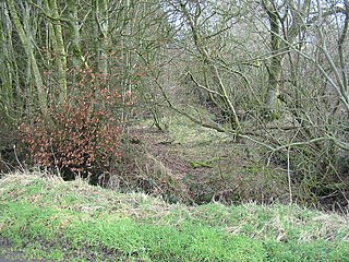
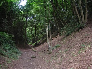
Grim's Ditch, Grim's Dyke or Grim's Bank is a name shared by a number of prehistoric bank and ditch earthworks. Enigmatic in both their naming and original function, examples are found across the chalk uplands of southern England.

Fleam Dyke Linear earthwork and Site of Special Scientific Interest

Fleam Dyke is a linear earthwork between Fulbourn and Balsham in Cambridgeshire. It is now a Scheduled Monument and a 7.8 hectare biological Site of Special Scientific Interest. It formed a boundary of the late Anglo-Saxon, pre-Norman administrative division of Flendish Hundred.

Wats Dyke Linear earthwork in Wales and England

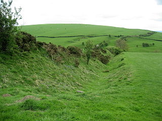
Wat's Dyke is a 40-mile (64 km) earthwork running through the northern Welsh Marches from Basingwerk Abbey on the River Dee estuary, passing east of Oswestry and on to Maesbury in Shropshire, England. It runs generally parallel to Offa's Dyke, sometimes within a few yards but never more than three miles (5 km) away. It now appears insignificant, sometimes a raised hedgerow and in other places is now no more than a cropmark, the ditch long since filled in and the bank ploughed away, but originally it was a considerable construction, considered to be more sophisticated than Offa's Dyke.

Aberford Dykes Series of archaeological earthworks

The Aberford Dykes are a series of archaeological monuments located around the valley of the Cock Beck, where it runs just north of the village of Aberford on the border between North and West Yorkshire, England.

Earthworks (archaeology) General term to describe artificial changes in land level

In archaeology, earthworks are artificial changes in land level, typically made from piles of artificially placed or sculpted rocks and soil. Earthworks can themselves be archaeological features, or they can show features beneath the surface.

Ponters Ball Dyke Cross dyke in Somerset, England

Ponter's Ball Dyke is a linear earthwork located near Glastonbury in Somerset, England. It crosses, at right angles, an ancient road that continues on to the Isle of Avalon. It consists of an embankment with a ditch on the east side. It is built across the ridge of land between Glastonbury and West Pennard. Both ends of the ditch and dyke disappear into moorland, formerly swamps.

Alloway Mote medieval castle in Scotland

The Scheduled Ancient Monument of Alloway Mote, also known as the Alloway Moat or Alloway Motte, is a roughly circular earthwork that is regarded as a possible early medieval ringwork, located near the town of Alloway in South Ayrshire, Scotland.

Deils Dyke Ancient linear earthwork in Scotland

Deil's Dyke, Pict's Dyke or Celt's Dyke in south-west lowland Scotland is a linear earthwork that roughly follows the contours that divide upland pasture from lowland arable land, effectively acting like the head-dykes of medieval and later times although its true purpose has not been settled. The Deil's Dyke, sometimes written as 'dike', is formed from an earthen berm of rounded form that varies from 2.0-4.0m wide and a maximum of 0.7m high sometimes having a stone core. Where a fosse accompanies the bank it is usually an inconsequential 0.5m or so in width on average and around 0.4m deep, more often located on the uphill or outfield side. As a defensive structure the dyke has no obvious military value and its erratic route mitigates against it being a practical political boundary.

References

  1. 1 2 "Prehistoric Linear Boundary Earthworks" (PDF). English Heritage. Retrieved 10 October 2018.