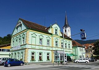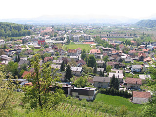
Vojnik is the largest settlement and the centre of the Municipality of Vojnik in eastern Slovenia. It lies on the Hudinja River, north of Celje. Traditionally the area was part of the Lower Styria region. The municipality is now included in the Savinja Statistical Region.
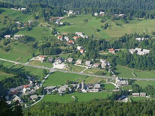
Lipnica is a settlement along Lipnica Creek in the Municipality of Radovljica in the Upper Carniola region of Slovenia.

Brezovica pri Predgradu is a small settlement in the Municipality of Kočevje in southern Slovenia. The area is part of the traditional region of Lower Carniola and is now included in the Southeast Slovenia Statistical Region.
Beli Potok pri Frankolovem is a small settlement in the Municipality of Vojnik in eastern Slovenia. It lies next to White Creek, from which it gets its name, just off the main road north of Vojnik to Slovenske Konjice. The area was traditionally part of the Styria region. It is now included with the rest of the municipality in the Savinja Statistical Region.
Bezenškovo Bukovje is a settlement in the Municipality of Vojnik in eastern Slovenia. It lies in the hills east of Frankolovo off the main road from Vojnik to Slovenske Konjice. The area was traditionally part of the Styria region. It is now included with the rest of the municipality in the Savinja Statistical Region.
Gabrovec pri Dramljah is a small dispersed settlement in the Municipality of Vojnik in eastern Slovenia. The area was traditionally part of Styria. It is now included in the Savinja Statistical Region.
Globoče is a settlement in the Municipality of Vojnik in eastern Slovenia. It lies just south of Frankolovo off the main road from Vojnik towards Slovenske Konjice. The area was traditionally part of Styria. It is now included with the rest of the municipality in the Savinja Statistical Region.
Gradišče pri Vojniku is a settlement in the Municipality of Vojnik in eastern Slovenia. It lies in the hills east of Vojnik. The area was traditionally part of Styria. It is now included with the rest of the municipality in the Savinja Statistical Region.
Hrastnik is a small settlement in the hills east of Vojnik in eastern Slovenia. The area was traditionally part of the Styria region. It is now included with the rest of the Municipality of Vojnik in the Savinja Statistical Region.
Hrenova is a settlement in the Municipality of Vojnik in eastern Slovenia. The area was traditionally part of the Styria region. It is now included with the rest of the municipality in the Savinja Statistical Region.
Lemberg pri Novi Cerkvi is a village in the Municipality of Vojnik in eastern Slovenia. The area was traditionally part of the Styria region. It is now included with the rest of the municipality in the Savinja Statistical Region.

Nova Cerkev is a settlement in the Municipality of Vojnik in eastern Slovenia. It lies on the left bank of the Hudinja River northwest of Vojnik off the main road to Velenje. The area was traditionally part of the Styria region. It is now included with the rest of the municipality in the Savinja Statistical Region.
Pristava is a small settlement in the Municipality of Vojnik in eastern Slovenia. It lies in the valley of Ložnica Creek southeast of Vojnik. The area was traditionally part of the Styria region. It is now included in the Savinja Statistical Region.
Razgorce is a small settlement in the Municipality of Vojnik in eastern Slovenia. It lies in the hills northeast of Vojnik. The area was traditionally part of the Styria region. It is now included with the rest of the municipality in the Savinja Statistical Region.
Straža pri Dolu is a small settlement in the hills northwest of Frankolovo in the Municipality of Vojnik in eastern Slovenia. The area was traditionally part of the Styria region. It is now included in the Savinja Statistical Region.
Straža pri Novi Cerkvi is a settlement in the hills north of Nova Cerkev in the Municipality of Vojnik in eastern Slovenia. It is part of the traditional region of Styria and is now included with the rest of the municipality in the Savinja Statistical Region.
Stražica is a settlement in the Municipality of Vojnik in eastern Slovenia. It lies in the hills northwest of Frankolovo off the main road from Vojnik to Slovenske Konjice. The area is part of the traditional region of Styria. It is now included with the rest of the municipality in the Savinja Statistical Region.
Trnovlje pri Socki is a settlement in the hills east of Socka in the Municipality of Vojnik in eastern Slovenia. The area was traditionally part of Styria. It is now included with the rest of the municipality in the Savinja Statistical Region.
Primož pri Šentjurju is a settlement in the Municipality of Šentjur in eastern Slovenia. The area is part of the historical Styria region. The municipality is now included in the Savinja Statistical Region. The settlement includes the hamlets of Bozne, Brezne, Grabne, and Kote.
Dedni Vrh pri Vojniku is a settlement in the Municipality of Vojnik in eastern Slovenia. It lies just south of Frankolovo off the main road from Vojnik towards Slovenske Konjice. The area was traditionally part of Styria. It is now included with the rest of the municipality in the Savinja Statistical Region.