Related Research Articles

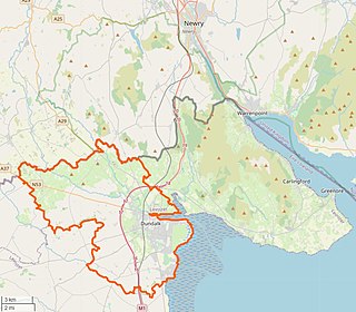
Dundalk, meaning "the fort of Dealgan", is the county town of County Louth, Ireland. The town is on the Castletown River, which flows into Dundalk Bay on the east coast of Ireland. It is halfway between Dublin and Belfast, close to the border with Northern Ireland. It is the eighth largest urban area in Ireland, with a population of 39,004 as of the 2016 census.

Ardee is a town and townland in County Louth, Ireland. It is located at the intersection of the N2, N52, and N33 roads. The town shows evidence of development from the thirteenth century onward but as a result of the continued development of the town since then much of the fabric of the medieval town has been removed.

Dunleer is a town and townland in County Louth, Ireland. Dunleer is situated midway between Dundalk and Drogheda and is located on the junction of the R132, R169 and R170 regional roads that intersect the town.
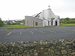
Jenkinstown is a village and townland in the Municipal District of Dundalk, County Louth, Ireland on the Cooley Peninsula.

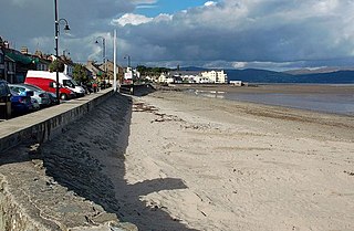
Omeath is a village on the Cooley Peninsula in County Louth, Ireland, close to the border with Northern Ireland. It is roughly midway between Dublin and Belfast, very near the County Louth and County Armagh / County Down border. As of the 2016 census, Omeath had a population of 603, up from 439 during the 2006 census. It is approximately 6 km (3.7 mi) from Carlingford and about 8 km (5.0 mi) from Newry. By sea, Omeath's nearest land neighbour is Warrenpoint on the south County Down coast.
Blackrock is a seaside village just to the south of Dundalk, County Louth, Ireland. The village is in the townland of Haggardstown, in the Barony of Upper Dundalk, and part of the Dundalk metropolitan area. The population of the village is between 3,000 and 5,000.

Castlebellingham is a village and townland in County Louth, Ireland. The village has become quieter since the construction of the new M1 motorway, which bypasses it. The population of Castlebellingham-Kilsaran increased from 721 inhabitants as of the 2002 census to 1,126 people as of the 2016 census.
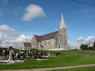
Louth is a village at the heart of County Louth, Ireland. It is roughly 11 km south-west of the town of Dundalk, 10.9 km to neighbouring town Ardee. The village is approximately 15 km south-east of Carrickmacross town in County Monaghan. The village gave its name to the county.

Knockbridge is a village in County Louth, Ireland. It is located in the townland of Ballinlough in the historical barony of Dundalk Upper. As of the 2016 census, the village had a population of 667 people. Knockbridge won a "best kept village" award in the 2008 Tidy Towns competition.

Haggardstown is a townland and a civil parish located in the Barony of Upper Dundalk, on the Southern outskirts of Dundalk, County Louth, Ireland. The civil parish of Haggardstown lies on the shore of Dundalk Bay, north of the estuary of the River Fane, and includes The Dundalk gold club and the village of Blackrock.

Ravensdale is a hamlet and area located at the foothills of the Cooley Mountains on the Cooley Peninsula in the north of County Louth in Ireland. It is positioned approximately 8 km to the north of Dundalk, County Louth. The dual carriageway between Dublin and Belfast runs past it, and the R174 connects it with Jenkinstown. The district is heavily wooded and the housing is suburban/rural. Ravensdale is part of the parish of Ballymacscanlon and Lordship; however, the northern part of Ravensdale is part of the parish area of Jonesborough and Dromintee.

Moycashel, previously the barony of Rossaughe, and before that, Delamares country, is a barony in south County Westmeath, in Ireland. It was formed by 1542. It is bordered by three other baronies: Clonlonan to the west, Rathconrath to the north, Moyashel and Magheradernon to the north-east and Fartullagh to the west. The largest population centre is Kilbeggan.

Stonetown is a small rural community spanning the townlands of Stonetown Upper and Stonetown Lower in County Louth. It lies in the parish of Louth, 10 kilometres from Dundalk, County Louth, and 11 kilometres from Carrickmacross, County Monaghan. The community consists of a small chapel, a primary school, a football field and a community centre.

Delvin is a barony in north-east County Westmeath, in Ireland. It was formed by 1672. It is bordered by County Meath to the east and three other baronies: Fore, Moyashel and Magheradernon and Farbill. The largest centre of population is Delvin.
Dundalk Upper is a barony in County Louth, Ireland.

Erin McGreehan is an Irish Fianna Fáil politician who has served as a Senator since June 2020, after being nominated by the Taoiseach.

The R171 road is a regional road in Ireland linking Ardee and Dundalk in County Louth. The road is 21 km (13 mi) long. Clochafarmore is located along the R171.

The R171 road is a regional road in Ireland linking Dundalk and Greengates in County Louth, via Blackrock. The road is 7.7 km (4.8 mi) long.

The R215 road is a regional road in Ireland which links Ardee with Dundalk in County Louth. The road was originally a section of the N52; however, it was downgraded to ease traffic and encourage use of the nearby M1 motorway. Signage on the road have yet to reflect the change.

The R934 road is a regional road in Ireland which links the M1 motorway with the R132 regional road in Dundalk in County Louth.
References
- ↑ "Lisdoo Townland, Co. Louth". www.townlands.ie. Retrieved 10 July 2020.
- ↑ "An Lios Dubh/Lisdoo". Logainm.ie. Retrieved 10 July 2020.
- ↑ "Relation: Lisdoo (5274073)". OpenStreetMap. Retrieved 10 July 2020.
| | This article related to the geography of County Louth, Ireland is a stub. You can help Wikipedia by expanding it. |