Related Research Articles

The Pearl River is a river in the U.S. states of Mississippi and Louisiana. It forms in Neshoba County, Mississippi from the confluence of Nanih Waiya and Tallahaga creeks, and has a meander length of 444 miles (715 km). The lower part of the river forms part of the boundary between Mississippi and Louisiana.

The Ouachita River is a 605-mile-long (974 km) river that runs south and east through the U.S. states of Arkansas and Louisiana, joining the Tensas River to form the Black River near Jonesville, Louisiana. It is the 25th-longest river in the United States.

Kisatchie National Forest, the only National forest in Louisiana, United States, is located in the forested piney hills and hardwood bottoms of seven central and northern parishes. It is part of the Cenozoic uplands and has large areas of longleaf pine forests. It is one of the largest pieces of natural landscape in Louisiana, with some 604,000 acres (2,440 km2) of public land, more than half of which is vital longleaf pine and flatwoods vegetation. These support many rare plant and animal species. There are also rare habitats, such as hillside seepage bogs and calcareous prairies. The forest also contains and provides a buffer for the Kisatchie Hills Wilderness, a nationally designated wilderness area that contributes to protecting biodiversity of the coastal plain region of the United States.
The Bogue Falaya, also known as the Bogue Falaya River, is a 28-mile-long (45 km) river in southeastern Louisiana in the United States. It is a tributary of the Tchefuncte River, which flows to Lake Pontchartrain. The river flows through an area of mixed pine-hardwood and bottomland hardwood forests on the Gulf Coastal Plain.
The Little River is a 96-mile-long (154 km) tributary of the Ouachita (Black) River in central Louisiana in the United States. Via the Ouachita and Red rivers, it is part of the watershed of the Mississippi River. According to the Geographic Names Information System, the Little River has also been known historically as "Bayou Des Nacitoches," "Catahoula Bayou," and "Catahoula River."
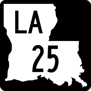
Louisiana Highway 25 (LA 25) is a state highway located in southeastern Louisiana. It runs 38.72 miles (62.31 km) in a north–south direction from U.S. Highway 190 (US 190) in Covington to the Mississippi state line north of Warnerton.
Whiskey Chitto Creek, or Ouiska Chitto Creek, also known officially as Whisky Chitto Creek is an 86.4-mile-long (139.0 km) spring-fed creek located in Allen, Beauregard, and Vernon parishes, Louisiana, in the United States. It is a tributary to the Calcasieu River and is located between present-day Mittie and Reeves, Louisiana.
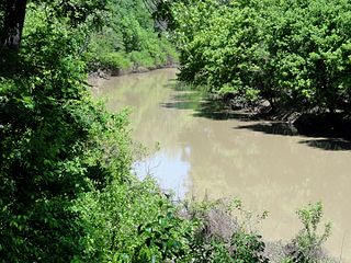
Bayou Macon is a bayou in Arkansas and Louisiana. It begins in Desha County, Arkansas, and flows south, between the Boeuf River to its west and the Mississippi River to its east, before joining Joe's Bayou south of Delhi in Richland Parish, Louisiana. Bayou Macon is about 218 miles (351 km) long.
Bogue Chitto National Wildlife Refuge is located 60 mi (97 km) northeast of New Orleans, Louisiana, U.S., and encompasses 36,000 acres (150 km2) of Pearl River Basin swampland.
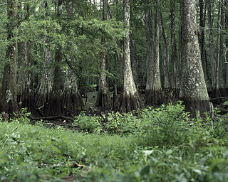
Bayou Cocodrie National Wildlife Refuge was established in 1992 to preserve waterfowl habitat and hardwood forest of the lower Mississippi river. The 13,200-acre (53 km2) refuge is located in Concordia Parish, Louisiana, 10 miles (16 km) southwest of Vidalia, Louisiana. It is named for the state-designated scenic river of Bayou Cocodrie.
D'Arbonne National Wildlife Refuge is a National Wildlife Refuge of the United States located north of West Monroe, Louisiana. It is in Ouachita and Union Parishes on either side of Bayou D'Arbonne near its confluence with the Ouachita River. It lies on the western edge of the Mississippi River alluvial valley. It was established in 1975 to protect bottomland hardwoods and provide wintering habitat for migratory waterfowl. D'Arbonne is one of four refuges managed in the North Louisiana Refuges Complex.
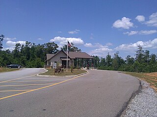
Bogue Chitto State Park is a Louisiana state park located off Louisiana State Highway 25 south of Franklinton, in Washington Parish. The name Bogue Chitto is from the Choctaw language, bok chito, meaning big creek. Bogue Chitto is a relatively recent addition to the Louisiana State Park system. It opened to the public on August 28, 2010, after a delay of approximately three months.
The Sherburne Complex is a joint land management venture of the U.S. Fish and Wildlife Service, the Louisiana Department of Wildlife and Fisheries (LDWF), and the U.S. Army Corps of Engineers that began in 1983. The area consists of 44,000 acres (180 km2), and is managed by the Louisiana Department of Wildlife and Fisheries. The complex is located in the Morganza Flood way system of the Atchafalaya Basin about 30 miles (48 km) west of Baton Rouge, Louisiana and actually extends a little south of the I-10 Atchafalaya Basin Bridge at Whiskey Bay, Louisiana. The bridge crosses the Whiskey Bay Pilot Channel. Located on the graveled LA 975, the west boundary is on the east side of the Atchafalaya River with the east boundary being the East Protection Levee. The complex stretches just north of old highway 190, and a short distance to the south of I-10. The nearest town is Krotz Springs to the north off US 190.
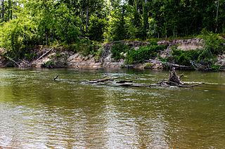
The Bogue Chitto River is a stream in the U.S. states of Louisiana and Mississippi. It is a tributary of the Pearl River.
Dewey W. Wills Wildlife Management Area, also just called Dewey Wills Wildlife Management Area and formally known as the Saline Wildlife Management area, is a 63,901-acre tract of protected area located in LaSalle Parish, Catahoula Parish, and Rapides parish, in Central Louisiana. The Louisiana Department of Wildlife and Fisheries (LDWF) owns 63,901 acres, the LaSalle Parish School Board owns 1530 acres, and the U.S. Army Corps of Engineers (USCOE) owns 265 acres, managed by the LDWF.
Pearl River Wildlife Management Area, also known as Pearl River WMA, is a 35,619 acres (14,414 ha) tract of protected area near Slidell in St. Tammany Parish, Louisiana, in the United States. The WMA is managed by the Louisiana Department of Wildlife and Fisheries (LDWF)
J. C. "Sonny" Gilbert Wildlife Management Area is a 7,524-acre (3,045 ha) wildlife management area in Catahoula, Parish, Louisiana, owned by the Louisiana Department of Wildlife and Fisheries. It is located 6 miles (9.7 km) miles west of Sicily Island. The area contains the 17 ft (5.2 m) high Rock Falls, one of the tallest waterfalls in the state.
References
- ↑ DEQ: Louisiana Natural and Scenic Rivers: pp (appendix) B-2 - Retrieved 2017-03-21
- ↑ "Paddle Louisiana: Natural and scenic rivers system- Retrieved 2017-03-21