| ID | Site name | Description | District | Location | Original function | Coordinates | Image |
|---|
| UG-W-001 | 1520AD Eclipse Monument | | Mbarara | | | |  More images More images Upload another image |
| UG-W-002 | Butiaba Fort | Main port on lake Albert since 1800s. | Buliisa | | | | Upload an image |
| UG-W-003 | Bugungu Fort | | | | | | Upload an image |
| UG-W-004 | Sempaya hot springs | In Semliki National park two natural hot springs female boils up to 106 degrees and the male boils at 90 degrees.) cultural significance attached. | Bundibugyo | | | |  More images More images Upload another image |
| UG-W-005 | Kitagata Hot Springs | Springs with clear water but curative, the Omugabe (royal) springs are on the easterly sides. The place is naturally stunning with papyrus swamp along it and it is a healing site for most locals as most of them flock into the site early in the morning and late in the evening for bathing. It attracts over 100 peoples on a daily basis. Has zones for women and children (Nazario Bihanga is the care taker)two sections one is Ekyomugabe, (royal) the other is Mulago as a general ward. | Bushenyi | near Kitagata hospital about 40 kilometers form Mbarara-Ishaka route. | | | 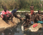 Upload another image |
| UG-W-006 | ? | Challenges: Climate change swings. | | | | | Upload an image |
| UG-W-007 | Katasiha Fort | The mouth of this cave was used for many generations for defence purposes and a fort was built at its mouth. | Hoima | | | | Upload an image |
| UG-W-008 | Kibiro caves | Royal wives were hidden during the times of war. | | | | | Upload an image |
| UG-W-009 | Kibiro Harbour | Ancient port used by Banyoro to cross Lake Albert. | | | | | Upload an image |
| UG-W-010 | Kibiro ancient salt gardens | | | | | | Upload an image |
| UG-W-011 | Musaijaa Mukuru hill | An ancient citadel and military observation post. History of war times, stronghold of Banyoro against Baganda, later it was taken by Thurston/50 soldiers in 1894. Bwebandwa caves lie in the north. | | | | | Upload an image |
| UG-W-012 | Buhuka early mans site | | | | | | Upload an image |
| UG-W-013 | Buyaga hill | The oldest settlement in the kingdom that has existed perpetually before the Ababiito dynasty. | | | | | Upload an image |
| UG-W-014 | Bugyalya stools | curved out of stones.tools c | | | | | Upload an image |
| UG-W-015 | ? | Tomb of Cwaii Kabalega (1870–1899) and Tomb of Sir Toto Winyi IV (1924–1967) | | Mparo Tombs | | |  More images More images Upload another image |
| UG-W-016 | Omukama’s palace | | | | | |  More images More images Upload another image |
| UG-W-017 | Emin pasha s monument n at Buhanika | Place where Kabaka cwa ii and Kabalega received Dr Emin Pasha. | | | | | Upload an image |
| UG-W-018 | Bakers view Kyangwali | Captain Lugards camping sites in Kyangwali | | | | | Upload an image |
| UG-W-019 | Kaiso fossil site | | | | | | Upload an image |
| UG-W-020 | Ngangi historical tombs | | | | | | Upload an image |
| UG-W-021 | Kibedi historical tombs | | | | | | Upload an image |
| UG-W-022 | Kinogozi historical tomb (Bughahya) | | | | | | Upload an image |
| UG-W-023 | Miduuma historical tomb. | | | | | | Upload an image |
| UG-W-024 | Buhimba Heros Monument | War Mass grave. | | | | | 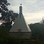 More images More images Upload another image |
| UG-W-025 | Galt Memorial | The 5-meter high monument was forcefully built by the locals at the site of Harry George Galt's killing by Rutaraka who hurled a spear towards Galt's chest on 19 May 1905. A trial and conviction were held for the Omugabe and his senior chiefs who were accused of gross negligence and were not spared. The Bahinda princes (Igumira and Rwakakaiga) were banished | Ibanda | | | | 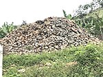 More images More images Upload another image |
| UG-W-026 | Kibubura graves | Memorial first person to embrace christianity Ist district administrator of Ibanda, Julia Kibubura | | | | |  More images More images Upload another image |
| UG-W-027 | Kibubura Girls' Secondary School | Named after Julia Kibubura. | | | | |  More images More images Upload another image |
| UG-W-028 | Kibubura Church | Named after Julia Kibubura. Also known as St. Paul Church of Uganda pro-cathedral, It is where Julia Kibubura and 25 other readers travelled by foot to Mbarara for baptism in 1903. Julia Kibubura was instrumental in the construction of the first church made of mud and wattle and which was later in 1970's to be replaced with the current St. Paul COU Ibanda on which Late Archbishop Luwum laid a foundation stone in 1976. | | | | | 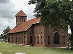 More images More images Upload another image |
| UG-W-029 | Kagongo Hill | Hill for punishing girls that misbehaved. | | | | | Upload an image |
| UG-W-030 | Nsongezi Archaeological site | Nsongezi caves and rock shelter of early man, containing late stone age microliths and dimple based pottery. | Isingiro | Kikagati trading center. Kampala-Kabale route past oruchinga refugees settlement and another route is about 64 kilometers Mbarara-Kitagati route | | | Upload an image |
| UG-W-031 | Oruchinga valley | | | | | | Upload an image |
| UG-W-032 | Kanshhore island | Small island in Kagera river used by rulers of Ankole Ntare and Rwanga, as refuge sites, contains abundant dimple based wares | | | | | Upload an image |
| UG-W-033 | W.J.Dogget Memorial | During the survey of boundary | | | | | Upload an image |
| UG-W-034 | Rwandan Genocide burial ground, Kasensero | | | | | | Upload an image |
| UG-W-035 | Kigezi Museum | | Kabale | | | | Upload an image |
| UG-W-036 | Karambi tombs | Tombs for three Abakama (Tooro Kings) that is Kyebambe Kamurasi, Rukidi III and Olumi Kaboyo II each holding his own tomb and also other royals of Tooro Kingdom. The royal regalia that were used by each of the three kings are kept in these tombs | Fortportal | 6km away from town on Fort Portal- Kasese road | | | 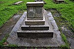 More images More images Upload another image |
| UG-W-037 | Amabere ga Nyina mwiru | Cwezi legend.(Stalactites and stalagmites) | | | | |  More images More images Upload another image |
| UG-W-038 | Toro royal Palace | 3 storied Building. | | | | |  More images More images Upload another image |
| UG-W-039 | Kagoma Tombs | | | | | | Upload an image |
| UG-W-040 | Karambi Tombs | | | | | |  More images More images Upload another image |
| UG-W-041 | Fort portal | Fort of 1893 | | | | |  Upload another image |
| UG-W-042 | Kasusu | NRA war mass grave | | | | | Upload an image |
| UG-W-043 | Katebwa | NRA war mass grave | | | | |  More images More images Upload another image |
| UG-W-044 | Kicwamba | NRA war mass grave | | | | |  More images More images Upload another image |
| UG-W-045 | Buranga hot spring | Hot spring with curative | | | | | Upload an image |
| UG-W-046 | Lake Saka | | | | | | Upload an image |
| UG-W-047 | Rweihamba market | Performs twice a week. | | | | | Upload an image |
| UG-W-048 | Mpanga Market | New market? | | | | |  Upload another image |
| UG-W-049 | Toro botanical gardens | Conservational areas for the different medicinal plants. | | | | | Upload an image |
| UG-W-050 | Royal Palace of Ntara | Kitagwenda Kingdom Kings. | Kamwenge | | | | Upload an image |
| UG-W-051 | Lugards camp | At Rugonjo is Lugards camp. | | | | | Upload an image |
| UG-W-052 | Manyoro Fishing village | Fishing village and Market place. | | | | | Upload an image |
| UG-W-053 | Kanungu inferno | At Katate, Kibwetere, Father Kataribabo, and Mwerinde leaders of the cult, conspired and set fire on their followers, also believed to perished in the fire. | Kanungu | | | | Upload an image |
| UG-W-054 | Banyabutumbi Tree | | | | | |  More images More images Upload another image |
| UG-W-055 | Katwe salt gardens | Volcanic crater lake associated with traditional, salt production. | Kasese | | | | Upload an image |
| UG-W-056 | Equator Monument | At Kikorongo equator crossing is marked by two circular arches | | | | | 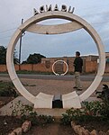 More images More images Upload another image |
| UG-W-057 | Queen mother memorial | monument at Kikorongo Located within the Queen Elizabeth national park. | | | | | Upload an image |
| UG-W-058 | Fort George | Fort established by Lugard | | | | | Upload an image |
| UG-W-059 | Kilembe mines | One of the oldest mines in Africa established in 1956 to exploit copper deposits. | | | | | Upload an image |
| UG-W-060 | Kashenyi salt lakes. | Salt mining | | | | | Upload an image |
| UG-W-061 | Kabusongora hill | (Bukonzo west), Associated with the origin of the Basongora clan among the Bakonzo. A cattle keeping clan. Common to the hill is the collection of grasshoppers (emishenene) which is also the totem for the clan. | | | | | 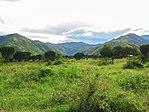 Upload another image |
| UG-W-062 | Rwagimba Hot springs | medicinal values of the hot spring. | | | | | 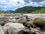 Upload another image |
| UG-W-063 | Rwenzori mountain shrines. | | | | | | Upload an image |
| UG-W-064 | Buthale | Source of iron ore for the local smiths and early iron implements market. | | | | | Upload an image |
| UG-W-065 | Kagando | Is a monument that commemorates the grave of 3 Bakonzo heroes who fought against British colonial rule (through Toro) between 1919 and 1921. | | | | | Upload an image |
| UG-W-066 | Bulemba. | In Ihandiro is a grave for Isaya Mukirane founder and late king of the Rwenzururu Kingdom and palace for the Rwenzururu movement . Also a pilgrimage site every year for the Rwenzururu. | | | | | Upload an image |
| UG-W-067 | Mweya , Queen Elizabeth park | Archeulian tools are abundant at this site. A museum within the park. | | | | | Upload an image |
| UG-W-068 | Ensa za Kateboha | Earth works of unknown date and origin, near Bugoma forest. | Kibaale | | | | Upload an image |
| UG-W-069 | Munsa earth works | Earthworks greatly preserved. | | | | | Upload an image |
| UG-W-070 | Semwema rock Shelter | Caves and shrines | | | | | Upload an image |
| UG-W-071 | Kibengo earth works | Earthworks | | | | | Upload an image |
| UG-W-072 | Birembo | War mass grave NRA | | | | | Upload an image |
| UG-W-073 | Kacuba caves | With pottery remains | | | | | Upload an image |
| UG-W-074 | Mutaka caves | Ritual are visible. | | | | | Upload an image |
| UG-W-075 | Kyempisi caves | Early occupation. | | | | | Upload an image |
| UG-W-076 | Bigoma shelters | Opposite Lwenseera rock. | | | | | Upload an image |
| UG-W-077 | Butonzo shelters | Over looks Munsa earthworks and Semwema rock shelters. | | | | | Upload an image |
| UG-W-078 | Bwaanswa/Bijogoli caves | Rock shelter | | | | | Upload an image |
| UG-W-079 | Isunga cold springs | At Isunga, in a pond containing cold water with sulphur, gives out bubbles at three different places, treatment of different ailments. | | | | | Upload an image |
| UG-W-080 | Kibaale Royal palace | Bunyoro Kitala kings | | | | | Upload an image |
| UG-W-081 | Nyabushozi | Birth place of wamara last ruler of the 14th-century Bacwezi empire. | Kiruhura | | | | Upload an image |
| UG-W-082 | ? | | Kiryandongo | | | | Upload an image |
| UG-W-083 | Kigezi memorial | First administrative centre for Kigezi district, where the agreement of demarcation between Uganda and Rwanda was made. | Kisoro | | | | Upload an image |
| UG-W-084 | Ruhengu cave | | | | | | Upload an image |
| UG-W-085 | Soko Cave | | | | | | Upload an image |
| UG-W-086 | Mutolerere cave | | | | | | Upload an image |
| UG-W-087 | Rwisangane cave | | | | | | Upload an image |
| UG-W-088 | Garama cave | Inside Mgahinga Gollira national park | | | | | Upload an image |
| UG-W-089 | Bakers view | | Kyegegwa | | | | Upload an image |
| UG-W-090 | Ibale lye Kitinisa | Buhembo village, home to one of the ancestral rulers of the Bachwezi. | Kyenjojo | | | | Upload an image |
| UG-W-091 | Kazinga channel and fossil village | early Pleistocene site | | | | | Upload an image |
| UG-W-092 | Kasunga tea plantations | Open and offers experiences about tea growing, processing and promotion. | | | | | Upload an image |
| UG-W-093 | Kiraba hill shelters | Popular site for refugee. | | | | | Upload an image |
| UG-W-094 | Isandara Pit shafts (Enamba) | Pit shafts for iron ore smelting. | | | | | Upload an image |
| UG-W-095 | Nyabihuru Caves | Near Muzizi river opposite Nakabimba. | | | | | Upload an image |
| UG-W-096 | Kabashenyi caves | Kibanga hill, early stone age. | | | | | Upload an image |
| UG-W-097 | Katosa matyrs shrine | Among the 22 martyrs’ killed in 1886was a born at Katoosa St Adolf Tibeyalirwa Abwooli. A pilgrimage is held every 27 January every year in memory of the victim on At Adolf day. Katoosa Parish. | | | | | Upload an image |
| UG-W-098 | Mwenge ancestral Palace | | | | | | Upload an image |
| UG-W-099 | Bakers fort Masindi | Also known as Fort Baker. It was completed in 1872. The stone structure around the fort symbolizes Sir Samuel Baker's exceptional effort against ending slavery in this area | Masindi | | | | 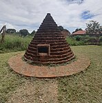 More images More images Upload another image |
| UG-W-100 | Kihande | | | | | | Upload an image |
| UG-W-101 | Kinogozi tombs | Oyo Nyimba Kabamba Iguru. | | | | | Upload an image |
| UG-W-102 | Butiaba landing site | Landing port for ships plying lake Albert since 1880 | | | | | Upload an image |
| UG-W-103 | Kikonko Monument | Site where supervisor was killed by an elephant. | | | | | Upload an image |
| UG-W-104 | Foweiras Fort | Established by Grant( Murchison falls) | | | | | Upload an image |
| UG-W-105 | Magungo Fort | ? | | | | | 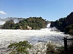 Upload another image |
| UG-W-106 | Polish refuge camp | At Nyabyeya in 1945 | | | | | 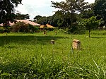 More images More images Upload another image |
| UG-W-107 | Omukamas Royal mile | Omukamas royal mile in Budongo forest | | | | | Upload an image |
| UG-W-108 | Rwabudongo | Training ground for senior army officers for Bunyoro Kingdom. | | | | | Upload an image |
| UG-W-109 | Rwabugoma | Training grounds for senior officers. | | | | | Upload an image |
| UG-W-110 | Parra stone age site | Murchison falls national park. | | | | | Upload an image |
| UG-W-111 | Bakers view kyangwali | 1864 baker sites Muttanzige | | | | | Upload an image |
| UG-W-112 | Ongo Forest | Traditional cultural resource | | | | | Upload an image |
| UG-W-113 | Motokayi Forest | Traditional cultural resource | | | | | Upload an image |
| UG-W-114 | Ewafara Forest | Traditional cultural resource | | | | | Upload an image |
| UG-W-115 | Tengele Forest | Traditional cultural resource | | | | | Upload an image |
| UG-W-116 | Kalongo Estteforest | Traditional cultural resource | | | | | Upload an image |
| UG-W-117 | Keith Bitamazires Forest | Traditional cultural resource | | | | | Upload an image |
| UG-W-118 | Alimugonza Forest | Traditional cultural resource | | | | | Upload an image |
| UG-W-119 | Maganaga Forest | Traditional cultural resource | | | | | Upload an image |
| UG-W-120 | Kapeka Foest | Traditional cultural resource | | | | | Upload an image |
| UG-W-121 | Bweyorere capital site | Ankole capital site ,occupied by rulers of Ankole, Kasasara mid 17th century and Kasasara 18th century. | Isingiro | kikagati Trading centre, 26 kilometers from Mbarara using Mbarara-Kitagati route and located nearly three quarter kilometers, off Mbarara-Kikagati route, when heading to Rwanda, Kabale road | | | Upload an image |
| UG-W-122 | Nuwa Mbaguta memorial | Monument in the memory of the Late Nuwa Mbaguta the Prime Minister (Enganzi) of Ankole. Within Mbarara town, there is the peace memorial site the parade square just in front of the old police headquarters and the Ntare Stanley memorial site around Mbarara central government prison. | Mbarara | Kamukuzi Division Head Quarters, Mbarara City | | |  More images More images Upload another image |
| UG-W-123 | Kakiika historical site | | | | | | Upload an image |
| UG-W-124 | Nkokonjeru Tombs | burial place for the last two Abagabe (kings of Ankole) that is Edward Solomon Kahaya II and Sir Charles Godfrey Rutahaba Gasyonga II. External to the main tombs are about 9 graves of other royals | Mbarara | At Kakiika, 3 and half kilometers west of Mbarara city | | | 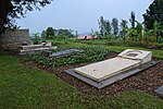 More images More images Upload another image |
| UG-W-125 | Mugaba Palace,kamukuzi | At Kamukuzi, is found the Royal Palace of Nkore. | | | | | 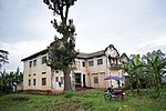 More images More images Upload another image |
| UG-W-126 | Amabare go Omugore | At Rwekikoma , Legendaly Cwezi story rocks. | Kiruhura | Past Kazo, Before Rwemikoma health centre | | | Upload an image |
| UG-W-127 | Buchunku stanley | This is where the famous explorer H.M. Stanley made blood brotherhood with Buchunku on 23 July 1889. Buchunku represented the King of Nkore, Ntare ‘V’ | Mbarara | 24 kilometers from Mbarara using Mbarara-Kitagati route | | | Upload an image |
| UG-W-128 | ? | | Mitooma | | | | Upload an image |
| UG-W-129 | ? | | Ntoroko | | | | Upload an image |
| UG-W-130 | Bugona tree | Active shrine | Ntugamo | | | | Upload an image |
| UG-W-131 | Karegyeya Rock shelter | | | | | |  More images More images Upload another image |
| UG-W-132 | Rukarango tilting rock, rock shelter and Gong | | | | | |  More images More images Upload another image |
| UG-W-133 | Rutobo Palace( kami kya Nyawera) | | | | | | Upload an image |
| UG-W-134 | Queen Muhumuzas seat of Mpororo | Led a rebellion against the British colonialists in Mpororo is her footprint and Omweeso board in the rock. | | | | | Upload an image |
| UG-W-135 | Kyafoora Hot springs | Near lake Nyabuhoko, in Rwashamire are the cultural curative hot springs. | | | | |  More images More images Upload another image |
| UG-W-136 | ? | | Rubirizi | | | | Upload an image |
| UG-W-137 | Kisizi water falls | Located on River, Rushoma, Kyabamba and Lake Bunyonyi. Traditionally, the Bakiga premarital pregnant girls were dumped at these sites. And the Girls whose legs and arms were weak would be rolled over the 15 meters high waterfalls or thrown into the deep Crater Lake. The practice has however stopped as the church of Uganda was set up the Kisiizi hospital in 1958. | Rukungiri | | | | 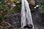 More images More images Upload another image |
| UG-W-138 | Nyabugoto caves | | | | | | Upload an image |
| UG-W-139 | Ihimbo hot spring | curative | | | | | Upload an image |
| UG-W-140 | Minera hot spring | Curative | | | | | Upload an image |
| UG-W-141 | ? | | Sheema | | | | Upload an image |
 More images
  More images
 More images
  More images
  More images
  More images
  More images
  More images
  More images
  More images
  More images
  More images
  More images
 More images
  More images
 More images
  More images

 More images
 More images
  More images
  More images
  More images
  More images
  More images
  More images
  More images


