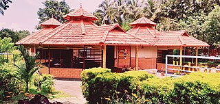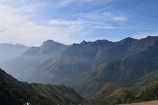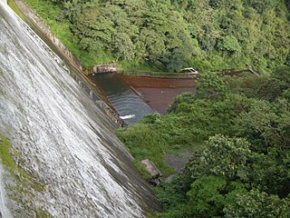
Pathanamthitta District, is one of the 14 districts in the Indian state of Kerala. The district headquarters is in the town of Pathanamthitta. There are four municipalities in Pathanamthitta: Adoor, Pandalam, Pathanamthitta and Thiruvalla.

Nilambur is a major town, a municipality and a Taluk in the Malappuram district of the Indian state of Kerala. It is located close to the Nilgiris range of the Western Ghats on the banks of the Chaliyar River. This place is also known as 'Teak Town' because of the abundance of Nilambur teaks, which is a variety of a large, deciduous tree that occurs in mixed hardwood forests. Unlike many Municipalities of India; Nilambur is covered with large amounts of vegetation, making it very scenic.

Ponmudi is a hill station in the Peringamala gramapanchayath of Trivandrum District of Kerala in India. It is located 22km west of Vithura town, 53 km north-east of Trivandrum City, 78 km south-east of Varkala town and 69 km north-east of Kovalam Beach at an altitude of 1,100 m (3,600 ft). Ponmudi (Varayadumotta) peak is a part of the Western Ghats mountain range that runs parallel to the Arabian Sea. Ponmudi is a popular honeymoon destination in South India. The normal temperature of Ponmudi is between 18 and 25 °C.

Silent Valley National Park is a national park in Kerala, India. It is located in the Nilgiri hills and has a core area of 89.52 km2 (34.56 sq mi). It is surrounded by a buffer zone of 148 km2 (57 sq mi). This national park has some rare species of flora and fauna. Silent Valley National Park was explored in 1847 by the botanist Robert Wight. It is located in the border of Mannarkkad Taluk of Palakkad district, Nilambur Taluk of Malappuram district, Kerala, and Nilgiris district of Tamil Nadu.

The Cardamom Hills or Yela Mala are mountain range of southern India and part of the southern Western Ghats located in Idukki district, Kerala, India. Their name comes from the cardamom spice grown in much of the hills' cool elevation, which also supports pepper and coffee. The Western Ghats and Periyar Sub-Cluster including the Cardamom Hills are UNESCO World Heritage Sites.

Periyar, IPA:[peɾijɐːr], is the longest river and the river with the largest discharge potential in the Indian state of Kerala. It is one of the few perennial rivers in the region and provides drinking water for several major towns. The Periyar is of utmost significance to the economy of Kerala. It generates a significant proportion of Kerala's electrical power via the Idukki Dam and flows along a region of industrial and commercial activity. The river also provides water for irrigation and domestic use throughout its course besides supporting a rich fishery. Due to these reasons, the river has been named the "Lifeline of Kerala". Kochi city, in the vicinity of the river mouth, draws its water supply from Aluva, an upstream site sufficiently free of seawater intrusion. Twenty five percent of Kerala's industries are along the banks of the Periyar. These are mostly crowded within a stretch of 5 kilometres (3 mi) in the Eloor-Edayar region (Udhyogamandal), about 10 kilometres (6 mi) north of Kochi harbor.

The Kabini River(Kapila River) is one of the major tributaries of the river Cauvery in southern India, It originates near Kavilumpara in Kozhikode district of Kerala state by the confluence of the Panamaram River and the Mananthavady River. It flows eastward through Wayanad district, entering Mysore district of Karnataka, to join the Kaveri River in Mysore district of Karnataka.

Marayur or Marayoor is a town in Devikulam taluk of Idukki district in the southwestern Indian state of Kerala. It is located 42 kilometers north of Munnar on SH 17 connecting Munnar with Udumalpet, Tamil Nadu. Marayur is situated at around 990 metres above mean sea level and is the only place in Kerala that has natural sandalwood forests. Ancient dolmens and rock paintings in Marayur date back to the Stone Age. In 1991 Marayur had a population of 9,590.

Periyar National Park and Wildlife Sanctuary (PNP) is a protected area located in the districts of Pathanamthitta and Idukki in Kerala, India. It is a renowned Elephant and Tiger reserve. The protected area encompasses 925 km2 (357 sq mi), of which 305 km2 (118 sq mi) of the main zone was declared as the Periyar National Park in 1982. The park is a repository of rare, endemic, and endangered flora and fauna and forms the major watershed of two important rivers of Kerala: the Periyar and the Pamba.

Mannarkkad, formerly known as Mannarghat, is a major municipal town in Palakkad district of the Indian state of Kerala. The Silent Valley National Park and the Attappadi Reserve Forest are located in Mannarkkad Taluk. Mannarkkad is situated 36 km away from district headquarters Palakkad on National Highway 966. It is the traditional seat of the Mannarghat Moopil Nair.
Bio reserved of india full map of india

Agastya Mala is one of the peaks in the Western Ghats of Thiruvananthapuram District of Kerala, near to the border of Tamilnadu, India. This peak is a part of the Agasthyamala Biosphere Reserve which lies on the border between the Indian states of Tamil Nadu, Tirunelveli district and Kerala, Thiruvananthapuram district. The perennial Thamirabarani River originates from the eastern side of the range and flows into the Tirunelveli district of Tamil Nadu. It is 1,868-metres tall.

Chinnar Wildlife Sanctuary is located 18 km north of Marayoor on State Highway 17 in the Marayoor and Kanthalloor panchayats of Devikulam taluk in the Idukki district of India's Kerala state. It is one of 18 wildlife sanctuaries among the protected areas of Kerala.

Parambikulam Tiger Reserve, which also includes the erstwhile Parambikulam Wildlife Sanctuary, is a 643.66 square kilometres (248.5 sq mi) protected area lying in Palakkad district and Thrissur district of Kerala state, South India. The Wildlife Sanctuary, which had an area of 285 square kilometres (110 sq mi) was established in part in 1973 and 1984. It is in the Sungam range of hills between the Anaimalai Hills and Nelliampathy Hills. Parambikulam Wildlife Sanctuary was declared as part of the Parambikulam Tiger Reserve on 19 February 2010. Including the buffer zone, the tiger reserve has a span of 643.66 km2. The Western Ghats, Anamalai Sub-Cluster, including all of Parambikulam Wildlife Sanctuary, has been declared by the UNESCO World Heritage Committee as a World Heritage Site. The Tiger Reserve is the home of four different tribes of indigenous peoples including the Kadar, Malasar tribe, Muduvar and Mala Malasar settled in six colonies. Parambikulam Tiger Reserve implements the Project Tiger scheme along with various other programs of the Government of India and the Government of Kerala. The operational aspects of administering a tiger reserve is as per the scheme laid down by the National Tiger Conservation Authority. People from tribal colonies inside the reserve are engaged as guides for treks and safaris, and are provided employment through various eco-tourism initiatives. Parambikulam Tiger Reserve is among the top-ten best managed Tiger Reserve in India. The tiger reserve hosts many capacity building training programmes conducted by Parambikulam Tiger Conservation Foundation in association with various organisations.

Kulathupuzha is a town in the eastern part of Kollam district of Kerala, India. It is one of the important pilgrim spots linked with the legend of Sabarimala. It is the birthplace of the Malayalam music composer Raveendran. Kulathupuzha is the source of the Kallada river, Thenmala Dam (KIP) is located on this river. As declared by the Governor Arif Mohammad Khan, Kulathupuzha panchayat is the first in India to have achieved Constitution-literacy.

The Pothigai Hills, also known as Agasthiyar Mountain is a 1,866-metre (6,122 ft)-tall peak in the southern part of the Western Ghats or Sahyadri of South India. The peak lies in Tirunelveli District of Tamil Nadu near the border of Kerala.

Veeyapuram is a village in the district of Alappuzha, Kerala, India. It is located about 7 kilometers north of Haripad town.

Siruvani dam is a dam in Palakkad District, Kerala located 46 km away from Palakkad town. This dam constructed across the Siruvani River, is for supplying drinking water to the city of Coimbatore in Tamil Nadu. The dam is surrounded by reserve forests. Muthikulam hill is situated on the eastern side of the dam. There is a natural waterfall in the hill. The waterfalls and the Dam are big tourist attractions. The famous 150-year-old Pattiyar Bungalow is on the banks of the Siruvani Reservoir. An agreement was executed in August 1973 between the state Governments for drinking water supply to Coimbatore town and neighbouring areas from the Siruvani Dam. The location being in the state of Kerala, the project was executed by the Kerala Public Works Department using the funds made available by the Tamil Nadu Government. The gross storage capacity of the dam is 9 tmc ft

Malabar Wildlife Sanctuary is a protected area located along the Western Ghats and spread across 74 square kilometres (29 sq mi) in Chakkittapara and Koorachundu revenue villages of Koyilandy Taluk in Kozhikode, Kerala. The sanctuary is part of the western ghats, a biodiversity hotspot. It also comes under the Nilgiri Biosphere Reserve and forms a part of the Wayanad Elephant Reserve.