
The Lake District, also known as the Lakes or Lakeland, is a mountainous region and national park in Cumbria, North West England. It is famous for its landscape, including its lakes, coast, and the Cumbrian mountains; and for its literary associations with Beatrix Potter, John Ruskin, and the Lake Poets.
Alfred Wainwright MBE, who preferred to be known as A. Wainwright or A.W., was a British fellwalker, guidebook author and illustrator. His seven-volume Pictorial Guide to the Lakeland Fells, published between 1955 and 1966 and consisting entirely of reproductions of his manuscript, has become the standard reference work to 214 of the fells of the English Lake District. Among his 40-odd other books is the first guide to the Coast to Coast Walk, a 182-mile (293-kilometre) long-distance footpath devised by Wainwright which remains popular today.

Scrambling is a mountaineering term for ascending steep terrain using one's hands to assist in holds and balance. It is also used to describe terrain that falls between hiking and rock climbing.

Helvellyn is a mountain in the English Lake District, the highest point of the Helvellyn range, a north–south line of mountains to the north of Ambleside, between the lakes of Thirlmere and Ullswater.

The British Mountaineering Council (BMC) is the national representative body for England and Wales that exists to protect the freedoms and promote the interests of climbers, hill walkers and mountaineers, including ski-mountaineers. The BMC are also recognised by government as the national governing body for competition climbing.
The Lake Poets were a group of English poets who all lived in the Lake District of England, United Kingdom, in the first half of the nineteenth century. As a group, they followed no single "school" of thought or literary practice then known. They were named, only to be uniformly disparaged, by the Edinburgh Review. They are considered part of the Romantic Movement.
Founded in 1982, Rough Guides Ltd is a British publisher of print and digital guide book, phrasebooks and inspirational travel reference books, and a provider of personalised trips. Since November 2017, Rough Guides has been owned by APA Publications UK Ltd, the parent company of Insight Guides.
George and Ashley Abraham, sometimes referred to as "The Keswick Brothers", were climbers, authors and photographers who lived in Keswick, Cumberland in the English Lake District. They made a photographic record of the exploits of many of the climbing pioneers, especially Owen Glynne Jones, with whom they formed a close climbing partnership from 1896 until his death in 1899. Most of their work was done between 1890 and 1920 and forms a valuable record of the evolution of early rock-climbing in the English Lake District.
Davis Creek is an unincorporated community in Modoc County, California. It is located 19 miles (31 km) north-northeast of Alturas, at an elevation of 4846 feet. There is a post office, service station, and mini-mart housed in a single structure. The ZIP Code is 96108. The community is inside area code 530.

Mountford John Byrde Baddeley (1843–1906) was an English guidebook writer of the late 19th and early 20th century. His guides appeared in the 'Thorough Guide' series, edited by Baddeley and his colleague, Charles Slegg Ward, and included guides to Scotland, Devon and Cornwall, the Peak District of Derbyshire, the Eastern Counties, Wales, Ireland, Surrey & Sussex, Yorkshire, Bath and Bristol and 40 miles (64 km) round, Isle of Wight. (These volumes were numbered I - XIX and had appeared by 1908. South Hants and Dorset was published in 1914 and ascribed to Baddeley on the spine but written by W M Baxter. They included "maps by Bartholomew" and were published by Thomas Nelson & Sons, London.

The Shell Guides were originally a 20th-century series of guidebooks on the counties of Britain. They were aimed at a new breed of car-driving metropolitan tourist, and for those who sought guides that were neither too serious nor too shallow and who took pleasure in the ordinary and peculiar culture of small town Britain. In the three decades after the Second World War the Shell Guides provided a surreptitiously subversive synthesis of the British countryside.

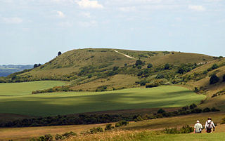
Ling Fell is a small hill in the north west of the Lake District in the United Kingdom. It is close to the village of Wythop Mill, from where it can easily be climbed. The fell is shaped like a wide dome, with no particular dangers. Its name derives from the fact that it is largely covered in heather, also known as "ling". The summit has good views of the town of Cockermouth.

Black Fell is a fell in the English Lake District. It rises to the north of Tarn Hows, between Coniston and Hawkshead.

The Southern Fells are a part of the Cumbrian Mountains in the Lake District of England. Including Scafell Pike, the highest peak in England, they occupy a broad area to the south of Great Langdale, Borrowdale and Wasdale. High and rocky towards the centre of the Lake District, the Southern Fells progressively take on a moorland character toward the south-west. In the south-east are the well-known Furness Fells, their heavily quarried flanks rising above Coniston Water.
Cicerone Press is an English publisher, founded in 1969, specialising in guidebooks for walkers, climbers, trekkers and cyclists.
Walking is one of the most popular outdoor recreational activities in the United Kingdom, and within England and Wales there is a comprehensive network of rights of way that permits access to the countryside. Furthermore, access to much uncultivated and unenclosed land has opened up since the enactment of the Countryside and Rights of Way Act 2000. In Scotland the ancient tradition of universal access to land was formally codified under the Land Reform (Scotland) Act 2003. In Northern Ireland, however, there are few rights of way, or other access to land.
Thomas West was a Jesuit priest, antiquary and author, significant in being one of the first to write about the attractions of the Lake District. Partly through his book, A Guide to the Lakes, the Romantic vision of the scenery and wilderness of the north of England took hold, ushering in a period of continued tourism in the Lakes.

Guide to the Lakes, more fully A Guide through the District of the Lakes, William Wordsworth's travellers' guidebook to England's Lake District, has been studied by scholars both for its relationship to his Romantic poetry and as an early influence on 19th-century geography. Originally written because Wordsworth needed money, the first version was published in 1810 as anonymous text in a collection of engravings. The work is now best known from its expanded and updated 1835 fifth edition.
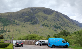
The Meall an t-Suidhe is a mountain in Scotland, located close to the Ben Nevis.