Related Research Articles

The Dead Sea, also known by other names, is a landlocked salt lake bordered by Jordan to the east and the Israeli-occupied West Bank and Israel to the west. It lies in the Jordan Rift Valley, and its main tributary is the Jordan River.

The West Bank, so called due to its relation to the Jordan River, is the larger of the two Palestinian territories. A landlocked territory near the coast of the Mediterranean Sea in the Levant region of West Asia, it is bordered by Jordan and the Dead Sea to the east and by Israel to the south, west, and north. The territory has been under Israeli occupation since 1967.

The Jordan River or River Jordan, also known as Nahr Al-Sharieat, is a 251-kilometre-long (156 mi) river in the Middle East that flows roughly north to south through the freshwater Sea of Galilee and on to the salt water Dead Sea. The river passes by Jordan, Syria, Israel, and the Palestinian territories.
This timeline of the Israeli–Palestinian conflict lists events from 1948 to the present. The Israeli–Palestinian conflict emerged from intercommunal conflict in Mandatory Palestine between Palestinian Jews and Arabs, often described as the background to the Israeli–Palestinian conflict. The conflict in its modern phase evolved since the declaration of the State of Israel on May 14, 1948 and consequent intervention of Arab armies on behalf of the Palestinian Arabs.

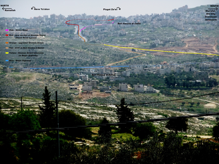
Pisgat Ze'ev is an Israeli settlement in East Jerusalem and the largest residential neighborhood in Jerusalem with a population of over 50,000. Pisgat Ze'ev was established by Israel as one of the city's five Ring Neighborhoods on land effectively annexed after the 1967 Six-Day War.

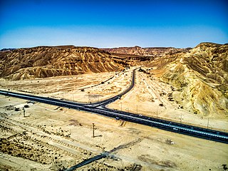
Highway 90 is the longest Israeli road, at about 480 kilometres (300 mi), and stretches from Metula and the northern border with Lebanon, along the western side of the Sea of Galilee, through the Jordan River Valley, along the Dead Sea's western bank, through the Arabah valley, and until Eilat and the southern border with Egypt on the Red Sea. The central section of the road traverses the Israeli-occupied West Bank. While it passes near the city of Jericho, it runs through Area C and does not enter areas controlled by the Palestinian Authority.

Kalya is an Israeli settlement organized as a kibbutz in the West Bank. It was originally established in 1929 but was occupied and destroyed by the Jordanians in 1948; it was later rebuilt in 1968 after the Six-Day War. Located on the northern shore of the Dead Sea, 360 meters below sea level, it falls under the jurisdiction of Megilot Regional Council. In 2022 it had a population of 490.

Megilot Regional Council, also Megilot Dead Sea Regional Council, is a regional council in the Judean Desert of the West Bank, near the western shores of the Dead Sea. It covers six Israeli settlements. With only about 1,400 residents, it is Israel's smallest regional council. Its municipal offices are located in Vered Yeriho.

Ahava Dead Sea Laboratories, Limited is an Israeli cosmetics company with headquarters in Lod that manufactures skin care products made of mud and mineral-based compounds from the Dead Sea. The company has flagship stores in Israel, Germany, Hungary, South Korea, the Philippines and Singapore. As of 2015, Ahava income was more than US$150 million a year. In 2015, the Chinese conglomerate Fosun International agreed to purchase a controlling share of the company, which has been valuated to ca. NIS 300 million.

Dzharylhach is a sand bank in Skadovsk Raion, Kherson Oblast near Crimea in Ukraine. Along with the Tendra island that lies to the west, in the past it was a spit that Greeks called "Course of Achilles". To the west it stretches as a spit and as a shoal, which sometimes dries up, and connects to the continental portion of Kherson Oblast near the town of Lazurne. The wider portion used to be called Tamyraca. It was named after an ancient town of Tamyraca located on the continent across the bay.

Tourism in the Palestinian territories is tourism in East Jerusalem, the West Bank, and the Gaza Strip. In 2010, 4.6 million people visited the Palestinian territories, compared to 2.6 million in 2009. Of that number, 2.2 million were foreign tourists while 2.7 million were domestic. In the last quarter of 2012 over 150,000 guests stayed in West Bank hotels; 40% were European and 9% were from the United States and Canada. Major travel guides write that "the West Bank is not the easiest place in which to travel but the effort is richly rewarded."

Highway 45 is the official designation of a 3.3 km stretch of road forming a continuous connection between Route 443 from the Tel Aviv Metropolitan Area and Highway 50 to central Jerusalem and a 1.4 km spur serving the Atarot Industrial Park.

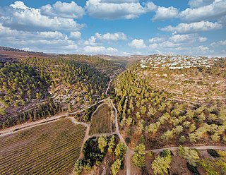
Jerusalem Road 20 is a combination of existing roads and new construction creating a continuous route between Jerusalem's Highway 50 and Pisgat Ze'ev via Beit Hanina. The number "20" is a designation used by the Jerusalem Municipality. Several segments of the road follow national road 4197. The cost of the project was NIS 180 million and was completed on 5 May 2013.

Geography of the State of Palestine refers to the geographic, climatic and other properties of the areas claimed by State of Palestine.

Women Wage Peace is an Israeli grassroots peace movement, formed shortly after the Gaza War in 2014. Its primary goal is to pressure the Israeli government into achieving a "bilaterally acceptable political agreement" to end the Israeli-Palestinian conflict, with a target date of 2018.
References
- ↑ "Biankini". www.biankini.com. Archived from the original on 2019-05-25. Retrieved 2023-11-12.
- ↑ "חוף ביאנקיני בסיאסטה | כל המידע באתר התיירות של ים המלח" [Biankini Besiesta Beach; All the information on the Dead Sea tourism website] (in Hebrew).[ dead link ]
- ↑ "Dead Sea map, Biankini". Archived from the original on 2015-12-08. Retrieved 2015-12-03.
- ↑ "Dead Sea map, Kalia Beach". Archived from the original on 2015-12-08. Retrieved 2015-12-03.
- ↑ "The New Kalia Beach: more info on Godeadsea.com". godeadsea.com. Retrieved 2023-11-12.
- ↑ "Neve Midbar Beach". nevemidbar-beach.com. Archived from the original on 2022-11-08. Retrieved 2021-03-04.
- ↑ "Neve Midbar Beach: more info on Godeadsea.com". godeadsea.com. Retrieved 2023-11-12.
- ↑ "Dead Sea map, Neve Midbar". Archived from the original on 2015-12-08. Retrieved 2015-12-03.
- ↑ "Mineral Beach" at GoDeadSea.com
- ↑ ""Mineral Beach" at DeadSeaGuide.com; archived copy". Archived from the original on 2015-12-08. Retrieved 2015-12-03.