Vallon-Pont-d'Arc is a village in southern France in the Ardèche Department.

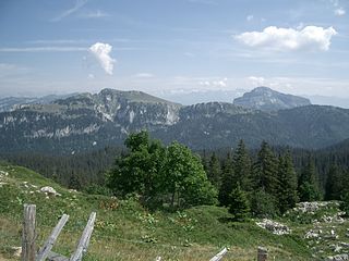
The Chartreuse Mountains are a mountain range in southeastern France, stretching from the city of Grenoble in the south to the Lac du Bourget in the north. They are part of the French Prealps, which continue as the Bauges to the north and the Vercors to the south.

The Vercors massif are a range in France consisting of rugged plateaus and mountains straddling the départements of Isère and Drôme in the French Prealps. It lies west of the Dauphiné Alps, from which it is separated by the rivers Drac and Isère. The cliffs at the massif's eastern limit face the city of Grenoble.

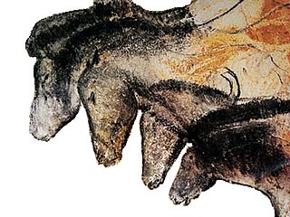
The Chauvet-Pont-d'Arc Cave in the Ardèche department of southeastern France is a cave that contains some of the best-preserved figurative cave paintings in the world, as well as other evidence of Upper Paleolithic life. It is located near the commune of Vallon-Pont-d'Arc on a limestone cliff above the former bed of the river Ardèche, in the Gorges de l'Ardèche.

Saint-Guilhem-le-Désert is a commune in the Hérault department in the Occitania region in Southern France. Situated where the Gellone river's narrow valley meets the steep-sided gorge of the river Hérault, Saint-Guilhem-le-Désert is essentially a medieval village located on the Chemin de Saint-Jacques pilgrim route to Santiago de Compostella.

Saint-Casimir is a municipality of about 1800 people in the Portneuf Regional County Municipality in the province of Quebec, Canada. It is located on the Sainte-Anne River, about 80 kilometres (50 mi) southwest of Quebec City and 50 kilometres (31 mi) northeast of Trois-Rivières. It was founded in 1836 by people who came from Ste-Anne-de-la-Pérade following to the east along the Sainte-Anne.

The Dent de Crolles is a karstic mountain of the Chartreuse Mountains range, 17 kilometres north east of Grenoble, Isère, France. The mountain has a characteristic "tooth-like" profile; the French word dent means "tooth". de Crolles is derived from the town of Crolles, located next to the peak. The Dent de Crolles is easily recognizable from the Isère Valley (Grésivaudan) near Grenoble.

Michel Augustin Francis Siffre was a French underground explorer, adventurer and scientist.

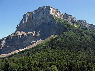
Mont Granier (1,933m) is a limestone mountain located between the départements of Savoie and Isère in France. It lies in the Chartreuse Mountains range of the French Prealps between the towns of Chapareillan and Entremont-le-Vieux. Its east face overlooks the valley of Grésivaudan and Combe de Savoie, and the north face overlooks Chambéry. At 900 meters tall, Mont Granier has one of the highest cliffs in France.

The communal section is the smallest administrative division in Haiti. The 144 communes are further divided into 571 communal sections.

The Goyet Caves are a series of connected caves located in Belgium in a limestone cliff about 15 m (50 ft) above the river Samson near the village of Mozet in the Gesves municipality of the Namur province. The site is a significant locality of regional Neanderthal and European early modern human occupation, as thousands of fossils and artifacts were discovered that are all attributed to a long and contiguous stratigraphic sequence from 120,000 years ago, the Middle Paleolithic to less than 5,000 years ago, the late Neolithic. A robust sequence of sediments was identified during extensive excavations by geologist Edouard Dupont, who undertook the first probings as early as 1867. The site was added to the Belgian National Heritage register in 1976.

The Schmerling Caves are a group of caves located in Wallonia on the right bank of the stream called the Awirs, near the village of Awirs in Flémalle, Belgium. The caves are notable for their past fossil finds, particularly of hominins. They were explored in 1829 by Philippe-Charles Schmerling, who discovered, in the lower cave, the remains of two individuals, one of which, now known as Engis 2, was a fossil of the first Neanderthal ever found; the other was a Neolithic homo sapiens. Also known as Trô Cwaheur or Trou Caheur, this lower cave has since collapsed. A third cave was destroyed because of work on the adjacent quarry, the Ancienne Carrière des Awirs.

Gouffre Mirolda is a karstic cave located in the Haut-Giffre mountain range, in the commune of Samoëns, Haute-Savoie, France. It is connected to the Lucien Bouclier cave system, and has a depth of −1,661 m (−5,449 ft). It is the sixth deepest cave in the world.

The Réseau du Clot d'Aspres is a cave system located mainly under the valley of Clot d'Aspres, which lies within the commune of Villard-de-Lans in the north of the Vercors Massif, in Isère, France. This extensive karst system contains 42 kilometres (26 mi) of passages over a height range of 1,066 meters. The highest point is upstream of the Oréade cave +74 metres (243 ft), and the lowest point is the siphon of the Nuits-Blanches scialet which has been dived to a depth of 34 metres (112 ft).

The Gouffre de la Pierre Saint-Martin, also called Gouffre Lépineux, is the original entrance to a major cave system located in the massif of La Pierre Saint-Martin, in the immediate vicinity of the Franco-Spanish border and the French commune of Arette, in the Pyrénées-Atlantiques in the Nouvelle-Aquitaine region, under which lies part of the cave network.
The réseau Félix-Trombe or Coume Ouarnède is an underground karst network formed by a succession of wells and galleries dug into the limestone.
This page is based on this
Wikipedia article Text is available under the
CC BY-SA 4.0 license; additional terms may apply.
Images, videos and audio are available under their respective licenses.


