List of cemeteries in Adair County, Iowa

Last updated

According to the USGS, there are 38 cemeteries in Adair County, Iowa, USA.

United States Geological Survey Scientific agency of the United States government

The United States Geological Survey is a scientific agency of the United States government. The scientists of the USGS study the landscape of the United States, its natural resources, and the natural hazards that threaten it. The organization has four major science disciplines, concerning biology, geography, geology, and hydrology. The USGS is a fact-finding research organization with no regulatory responsibility.

Cemetery Place of burial

A cemetery or graveyard is a place where the remains of dead people are buried or otherwise interred. The word cemetery implies that the land is specifically designated as a burial ground and originally applied to the Roman catacombs. The term graveyard is often used interchangeably with cemetery, but a graveyard primarily refers to a burial ground within a churchyard.

Adair County, Iowa County in the United States

Adair County is a county in the U.S. state of Iowa. As of the 2010 census, the population was 7,682. Its county seat is Greenfield.

Contents

Abandoned Timber

41°29′00″N94°28′51″W / 41.48333°N 94.48083°W / 41.48333; -94.48083 , Walnut Township, GNIS 1969033

Adair County

41°20′04″N94°25′59″W / 41.33444°N 94.43306°W / 41.33444; -94.43306 , Grove Township, GNIS 463587

Avondale

41°12′10″N94°36′20″W / 41.20278°N 94.60556°W / 41.20278; -94.60556 , Washington Township, GNIS 454294

Boley Farm

41°15′10″N94°20′01″W / 41.25278°N 94.33361°W / 41.25278; -94.33361 , Grand River Township, GNIS 1969032

Bryant

41°18′35″N94°35′56″W / 41.30972°N 94.59889°W / 41.30972; -94.59889 , Jackson Township, GNIS 1969030

Calvary

41°29′51″N94°18′18″W / 41.49750°N 94.30500°W / 41.49750; -94.30500 , Lincoln Township, GNIS 1823111

Campbell

41°09′31″N94°38′56″W / 41.15861°N 94.64889°W / 41.15861; -94.64889 , Washington Township, GNIS 455140

Canby

41°25′04″N94°33′58″W / 41.41778°N 94.56611°W / 41.41778; -94.56611 , Walnut Township, GNIS 1969040

Cears

41°18′30″N94°38′01″W / 41.30833°N 94.63361°W / 41.30833; -94.63361 , Jackson Township, GNIS 1969031

Eureka

41°22′25″N94°38′28″W / 41.37361°N 94.64111°W / 41.37361; -94.64111 , Eureka Township, GNIS 456401

Fairview

41°24′07″N94°19′02″W / 41.40194°N 94.31722°W / 41.40194; -94.31722 , Harrison Township, GNIS 1969037

Fontanelle

41°17′27″N94°32′25″W / 41.29083°N 94.54028°W / 41.29083; -94.54028 , Summerset Township, GNIS 456662

Garner

41°13′07″N94°39′40″W / 41.21861°N 94.66111°W / 41.21861; -94.66111 , Washington Township, GNIS 456846

Grand River Center

41°17′15″N94°17′51″W / 41.28750°N 94.29750°W / 41.28750; -94.29750 , Grand River Township, GNIS 1823057

Greenfield

41°17′23″N94°27′17″W / 41.28972°N 94.45472°W / 41.28972; -94.45472 , Greenfield Township, GNIS 457122

Grove Center

41°23′21″N94°24′58″W / 41.38917°N 94.41611°W / 41.38917; -94.41611 , Grove Township, GNIS 457161

Hebron

41°15′31″N94°17′22″W / 41.25861°N 94.28944°W / 41.25861; -94.28944 , Grand River Township, GNIS 1823056

Hill of Zion

41°12′06″N94°18′09″W / 41.20167°N 94.30250°W / 41.20167; -94.30250 , Union Township, GNIS 1969036

Immanuel

41°30′39″N94°38′33″W / 41.51083°N 94.64250°W / 41.51083; -94.64250 , Grant Township, GNIS 457757

Immanuel Lutheran

41°23′44″N94°30′35″W / 41.39556°N 94.50972°W / 41.39556; -94.50972 , Prussia Township, GNIS 1969029

Jefferson

41°27′40″N94°25′16″W / 41.46111°N 94.42111°W / 41.46111; -94.42111 , Jefferson Township, GNIS 457920

Liberty

41°09′30″N94°17′24″W / 41.15833°N 94.29000°W / 41.15833; -94.29000 , Union Township, GNIS 1822985

Loucks Grove

41°25′30″N42°40′0″W / 41.42500°N 42.66667°W / 41.42500; -42.66667 , Jefferson Township, GNIS 1969035

Mormon

41°12′02″N94°35′16″W / 41.20056°N 94.58778°W / 41.20056; -94.58778 , Washington Township, GNIS 1822999

Oakwood

41°29′52″N94°30′28″W / 41.49778°N 94.50778°W / 41.49778; -94.50778 , Walnut Township, GNIS 459783

Orient

41°12′29″N94°25′02″W / 41.20806°N 94.41722°W / 41.20806; -94.41722 , Orient Township, GNIS 1969038

Penn Avenue

41°13′49″N94°30′15″W / 41.23028°N 94.50417°W / 41.23028; -94.50417 , Richland Township, GNIS 460069

Pleasant Grove

41°13′43″N94°33′57″W / 41.22861°N 94.56583°W / 41.22861; -94.56583 , Richland Township, GNIS 1969034

Prussia

41°22′31″N94°31′41″W / 41.37528°N 94.52806°W / 41.37528; -94.52806 , Prussia Township, GNIS 460468

Roberts

41°20′22″N94°15′22″W / 41.33944°N 94.25611°W / 41.33944; -94.25611 , Harrison Township, GNIS 460694

Saint Johns

41°29′25″N94°38′34″W / 41.49028°N 94.64278°W / 41.49028; -94.64278 , Summit Township, GNIS 461013

Saint Josephs

41°29′55″N94°30′36″W / 41.49861°N 94.51000°W / 41.49861; -94.51000 , Walnut Township, GNIS 461112

Saint Marys

41°17′17″N94°40′49″W / 41.28806°N 94.68028°W / 41.28806; -94.68028 , Jackson Township, GNIS 1969039

Sunny Hill

41°29′27″N94°38′26″W / 41.49083°N 94.64056°W / 41.49083; -94.64056 , Summit Township, GNIS 462093

Union

41°12′53″N94°32′47″W / 41.21472°N 94.54639°W / 41.21472; -94.54639 , Richland Township, GNIS 462422

Wilson

41°13′04″N94°15′38″W / 41.21778°N 94.26056°W / 41.21778; -94.26056 , Union Township, GNIS 1822987

Winn

41°11′37″N94°39′25″W / 41.19361°N 94.65694°W / 41.19361; -94.65694 , Washington Township, GNIS 463132

Witt

41°13′49″N94°38′30″W / 41.23028°N 94.64167°W / 41.23028; -94.64167 , Washington Township, GNIS 463148

Related Research Articles

Highland Township, Oakland County, Michigan Charter township in Michigan, United States

Highland Township, officially the Charter Township of Highland, is a charter township of west Oakland County in the U.S. state of Michigan. The population was 19,202 at the 2010 census. Highland is a suburb of Detroit.

White Lake Township, Michigan Charter township in Michigan, United States

White Lake Charter Township is a charter township of Oakland County in the U.S. state of Michigan. Together with its two unincorporated communities, the township makes up part of the Detroit metropolitan area outskirts. As of the 2010 census, the township population was 30,019.

Jackson Township, Tippecanoe County, Indiana Township in Indiana, United States

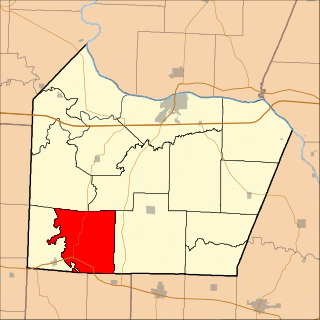
Jackson Township is one of thirteen townships in Tippecanoe County, Indiana, United States. As of the 2010 census, its population was 499 and it contained 185 housing units.

Tippecanoe Township, Pulaski County, Indiana Township in Indiana, United States

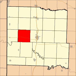
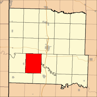
Tippecanoe Township is one of twelve townships in Pulaski County, Indiana, United States. As of the 2010 census, its population was 1,104 and it contained 580 housing units.

Richland Township, Steuben County, Indiana Township in Indiana, United States

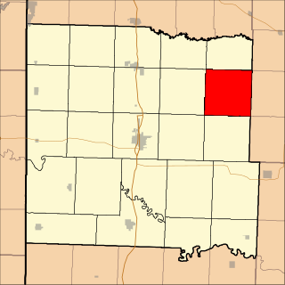
Richland Township is one of twelve townships in Steuben County, Indiana, United States. As of the 2010 census, its population was 570 and it contained 187 housing units, making it the smallest township in the county.

Jack Creek Township, Emmet County, Iowa Township in Iowa, United States

Jack Creek Township is one of twelve townships in Emmet County, Iowa, USA. As of the 2000 census, its population was 135.

Twelve Mile Lake Township, Emmet County, Iowa Township in Iowa, United States

Twelve Mile Lake Township is one of twelve townships in Emmet County, Iowa, USA. As of the 2000 census, its population was 202.

Putnam Township, Fayette County, Iowa Township in Iowa, United States

Putnam Township is one of twenty townships in Fayette County, Iowa, USA. As of the 2010 census, its population was 313.

Boonville Township, Cooper County, Missouri Township in Missouri, United States

Boonville Township is one of fourteen townships in Cooper County, Missouri, USA. As of the 2000 census, its population was 9,898.

Lebanon Township, Cooper County, Missouri Township in Missouri, United States

Lebanon Township is one of fourteen townships in Cooper County, Missouri, USA. As of the 2000 census, its population was 333.

Charlotte Township, Bates County, Missouri Township in Missouri, United States

Charlotte Township is one of twenty-four townships in Bates County, Missouri, USA. As of the 2000 census, its population was 367.

Homer Township, Bates County, Missouri Township in Missouri, United States

Homer Township is one of twenty-four townships in Bates County, Missouri, USA. As of the 2000 census, its population was 449.

Howard Township, Bates County, Missouri Township in Missouri, United States

Howard Township is one of twenty-four townships in Bates County, Missouri, USA. As of the 2000 census, its population was 552.

New Home Township, Bates County, Missouri Township in Missouri, United States

New Home Township is one of twenty-four townships in Bates County, Missouri, USA. As of the 2000 census, its population was 222.

Spruce Township, Bates County, Missouri Township in Missouri, United States

Spruce Township is one of twenty-four townships in Bates County, Missouri, USA. As of the 2000 census, its population was 288.

Walnut Township, Bates County, Missouri Township in Missouri, United States

Walnut Township is one of twenty-four townships in Bates County, Missouri, USA. As of the 2000 census, its population was 419.

Bear Grove Township is one of seventeen townships in Guthrie County, Iowa, United States. It is located WSW of Guthrie Center just west of Sutcliff Woodland. As of the 2010 census, its population was 160.

Pennsylvania State Game Lands Number 25

The Pennsylvania State Game Lands Number 25 are Pennsylvania State Game Lands in Elk County in Pennsylvania in the United States providing hunting, bird watching, and other activities.

References