Summit Township, Adair County, Iowa

Last updated

Summit Township, Adair County
Map highlighting Summit Township, Adair County, Iowa.svg
Coordinates: 41°27′45″N094°38′29″W / 41.46250°N 94.64139°W / 41.46250; -94.64139
Country Flag of the United States (23px).png  United States
State Flag of Iowa.svg Iowa
County Adair
Area
  Total
35.59 sq mi (92.18 km2)
  Land35.54 sq mi (92.04 km2)
  Water0.054 sq mi (0.14 km2)
Elevation
[1]
1,375 ft (419 m)
Population
 (2010)
  Total
967
  Density27/sq mi (10.5/km2)
Time zone UTC-6 (CST)
  Summer (DST) UTC-5 (CDT)
FIPS code 19-94035 [2]
GNIS feature ID 0468760

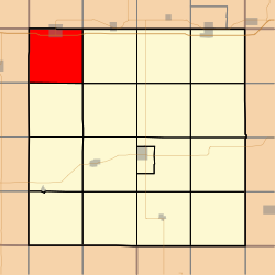
Summit Township is one of seventeen townships in Adair County, Iowa, USA. At the 2010 census, its population was 967. [3]

Contents

History

Summit Township was organized in 1871. Summit is named from the ridge it contains that forms the watershed between the Mississippi and Missouri rivers. [4]

A post office named Linwood opened in March 1895. Henry L. Manion was the postmaster. [5] This post office was in Summit Township and was discontinued [6] in 1903. [7]

Geography

Summit Township covers an area of 35.59 square miles (92.2 km2) and contains one incorporated settlement, Adair. According to the USGS, it contains two cemeteries: Saint Johns and Sunny Hill.

References

  1. "US Board on Geographic Names". United States Geological Survey. October 25, 2007. Retrieved January 31, 2008.
  2. "U.S. Census website". United States Census Bureau . Retrieved January 31, 2008.
  3. "IA - Summit township". United States Census Bureau. Archived from the original on April 9, 2013. Retrieved March 17, 2013.
  4. Kilburn, Lucian Moody (1915). History of Adair County, Iowa, and Its People, Volume 1. Pioneer Publishing Company. pp. 127–128.
  5. "Miscellaneous Washington News". Sioux City Journal. Sioux City, IA. March 7, 1895. p. 1. Retrieved January 26, 2024.
  6. Iowa State Gazetteer and Business Directory. R.L. Polk & Company. 1912. p. 732.
  7. "Post Offices". www.postalhistory.com. Retrieved January 26, 2024.